Map of North Richland Hills, Texas
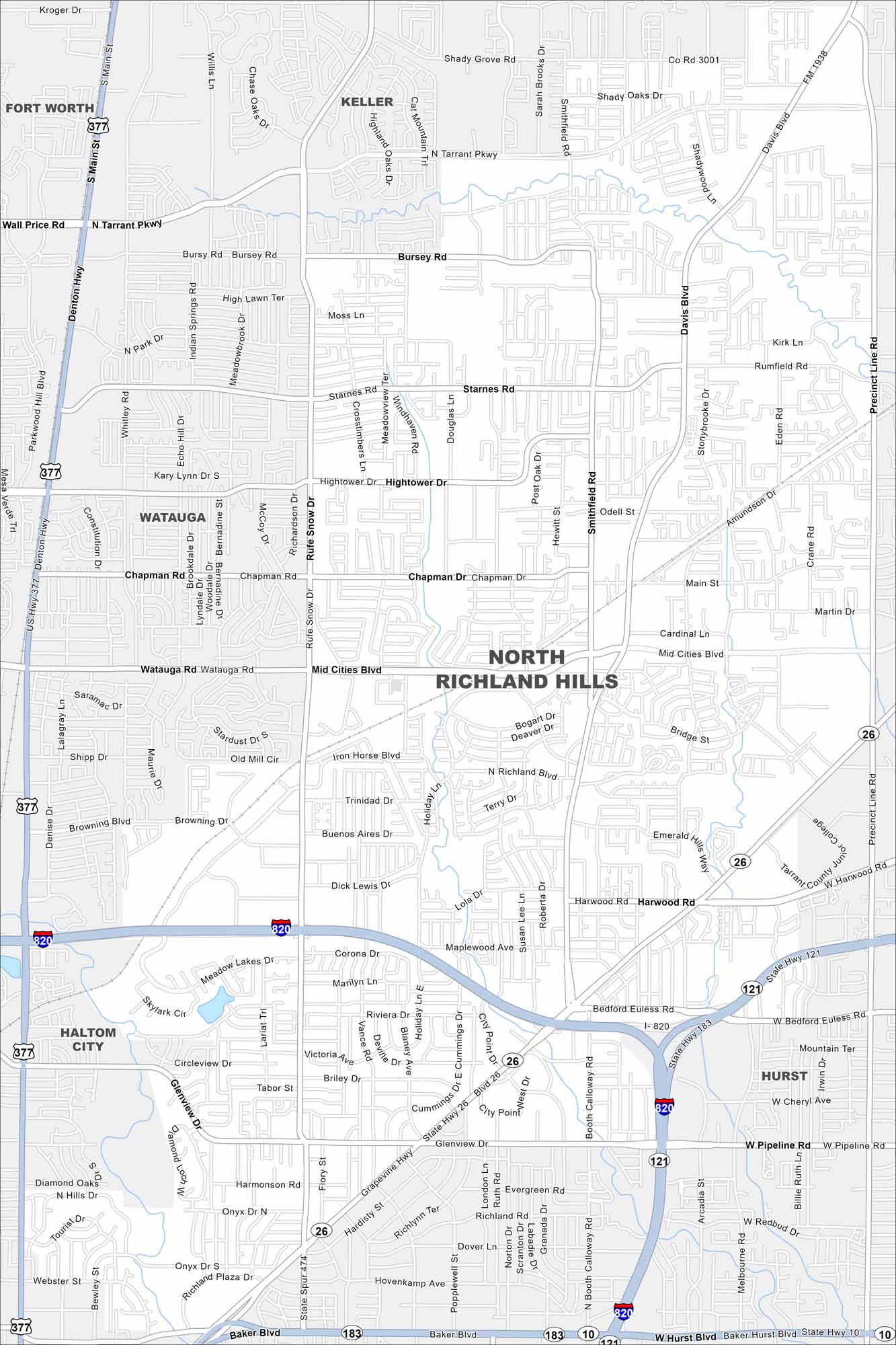
North Richland Hills sits northeast of Fort Worth. This map highlights residential areas, streets, and major highways. It’s one of the largest suburbs in Tarrant County.
Map Information
On the Map
Interstates/Highways: I-820, US Hwy 377, State Hwy 26, State Hwy 121, State Hwy 183, State Hwy 10 Major Roads: Mid Cities Blvd, Davis Blvd, Precinct Line Rd, Smithfield Rd, Tarrant Pkwy, Bursey Rd, Watauga Rd, Chapman Dr, Hightower Dr, Starnes Rd, Rufe Snow Dr, Main St, Harwood Rd, Bedford Euless Rd, Pipeline Rd, Glenview Dr, Holiday Ln, Iron Horse Blvd, Shady Grove Rd, Wall Price Rd Nearby Communities: Fort Worth, Keller, Watauga, Haltom City, HurstTexas State Maps
Scan our maps of the massive southern state of Texas.


City Maps of Texas
Explore our map collection of Texas cities.


