Map of Owasso, Oklahoma
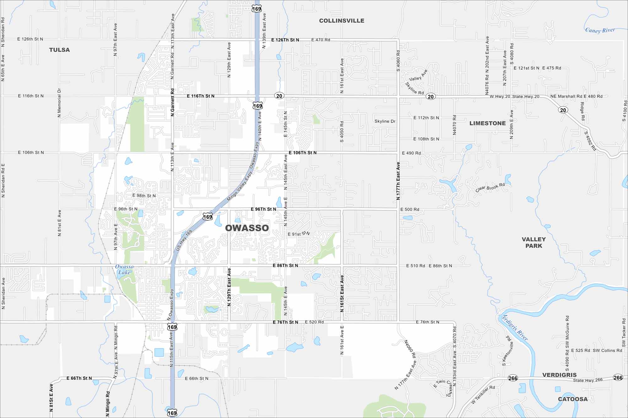
Our map of Owasso highlights a fast-growing suburb north of Tulsa. This map includes residential neighborhoods, ponds and highways. Rolling hills frame the city’s edges.
Map Information
On the Map
Interstates/Highways: US Hwy 169, State Rte 20, State Rte 266 Major Roads: 86th St, 96th St, 106th St, 116th St, 76th St, 66th St, Main St, Garnett Rd, 129th East Ave, 145th East Ave, 161st East Ave, 177th East Ave, 193rd East Ave, Memorial Dr, Mingo Rd, Sheridan Rd, 126th St, Skyline Dr, Marshall Rd, Keetonville Rd Lakes and Reservoirs: Owasso Lake Major Rivers: Caney River, Verdigris River Nearby Communities: Tulsa, Collinsville, Limestone, Valley Park, Verdigris, CatoosaOklahoma State Maps
Here is our map collection of the Sooner State.


City Maps of Oklahoma
Explore Oklahoma’s cities with our maps


