Map of Oxford, Mississippi
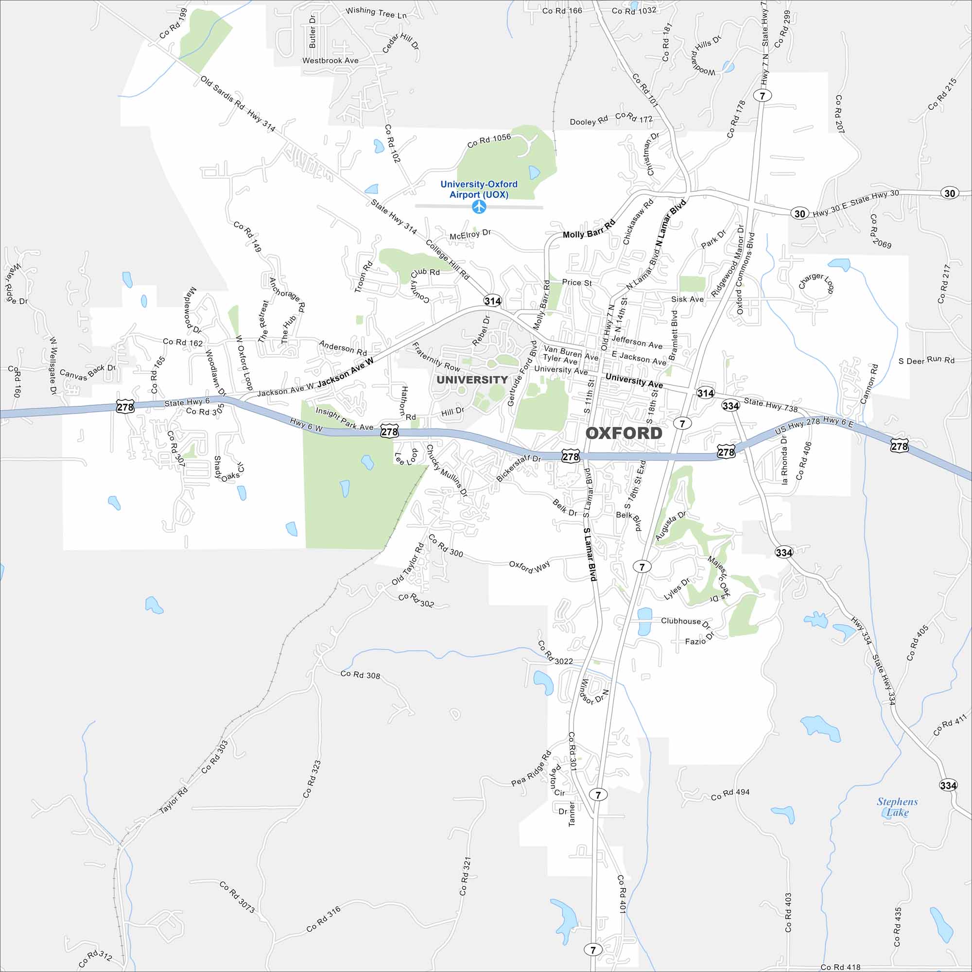
Oxford is home to the University of Mississippi. Take a look at the map to spot the central Square, surrounding neighborhoods, and campus streets. The city is also known for its literary history.
Map Information
On the Map
Interstates/Highways: US Hwy 278, State Hwy 6, State Hwy 7, State Hwy 30, State Hwy 314, State Hwy 334 Major Roads: University Ave, Jackson Ave, Lamar Blvd, Molly Barr Rd, College Hill Rd, McElroy Dr, Sisk Ave, Bramlett Blvd, Gertrude Ford Blvd, Chucky Mullins Dr, Old Taylor Rd, Anderson Rd, Heritage Dr, Hathorn Rd, Rebel Rd, Price St, Van Buren Ave, Tyler Ave, Jefferson Ave, Belk Dr Airports: University-Oxford Airport (UOX) Lakes and Reservoirs: Stephens Lake Nearby Communities: UniversityMississippi State Maps
Explore maps of Mississippi’s towns, rivers, and roads.


Mississippi City Maps
Discover Mississippi with our city maps