Map of Pasadena, Texas
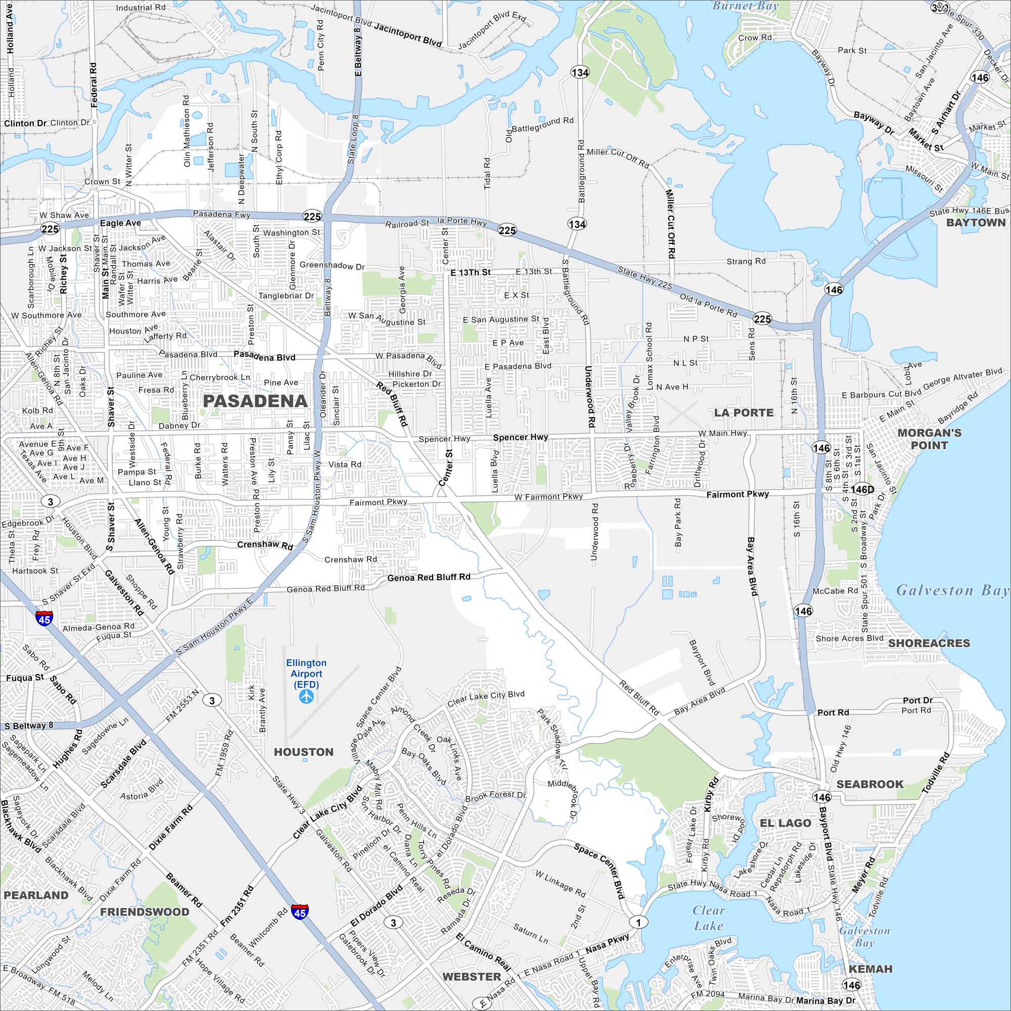
Our map of Pasadena shows this community southeast of Houston. Refineries and industry dominate much of the landscape. The city also has parks and neighborhoods tied to the Gulf Coast economy.
Map Information
On the Map
Interstates/Highways: I-45, State Hwy 225, State Hwy 146, State Hwy 3, State Hwy 134, State Hwy 146D Major Roads: Sam Houston Pkwy, Beltway 8, Pasadena Blvd, Spencer Hwy, Fairmont Pkwy, Red Bluff Rd, Genoa Red Bluff Rd, Bay Area Blvd, NASA Pkwy, Port Dr, Shoreacres Blvd, Clear Lake City Blvd, El Dorado Blvd, Dixie Farm Rd, Beamer Rd, Richey St, Shaver St, Main St, Broadway, Clinton Dr Airports: Ellington Airport (EFD) Lakes and Reservoirs: Galveston Bay, Clear Lake, Burnet Bay Nearby Communities: Baytown, La Porte, Morgan’s Point, Shoreacres, Seabrook, El Lago, Kemah, Webster, Houston, Friendswood, PearlandTexas State Maps
Scan our maps of the massive southern state of Texas.


City Maps of Texas
Explore our map collection of Texas cities.


