Map of Peabody, Massachusetts
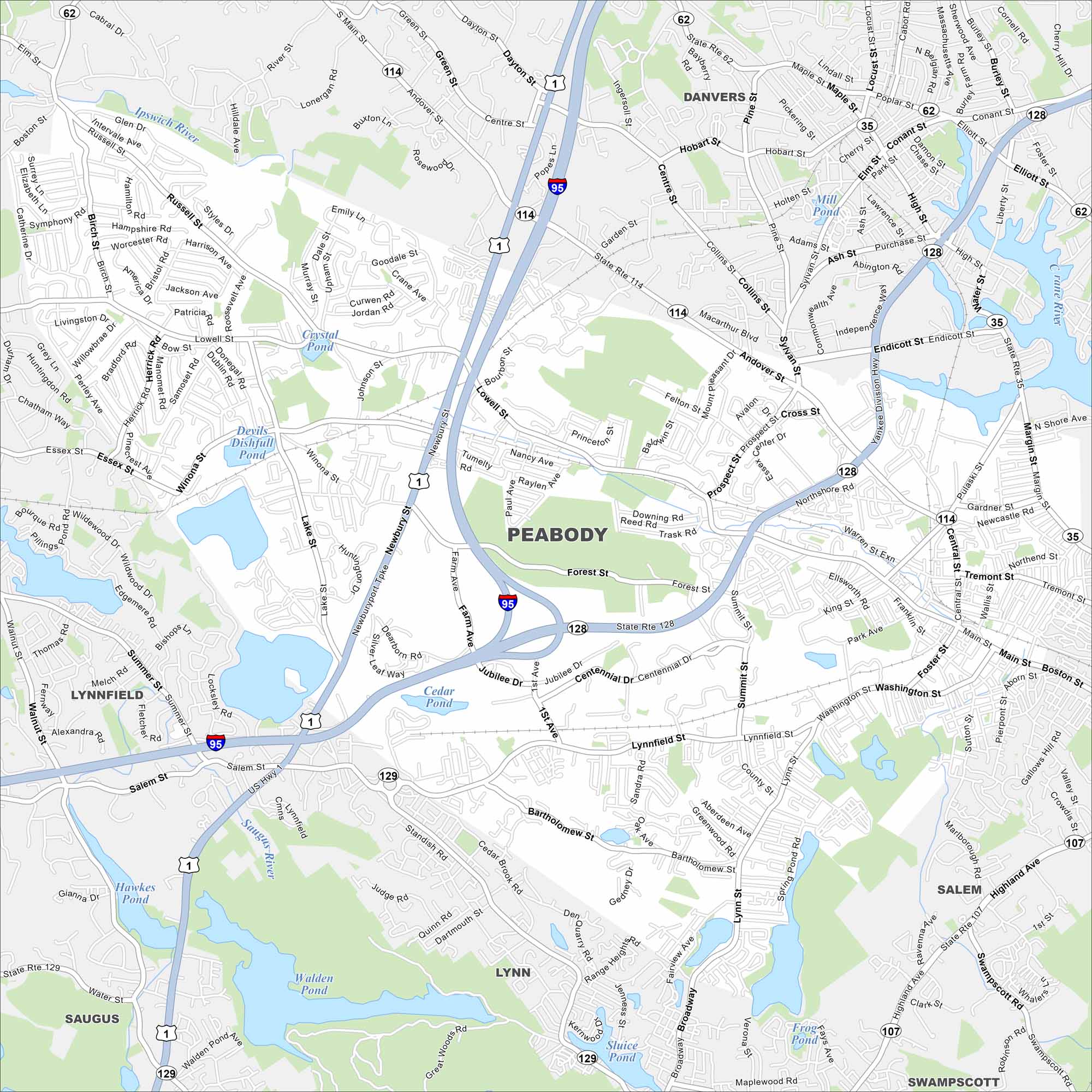
Peabody lies just inland from the North Shore. Take a look at our map to see its suburban areas and city highways. Fun fact: This city was once a hub for leather production.
Map Information
On the Map
Interstates/Highways: I-95, State Rte 128, State Rte 114, State Rte 1, State Rte 62, State Rte 107, State Rte 35, State Rte 129, US Hwy 1 Major Roads: Lowell St, Main St, Washington St, Forest St, Andover St, Central St, Lynnfield St, Bartholomew St, Summit St, Newburyport Tpke, Foster St, Tremont St Lakes and Reservoirs: Cedar Pond, Crystal Pond, Devils Dishfull Pond, Winona Pond, Pillings Pond, Hawkes Pond, Walden Pond, Sluice Pond, Frog Pond, Mill Pond Major Rivers: Ipswich River, Saugus River Nearby Communities: Danvers, Salem, Swampscott, Lynn, Lynnfield, SaugusMassachusetts State Maps
Here’s our state maps of Massachusetts


City Maps of Massachusetts
Explore Boston and other urban areas in Massachusetts


