Map of Plymouth, Minnesota
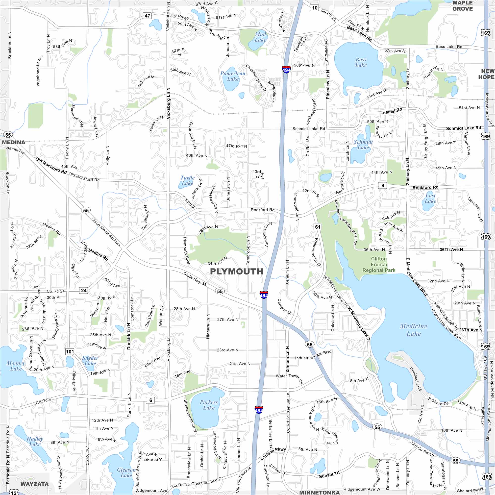
Plymouth sits among rolling lakes just west of Minneapolis. Our map highlights its residential areas and park systems. Medicine Lake stands out as the city’s centerpiece.
Map Information
On the Map
Interstates/Highways: I-494, State Rte 55, State Rte 47 Major Roads: Rockford Rd, Bass Lake Rd, Medicine Lake Rd, Vicksburg Ln, Fernbrook Ln, Schmidt Lake Rd, Old Rockford Rd, Medina Rd, Xenium Ln, Carlson Pkwy, Northwest Blvd, Pineview Ln, Zachary Ln, 36th Ave, 42nd Ave, 56th Ave, Industrial Park Blvd, Campus Dr, Nathan Ln, Plymouth Blvd Lakes and Reservoirs: Medicine Lake, Bass Lake, Schmidt Lake, Pomerleau Lake, Mud Lake, Turtle Lake, Snyder Lake, Gleason Lake, Hadley Lake, Lost Lake, Mooney Lake Parks and Preserves: Clifton French Regional Park Nearby Communities: Maple Grove, New Hope, Minnetonka, Wayzata, MedinaMinnesota State Maps
Explore every lake in our state maps of Minnesota


Minnesota City Maps
Browse through our city maps of Minnesota


