Map of Prior Lake, Minnesota
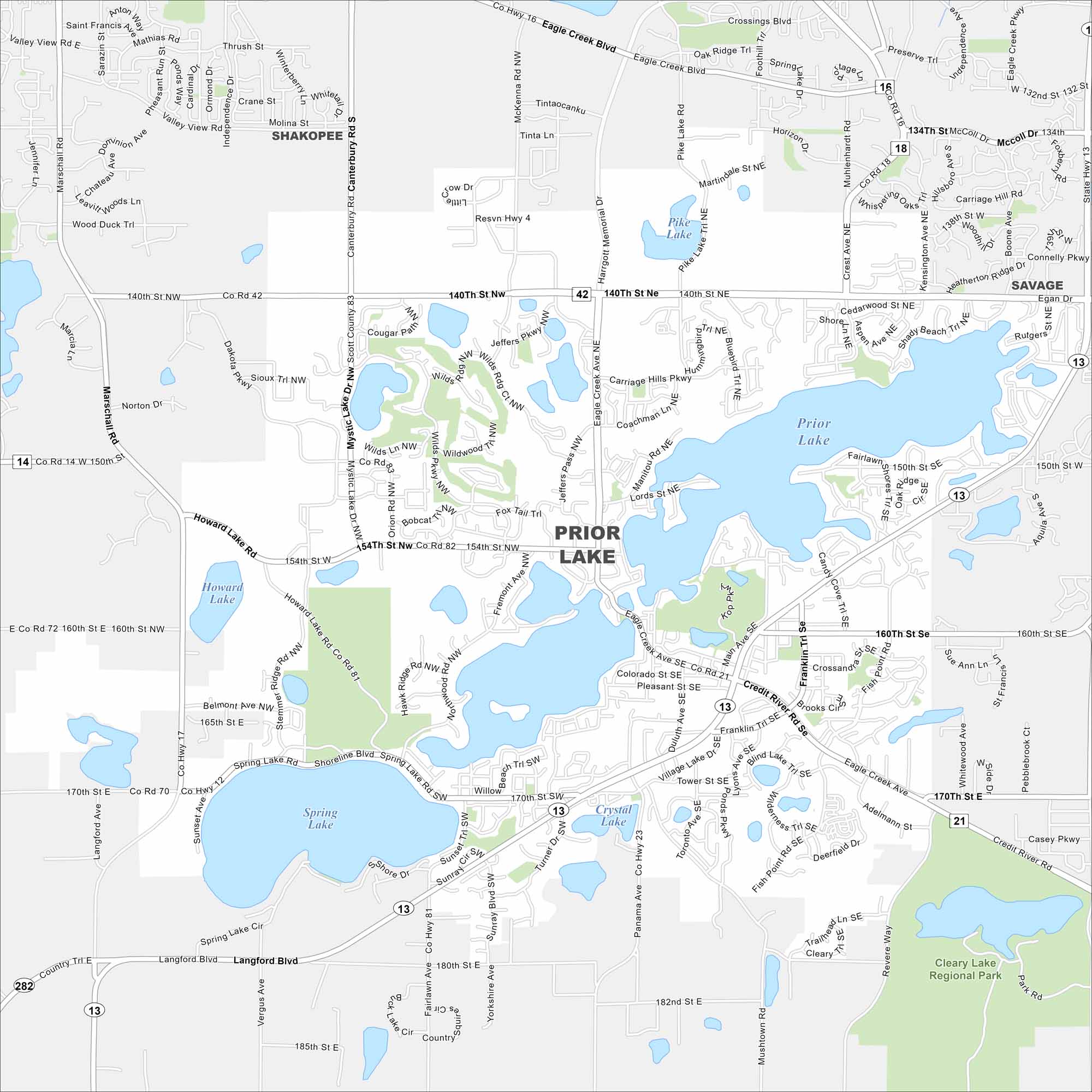
Prior Lake is a lakeside city southwest of Minneapolis. Our map highlights the main roads circling the water, plus neighborhoods and parks. Fishing and boating are central parts of daily life here, especially at Prior Lake.
Map Information
On the Map
Interstates/Highways: State Rte 13, State Rte 42, State Rte 21 Major Roads: 140th St, 150th St, 160th St, 170th St, 185th St, Eagle Creek Ave, Marschall Rd, Jeffers Pkwy, Dakota Pkwy, Mystic Lake Dr, Howard Lake Rd, Shoreline Blvd, Langford Blvd, Credit River Rd, Fish Point Rd, Main Ave, Franklin Trl, Village Lake Dr, Panama Ave, Mushtown Rd Lakes and Reservoirs: Prior Lake, Spring Lake, Mystic Lake, Howard Lake, Pike Lake, Crystal Lake Parks and Preserves: Cleary Lake Regional Park Nearby Communities: Shakopee, SavageMinnesota State Maps
Explore every lake in our state maps of Minnesota


Minnesota City Maps
Browse through our city maps of Minnesota


