Map of Quincy, Massachusetts
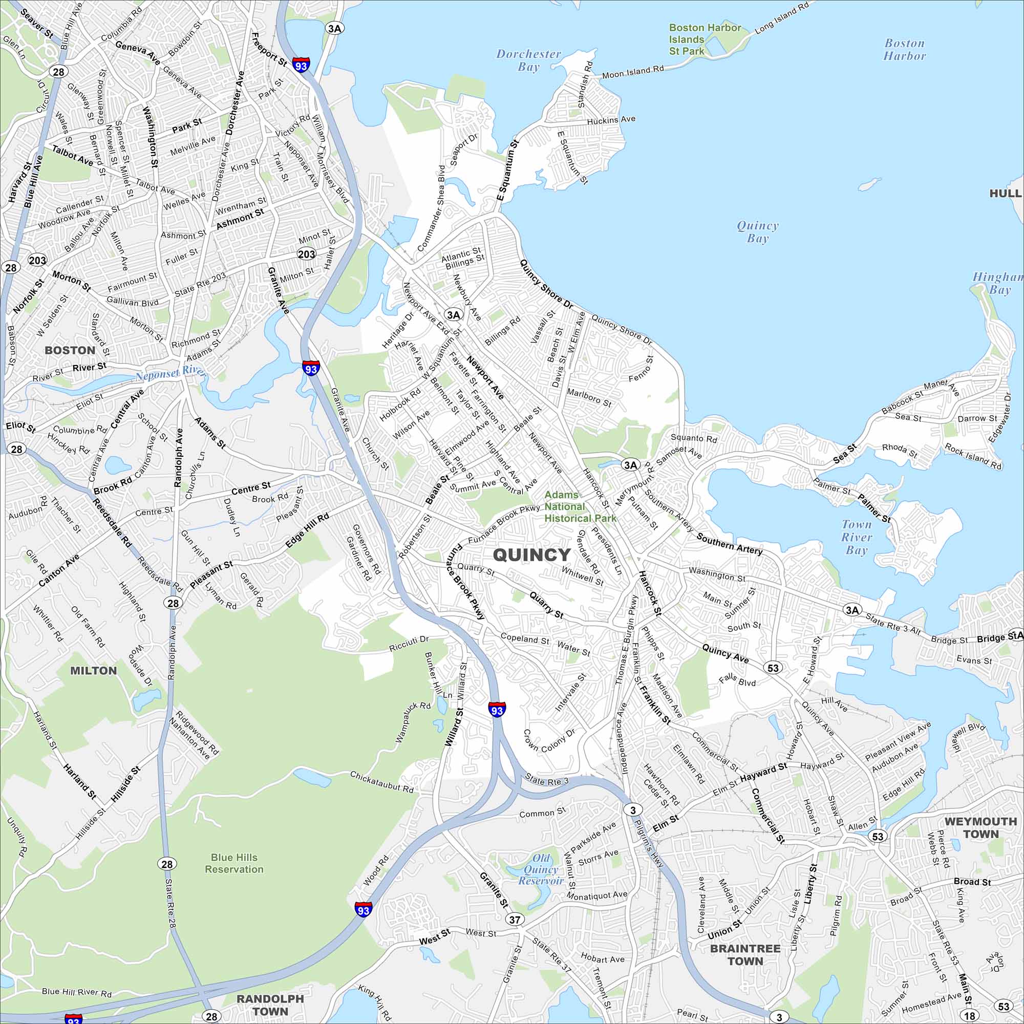
Often called the “City of Presidents”, Quincy is the birthplace of John Adams and John Quincy Adams. Our map shows its neighborhoods stretching along Boston’s South Shore. Shipbuilding was once a cornerstone of its economy.
Map Information
On the Map
Interstates/Highways: I-93, State Rte 3, State Rte 3A, State Rte 28, State Rte 37, State Rte 53, State Rte 203 Major Roads: Hancock St, Washington St, Quincy Shore Dr, Adams St, Franklin St, Granite Ave, Centre St, Newport Ave, Beale St, West St, Sea St, Palmer St, Common St, Willard St, Quarry St, Whitwell St, Phipps St, Independence Ave, Liberty St Lakes and Reservoirs: Dorchester Bay, Quincy Bay, Town River Bay, Hingham Bay, Boston Harbor, Old Quincy Reservoir Major Rivers: Neponset River, Furnace Brook Parks and Preserves: Adams National Historical Park, Blue Hills Reservation, Boston Harbor Islands St Park Nearby Communities: Boston, Milton, Randolph Town, Braintree Town, Weymouth Town, HullMassachusetts State Maps
Here’s our state maps of Massachusetts


City Maps of Massachusetts
Explore Boston and other urban areas in Massachusetts


