Map of Revere, Massachusetts
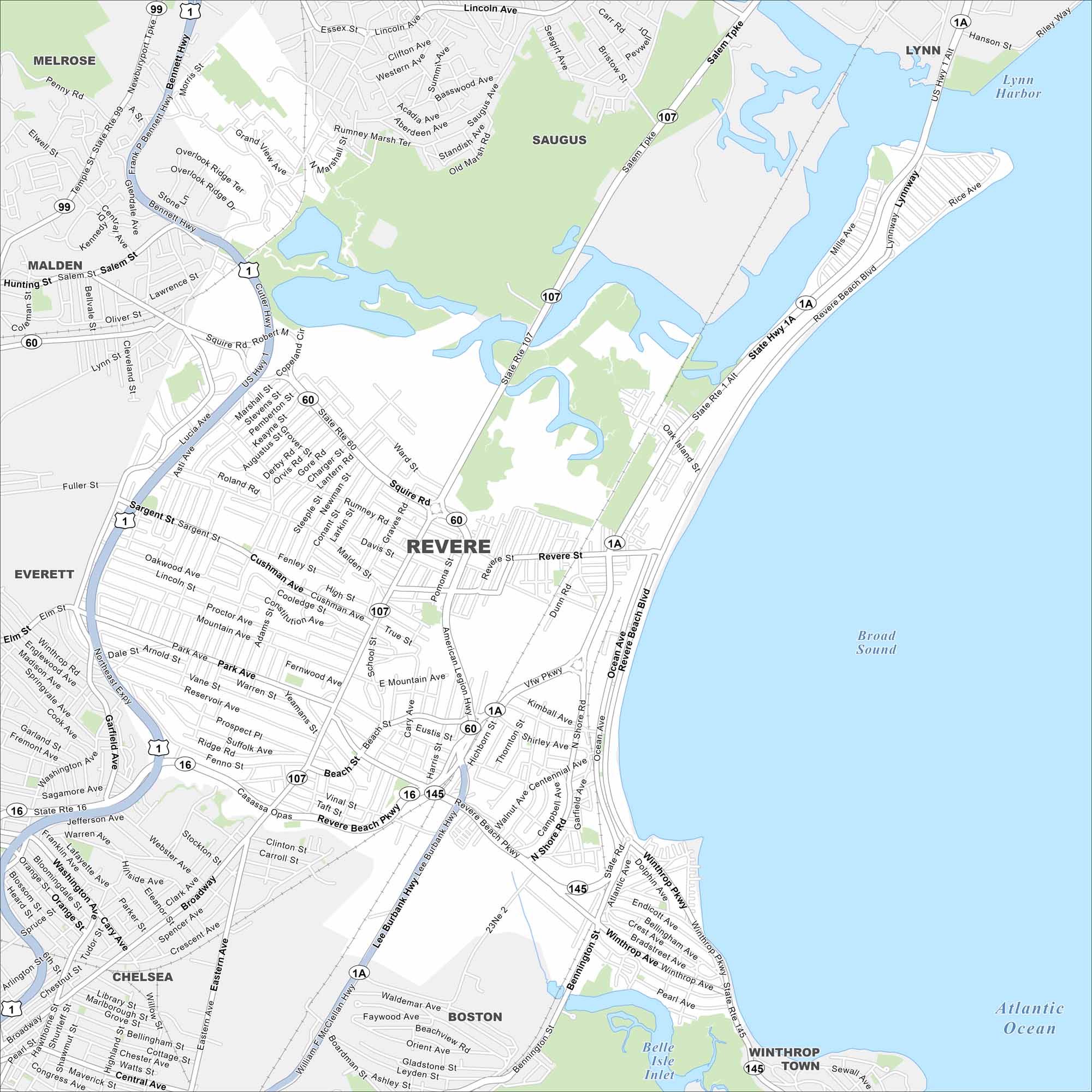
Revere is a historic seaside city just north of Boston. Our road map highlights the shoreline, neighborhoods, and main routes. The city is best known for Revere Beach, America’s first public beach.
Map Information
On the Map
Interstates/Highways: US Hwy 1, State Rte 1A, State Rte 1 Alt, State Rte 16, State Rte 60, State Rte 107, State Rte 145 Major Roads: Broadway, Revere St, Revere Beach Blvd, Revere Beach Pkwy, American Legion Hwy, Squire Rd, Lee Burbank Hwy, Winthrop Ave, Ocean Ave, Washington Ave, Malden St, Cushman Ave, Park Ave, Beach St, Central Ave, Salem Tpke, Lynnway, Bennett Hwy, Prospect Ave, Centennial Ave Lakes and Reservoirs: Broad Sound, Atlantic Ocean, Belle Isle Inlet, Lynn Harbor Nearby Communities: Saugus, Lynn, Winthrop Town, Boston, Chelsea, Everett, Malden, MelroseMassachusetts State Maps
Here’s our state maps of Massachusetts


City Maps of Massachusetts
Explore Boston and other urban areas in Massachusetts


