Map of Richardson, Texas
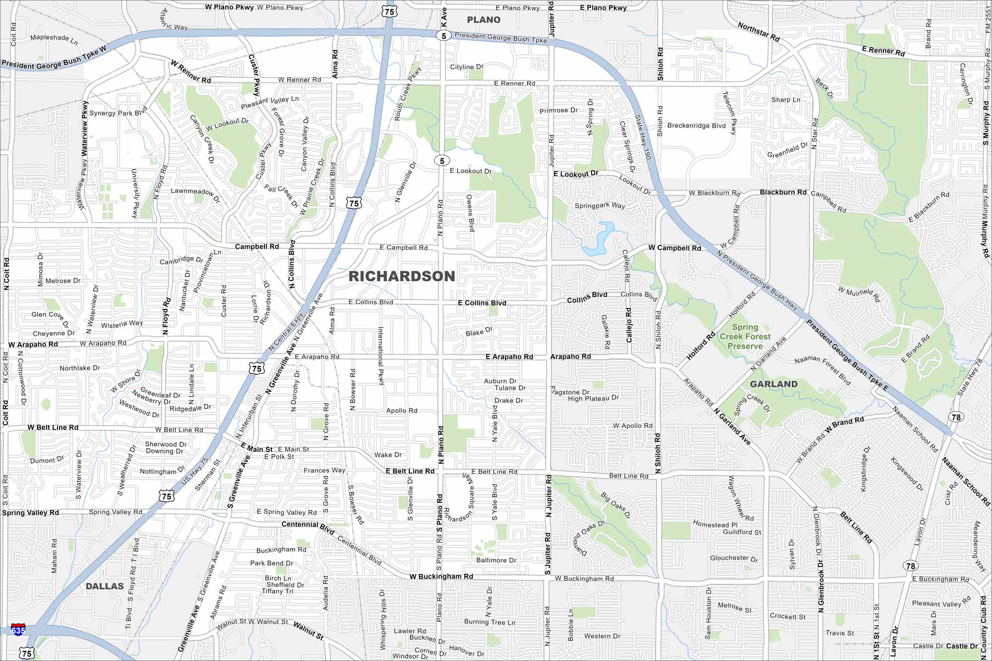
Part of the Dallas-Fort Worth metro, Richardson blends business districts with quiet residential streets. It’s a hub for telecom companies, giving it the nickname “Telecom Corridor”. Our map highlights main highways and local areas worth exploring.
Map Information
On the Map
Interstates/Highways: US Hwy 75, I-635, State Hwy 78, US Hwy 67 Major Roads: Campbell Rd, Arapaho Rd, Belt Line Rd, Spring Valley Rd, Central Expy, Plano Pkwy, Renner Rd, Lookout Dr, Collins Blvd, Apollo Rd, Main St, Buckingham Rd, Coit Rd, Waterview Pkwy, Custer Rd, Alma Dr, Greenville Ave, Jupiter Rd, Shiloh Rd, Garland Ave Parks and Preserves: Spring Creek Forest Preserve Nearby Communities: Plano, Garland, DallasTexas State Maps
Scan our maps of the massive southern state of Texas.


City Maps of Texas
Explore our map collection of Texas cities.


