Map of Rio Grande City, Texas
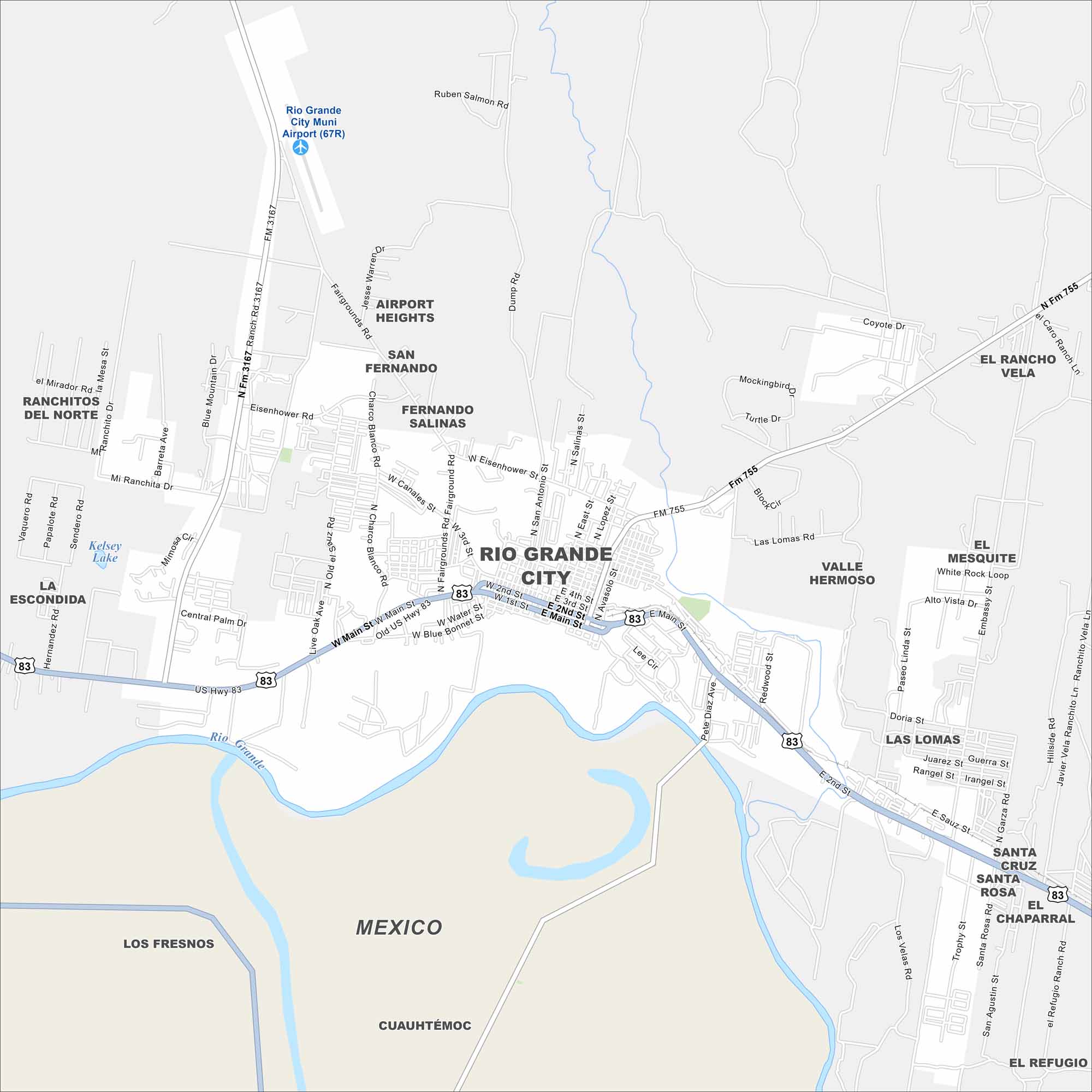
Get oriented with our Rio Grande City map. The river runs along the edge of town. The city itself, sits along the border of Mexico.
Map Information
On the Map
Interstates/Highways: US Hwy 83 Major Roads: Main St, Water St, Blue Bonnet St, Sauz St, Second St, Third St, Fourth St, Eisenhower Rd, Mirador Rd, Ranchitos Rd, Vaquero Rd, Sendero Rd, Barreta Ave, Blue Mountain Dr, Live Oak Ave, Old el Sauz Rd, Fairgrounds Rd, San Antonio St, East St, Lopez St Airports: Rio Grande City Muni Airport (67R) Major Rivers: Rio Grande Nearby Communities: Ranchitos del Norte, La Escondida, Airport Heights, San Fernando, Fernando Salinas, Valle Hermoso, El Mesquite, Las Lomas, Santa Cruz, Santa Rosa, El Chaparral, El Refugio, Los Fresnos, Cuauhtémoc, MexicoTexas State Maps
Scan our maps of the massive southern state of Texas.


City Maps of Texas
Explore our map collection of Texas cities.


