Map of Rochester, Minnesota
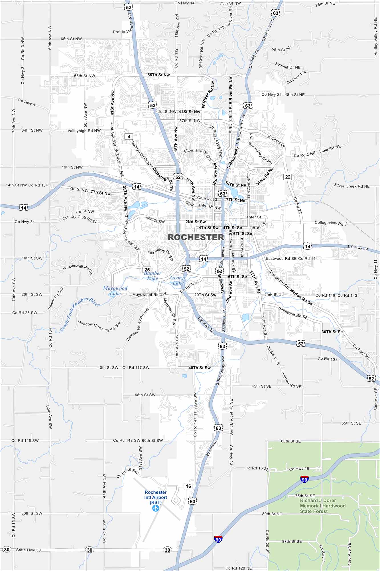
Our map of Rochester, Minnesota displays the local parks and the busy roads around downtown. It gives you a sense of how the city is arranged. Richard J. Dorer Memorial Hardwood State Forest sits just outside the city in the southeast.
Map Information
On the Map
Interstates/Highways: I-90, US Hwy 52, US Hwy 63, US Hwy 14, State Rte 30 Major Roads: Broadway, 2nd St, 4th St, 6th St, 7th St, 14th St, 16th St, 20th St, 30th St, 40th St, 55th St, 65th St, 75th St, 80th St, Circle Dr, Valleyhigh Rd, Marion Rd, Pinewood Rd, Simpson Rd, Saint Bridget Rd Airports: Rochester Intl Airport (RST) Lakes and Reservoirs: George Lake, Bamber Lake, Mayowood Lake Major Rivers: South Fork Zumbro River Parks and Preserves: Richard J Dorer Memorial Hardwood State ForestMinnesota State Maps
Explore every lake in our state maps of Minnesota


Minnesota City Maps
Browse through our city maps of Minnesota


