Map of Rockport, Texas
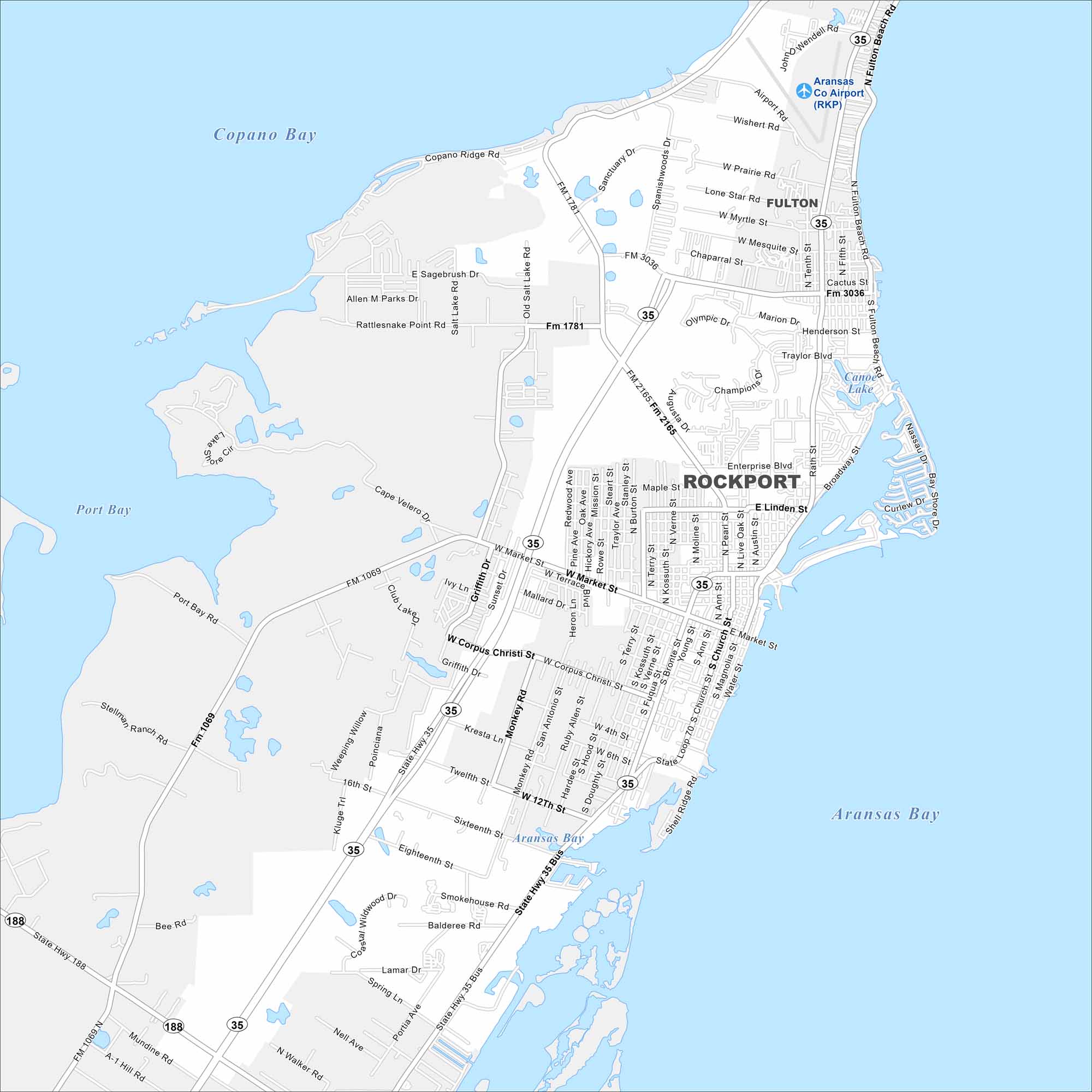
Here’s our map of Rockport with its waterfront, harbors, and streets. You’ll notice how the town spreads along the Gulf coast in Aransas County, Texas.
Map Information
On the Map
Interstates/Highways: State Hwy 35, State Hwy 188 Major Roads: Market St, Corpus Christi St, Twelfth St, Sixteenth St, Eighteenth St, Business 35, Enterprise Blvd, Linden St, Broadway St, Fourth St, Sixth St, Magnolia St, Church St, Live Oak St, Austin St, Pearl St, Nene St, Fulton Beach Rd, Traylor Blvd, Henderson St Airports: Aransas Co Airport (RKP) Lakes and Reservoirs: Copano Bay, Port Bay, Aransas Bay, Canoe Lake Nearby Communities: FultonTexas State Maps
Scan our maps of the massive southern state of Texas.


City Maps of Texas
Explore our map collection of Texas cities.


