Map of Rockwall, Texas
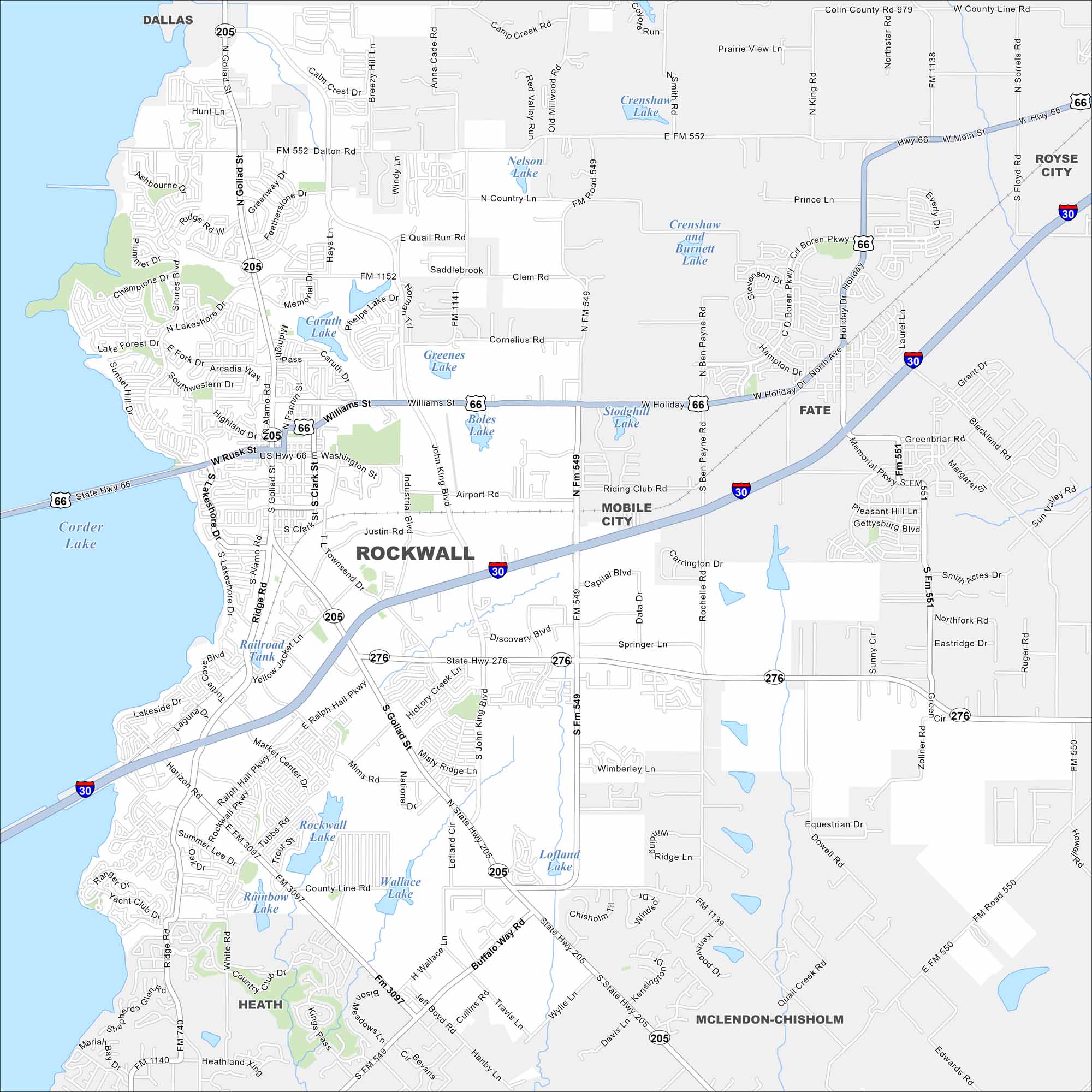
This street map of Rockwall highlights the lakefront, historic downtown, and key roads. You’ll also see quick connections into Dallas including I-30 and US State Highway 66.
Map Information
On the Map
Interstates/Highways: I-30, US Hwy 66, State Hwy 66, State Hwy 205, State Hwy 276 Major Roads: Goliad St, Rusk St, Washington St, Ralph Hall Pkwy, Ridge Rd, Shores Blvd, Lakeside Dr, Industrial Blvd, John King Blvd, Airport Rd, Discovery Blvd, Horizon Rd, Yellow Jacket Ln, Mims Rd, Buffalo Way Rd, Travis Ln, Wylie Ln, Davis Ln, Rochelle Rd, Capital Blvd Lakes and Reservoirs: Corder Lake, Boles Lake, Greenes Lake, Caruth Lake, Nelson Lake, Crenshaw and Burnett Lake, Stodghill Lake, Lofland Lake, Wallace Lake, Rockwall Lake, Rainbow Lake, Lake Ray Hubbard Nearby Communities: Dallas, Fate, Mobile City, Royse City, McLendon-Chisholm, HeathTexas State Maps
Scan our maps of the massive southern state of Texas.


City Maps of Texas
Explore our map collection of Texas cities.


