Map of Salem, Massachusetts
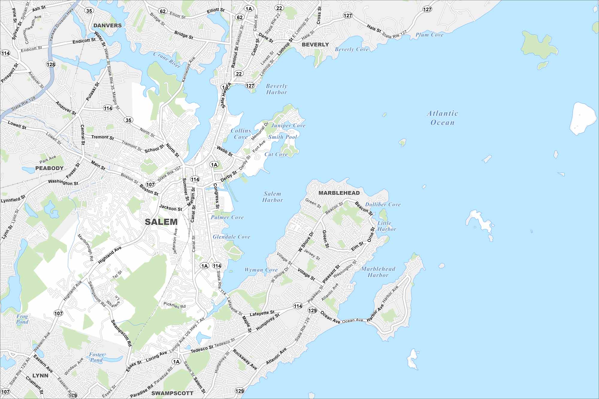
We’ve mapped out every major road in Salem, Massachusetts. From the harbor to the historic downtown, it’s all there. Our map helps you see the city’s witch trial legacy too with streets all laid out.
Map Information
On the Map
Interstates/Highways: State Rte 1A, State Rte 22, State Rte 35, State Rte 62, State Rte 107, State Rte 114, State Rte 127, State Rte 128, State Rte 129 Major Roads: Highland Ave, Loring Ave, Lafayette St, Boston St, North St, Essex St, Main St, Washington St, Bridge St, Canal St, Jefferson Ave, Swampscott Rd, Paradise Rd, Atlantic Ave, Pleasant St, West Shore Dr, Village St, Beacon St, Humphrey St, Tedesco St Lakes and Reservoirs: Atlantic Ocean, Salem Harbor, Beverly Harbor, Collins Cove, Smith Pool, Cat Cove, Juniper Cove, Palmer Cove, Glendale Cove, Wyman Cove, Marblehead Harbor, Little Harbor, Dolliber Cove, Plum Cove, Beverly Cove, Frog Pond, Foster Pond Nearby Communities: Danvers, Beverly, Marblehead, Swampscott, Lynn, PeabodyMassachusetts State Maps
Here’s our state maps of Massachusetts


City Maps of Massachusetts
Explore Boston and other urban areas in Massachusetts


