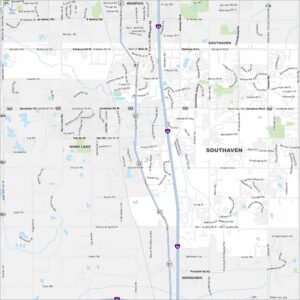
Map of Southaven, Mississippi
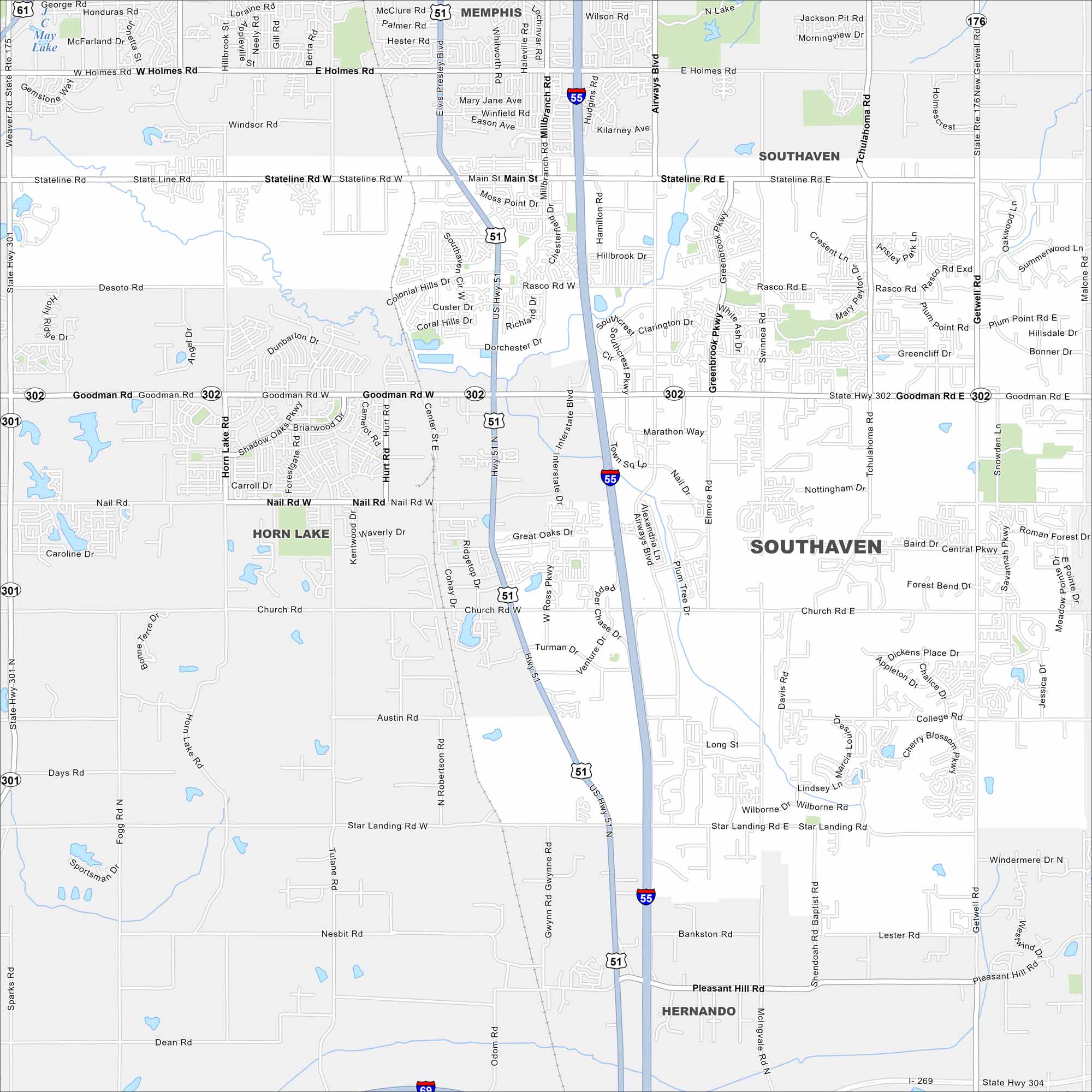
Our map of Southaven shows you around the largest suburb of Memphis. It’s a place with shopping centers, local parks, and a growing community feel.
Map Information
On the Map
Interstates/Highways: I-55, US Hwy 51, State Hwy 302, State Hwy 301, State Hwy 176 Major Roads: Goodman Rd, Stateline Rd, Airways Blvd, Swinnea Rd, Getwell Rd, Church Rd, Star Landing Rd, Rasco Rd, Main St, Holmes Rd, Nail Rd, Tchulahoma Rd, Snowden Ln, Elmore Rd, Pepper Chase Dr, Venture Dr, Turman Dr, Ross Pkwy, Dorchester Dr, Colonial Hills Dr Lakes and Reservoirs: May Lake Nearby Communities: Memphis, Horn Lake, HernandoMississippi State Maps
Explore maps of Mississippi’s towns, rivers, and roads.


Mississippi City Maps
Discover Mississippi with our city maps