Map of Southlake, Texas
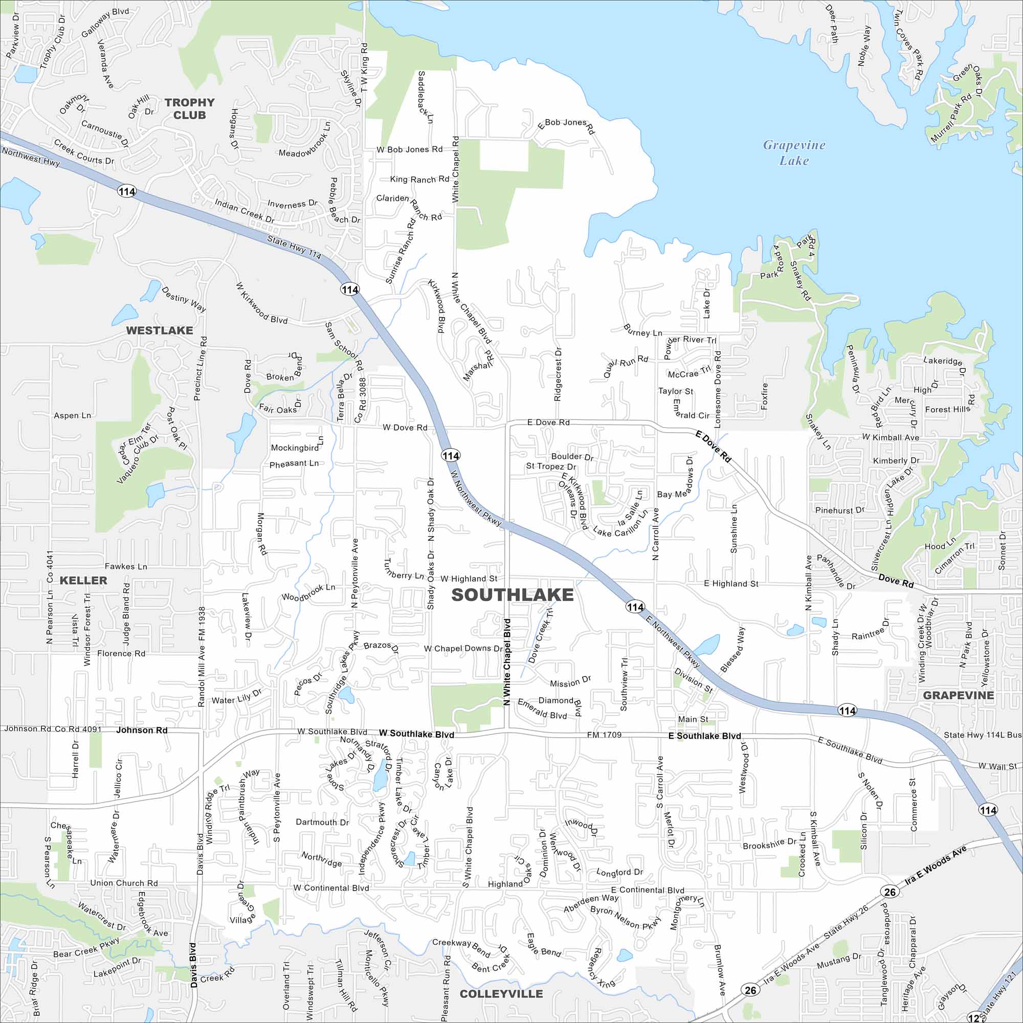
Southlake is known for its town square and high-quality schools. Our map highlights Grapevine Lake, major highways, and nearby outdoor spaces.
Map Information
On the Map
Interstates/Highways: State Hwy 26, State Hwy 114, State Hwy 121 Major Roads: Southlake Blvd, Continental Blvd, Northwest Pkwy, White Chapel Blvd, Carroll Ave, Dove Rd, Highland St, Main St, Kimball Ave, Davis Blvd, Randol Mill Ave, Peytonville Ave, Shady Oaks Dr, Kirkwood Blvd, Dove Creek Trl, Pearson Ln, Florence Rd, Johnson Rd, Ridgecrest Dr, Pearson Ln Lakes and Reservoirs: Grapevine Lake Nearby Communities: Trophy Club, Westlake, Keller, Colleyville, GrapevineTexas State Maps
Scan our maps of the massive southern state of Texas.


City Maps of Texas
Explore our map collection of Texas cities.


