Texas Biomes Map
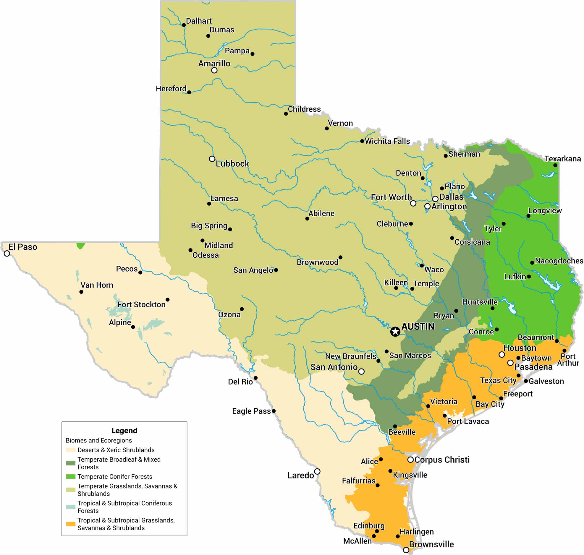
Texas is big, and the biomes prove it. We’ve mapped deserts, plains, forests, and coastal areas across the state. The west-to-east shift is especially clear. Few states show this much change on a single map.
Map Information
On the Map
Our table below displays the biome area and percent for Texas.|
Biome |
Area (Square Miles) |
Percent |
|
Deserts & Xeric Shrublands |
55091 |
20.8 |
|
Temperate Broadleaf & Mixed Forests |
21150 |
8.0 |
|
Temperate Conifer Forests |
24704 |
9.3 |
|
Temperate Grasslands, Savannas & Shrublands |
139846 |
52.9 |
|
Tropical & Subtropical Coniferous Forests |
980 |
0.4 |
|
Tropical & Subtropical Grasslands, Savannas & Shrublands |
22555 |
8.5 |
|
Ecoregion |
Area (Square Miles) |
Percent |
|
Arizona Mountains forests |
82 |
0.0 |
|
Central-Southern US mixed grasslands |
18057 |
6.8 |
|
Chihuahuan desert |
34412 |
13.0 |
|
Cross-Timbers savanna-woodland |
20048 |
7.6 |
|
East Central Texas forests |
21150 |
8.0 |
|
Edwards Plateau savanna |
28944 |
11.0 |
|
Piney Woods |
24622 |
9.3 |
|
Sierra Madre Oriental pine-oak forests |
980 |
0.4 |
|
Tamaulipan mezquital |
20679 |
7.8 |
|
Texas blackland prairies |
16750 |
6.3 |
|
Western Gulf coastal grasslands |
22555 |
8.5 |
|
Western shortgrass prairie |
56047 |
21.2 |
Texas State Maps
Scan our maps of the massive southern state of Texas.


