Map of Springdale, Arkansas
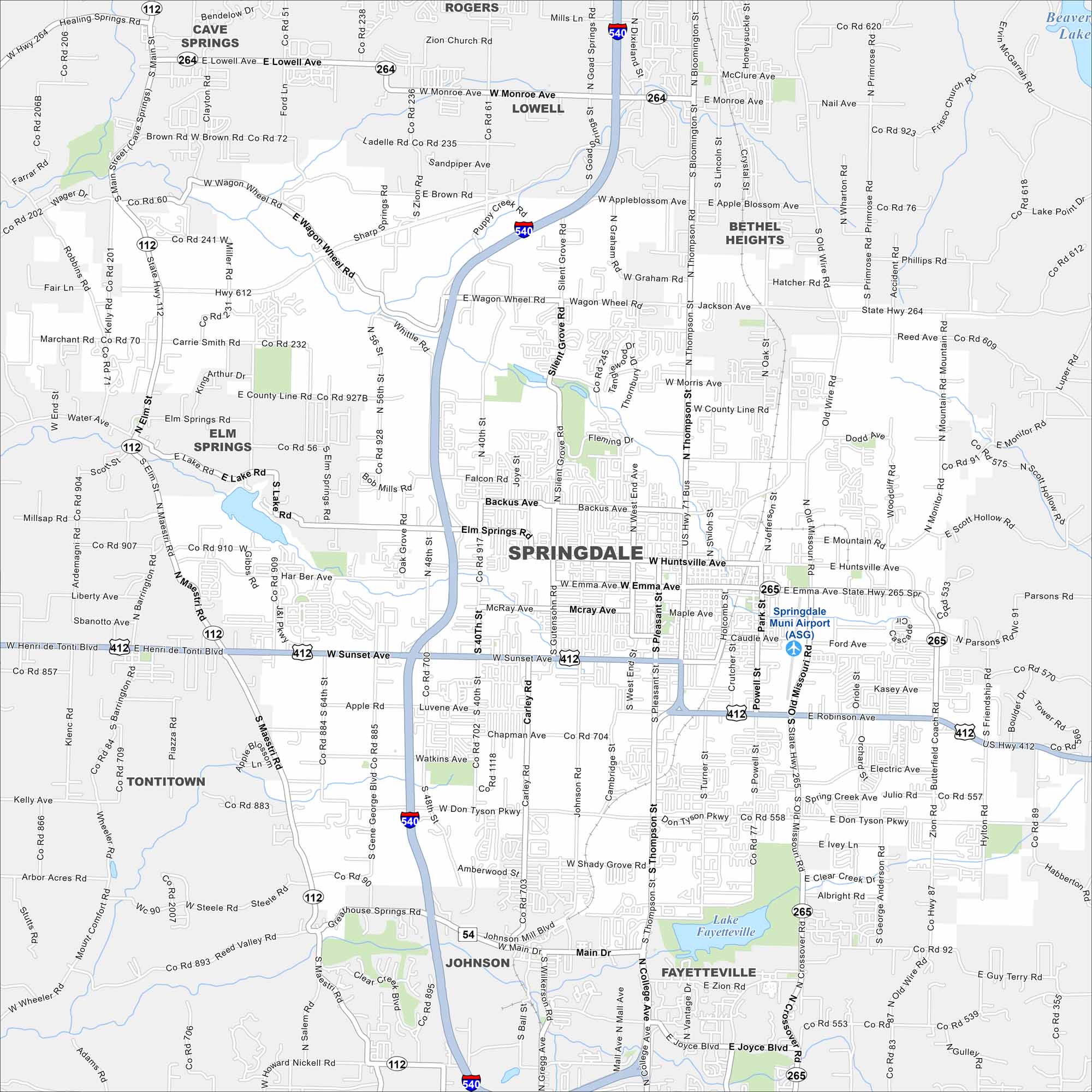
Our map of Springdale highlights a city in the Ozarks. It’s home to major employers, local trails and the Northwest Arkansas Naturals baseball team.
Arkansas State Maps
Check out our Arkansas maps here


Map Information
On the Map
Interstates/Highways: I-540, US Hwy 412, US Hwy 71 Bus, US Hwy 62, State Hwy 112, State Hwy 265, State Hwy 264 Major Roads: Sunset Ave, Thompson St, Huntsville Ave, Robinson Ave, Emma Ave, Don Tyson Pky, Wagon Wheel Rd, Elm Springs Rd, 40th St, 48th St, Carley Rd, Silent Grove Rd, Powell St, Crutcher St, Old Missouri Rd, Gutensohn Rd, McRay Ave, Apple Blossom Ave, Graham Rd, Pleasant St Airports: Springdale Muni Airport (ASG) Lakes and Reservoirs: Lake Fayetteville Nearby Communities: Rogers, Lowell, Bethel Heights, Elm Springs, Tontitown, Johnson, Fayetteville, Cave SpringsArkansas City Maps
Discover Arkansas through our city maps


