Map of St. Cloud, Minnesota
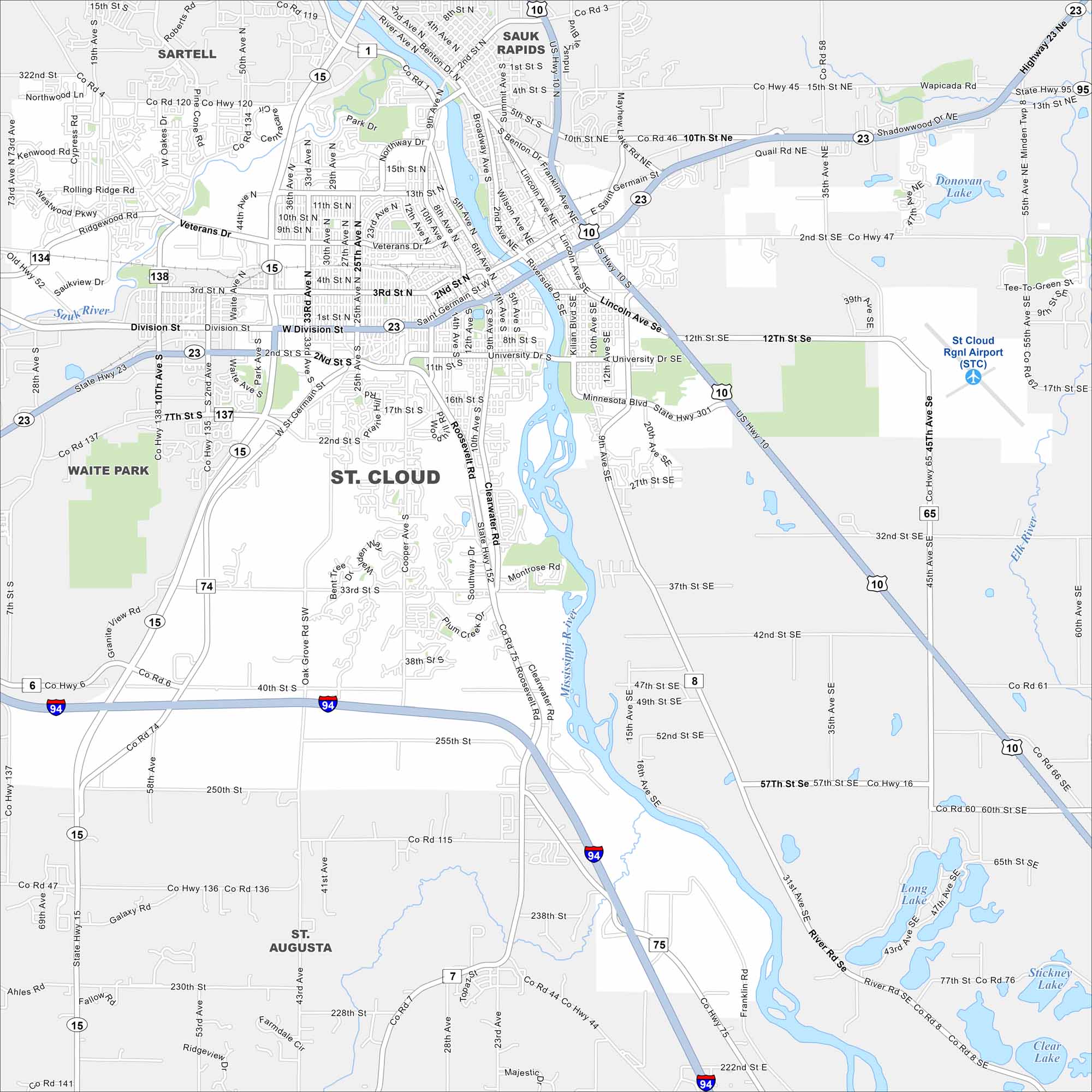
Our map of St. Cloud shows the Mississippi River running through downtown. The city is home to a university, trails, and busy riverfront parks.
Map Information
On the Map
Interstates/Highways: I-94, US Hwy 10, State Rte 15, State Rte 23, State Rte 95 Major Roads: Division St, University Dr, 33rd St, 10th Ave, 3rd St, 2nd St, 25th Ave, Veterans Dr, Roosevelt Rd, Clearwater Rd, Minnesota Blvd, Lincoln Ave, Stearns Co Rd 75, 42nd St, 32nd St, 15th St, 12th St, Co Rd 1, Co Rd 136, 15th Ave Airports: St Cloud Rgnl Airport (STC) Lakes and Reservoirs: Donovan Lake, Long Lake, Stickney Lake, Clear Lake Major Rivers: Mississippi River, Sauk River Nearby Communities: Sartell, Sauk Rapids, Waite Park, St. AugustaMinnesota State Maps
Explore every lake in our state maps of Minnesota


Minnesota City Maps
Browse through our city maps of Minnesota


