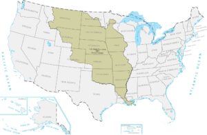
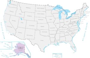
Louisiana Purchase of 1803 Map

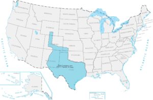
An enormous block of land fills the center of the country. Rivers, plains, and future states came with it. Our map of the Louisiana Purchase of 1803 shows this massive territory acquisition. Few territorial changes reshaped the map so dramatically as this one.
Map Information
On the Map
Here is a chronological breakdown of how the United States grew from the original colonies to its current span.
|
Year |
Acquisition Name |
Source / Former Entity |
|
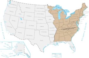
1783 |
Territory of the Original Thirteen States |
Ceded by Great Britain |
|
1803 |
Louisiana Purchase |
Purchased from France |
|
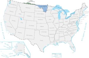
1818 |
British Cession |
Great Britain |
|
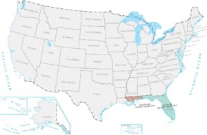
1819 |
Spanish Cession (Florida, parts of LA/CO) |
Spain |
|
1845 |
Texas Annexation |
Former Republic of Texas |
|
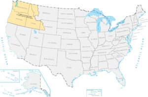
1846 |
Oregon Territory |
Treaty with Great Britain |
|
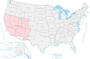
1848 |
Mexican Cession |
Mexico |
|
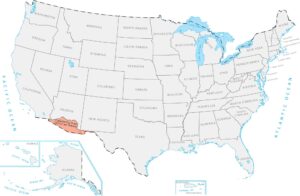
1853 |
Gadsden Purchase |
Purchased from Mexico |
|
1867 |
Alaska Purchase |
Purchased from Russia |
|
1898 |
Hawaii Annexation |
Former Republic of Hawaii |
|
1898 |
Puerto Rico |
Ceded by Spain |
|
1917 |
Virgin Islands |
Purchased from Denmark |
Maps of Territory Acquisition
Map the milestones of the American footprint.