Map of St. Louis Park, Minnesota
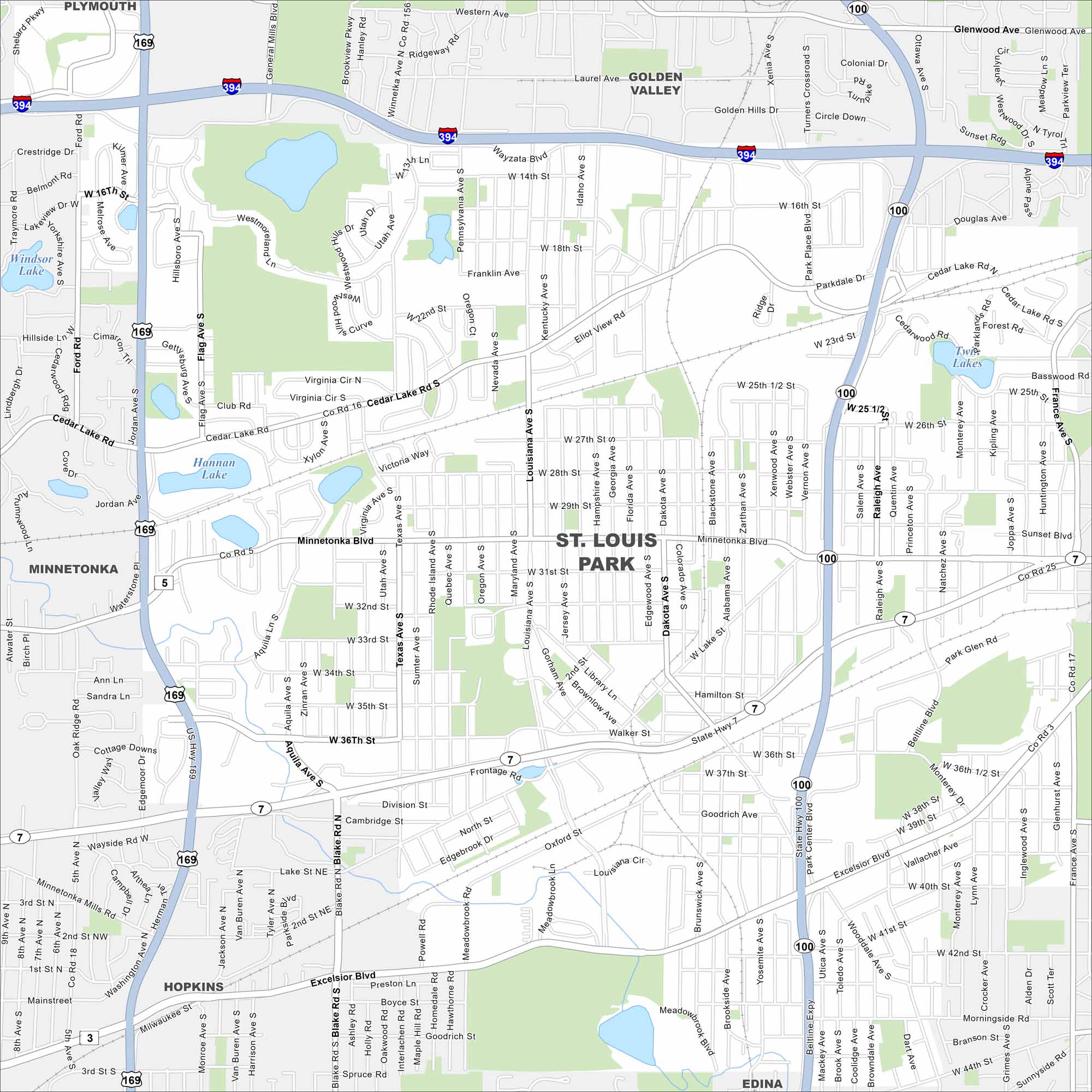
Get around St. Louis Park with our map. The city sits just west of Minneapolis and is filled with trails, parks, and active communities.
Map Information
On the Map
Interstates/Highways: I-394, US Hwy 169, State Rte 100, State Rte 7 Major Roads: Minnetonka Blvd, Excelsior Blvd, Cedar Lake Rd, Texas Ave, Louisiana Ave, Wooddale Ave, Dakota Ave, Walker St, W 36th St, W 28th St, W 26th St, Wayzata Blvd, Franklin Ave, W 16th St, Beltline Blvd, Monterey Ave, France Ave, Vernon Ave, Joppa Ave, Raleigh Ave Lakes and Reservoirs: Windsor Lake, Hannan Lake, Twin Lakes Nearby Communities: Plymouth, Golden Valley, Minnetonka, Hopkins, EdinaMinnesota State Maps
Explore every lake in our state maps of Minnesota


Minnesota City Maps
Browse through our city maps of Minnesota


