Map of Taunton, Massachusetts
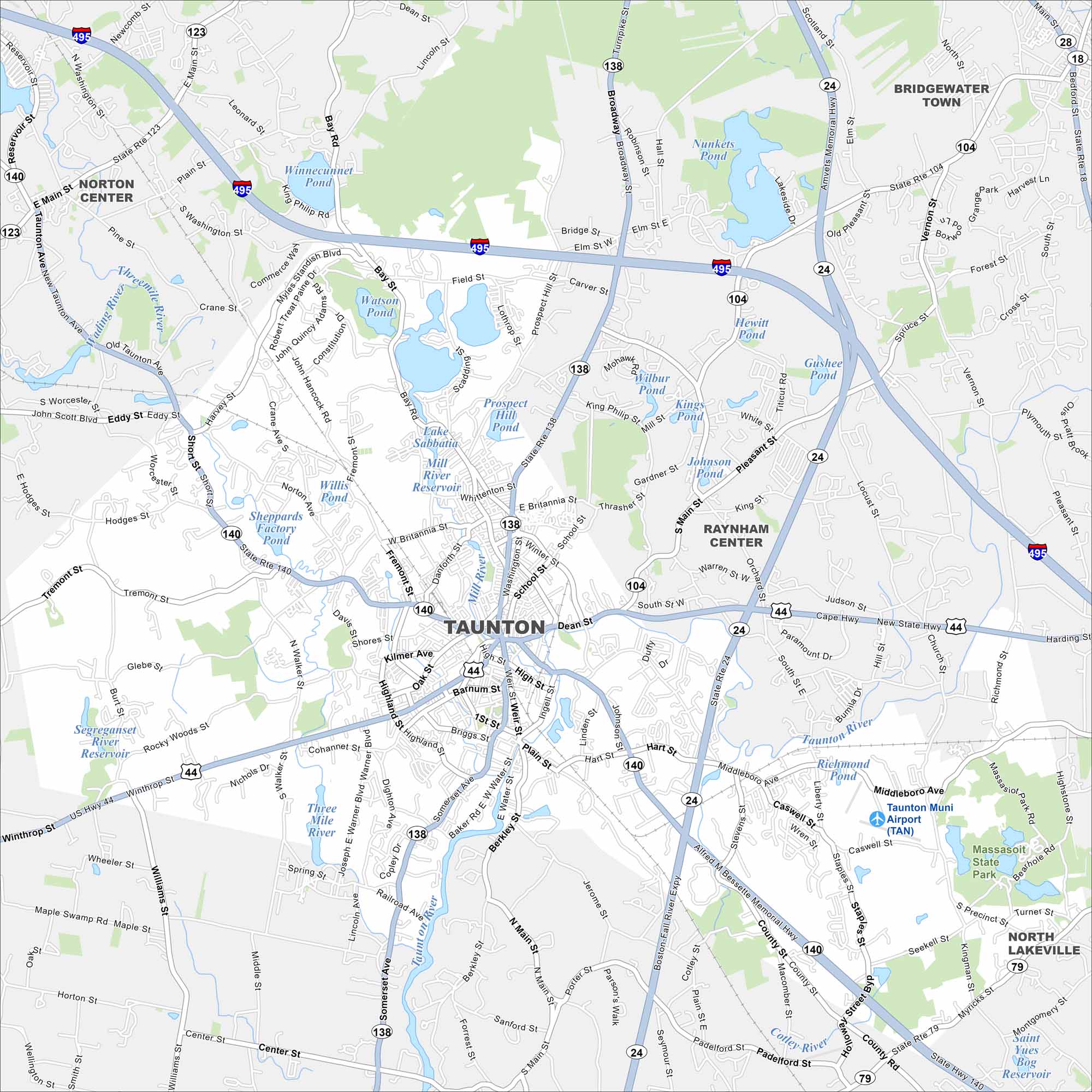
Our Taunton map shows you around the “Silver City”. It’s a historic New England community with a lively green, mills, and easy access to Boston.
Map Information
On the Map
Interstates/Highways: I-495, State Rte 24, State Rte 44, State Rte 79, State Rte 104, State Rte 123, State Rte 138, State Rte 140 Major Roads: Dean St, County St, Bay St, Winthrop St, Broadway, Somerset Ave, Middleboro Ave, Tremont St, Cohannet St, Weir St, Hart St, West Britannia St, East Britannia St, Thrasher St, Scadding St, Mill St, Highland St, Whittenton St, Oak St, Walker St Airports: Taunton Muni Airport (TAN) Lakes and Reservoirs: Watson Pond, Lake Sabbatia, Mill River Reservoir, Willis Pond, Winnecunnet Pond, Wilbur Pond, Kings Pond, Johnson Pond, Gushee Pond, Hewitt Pond, Richmond Pond, Segreganset Reservoir, Three Mile River, Saint Yves Bog Reservoir Major Rivers: Taunton River, Mill River, Snake River, Wading River, Three Mile River Parks and Preserves: Massasoit State Park Nearby Communities: Norton Center, Bridgewater Town, Raynham Center, North LakevilleMassachusetts State Maps
Here’s our state maps of Massachusetts


City Maps of Massachusetts
Explore Boston and other urban areas in Massachusetts


