Map of Temple, Texas
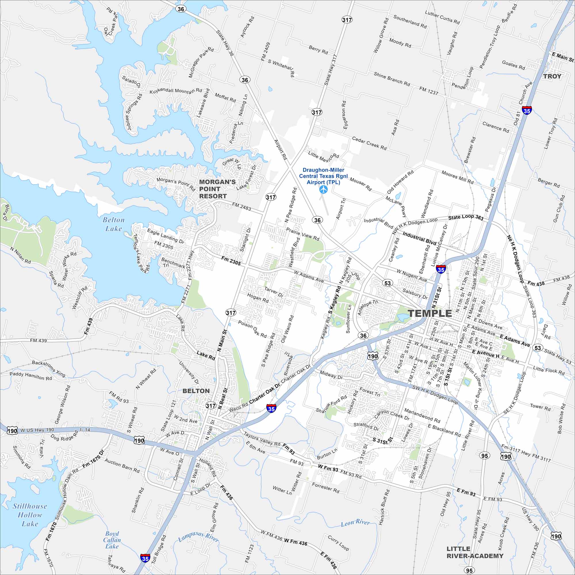
Here’s a simple map of Temple in Central Texas. It’s known for its medical hub, rail history, and growing neighborhoods.
Map Information
On the Map
Interstates/Highways: I-35, US Hwy 190, US Hwy 81, State Rte 36, State Rte 317, State Rte 53, State Rte 95 Major Roads: Dodgen Loop, State Loop 363, Adams Ave, Central Texas Expy, Nugent Ave, Main St, Kegley Rd, Airport Rd, Pea Ridge Rd, Charter Oak Dr, Taylors Valley Rd, HK Dodgen Loop Airports: Draughon-Miller Central Texas Rgnl Airport (TPL) Lakes and Reservoirs: Belton Lake, Stillhouse Hollow Lake, Boyd Callan Lake Major Rivers: Leon River, Lampasas River Nearby Communities: Belton, Troy, Morgan’s Point Resort, Little River-AcademyTexas State Maps
Scan our maps of the massive southern state of Texas.


City Maps of Texas
Explore our map collection of Texas cities.


