Map of Texarkana, Arkansas
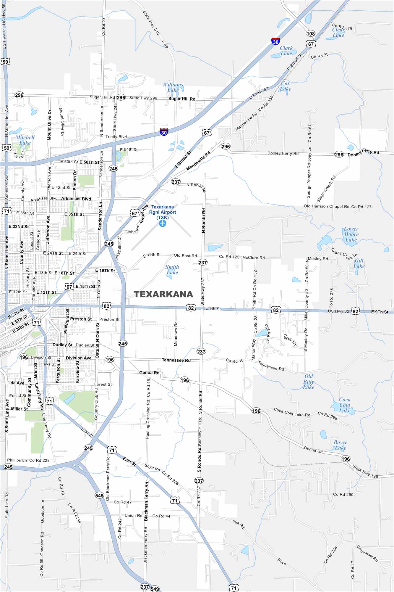
Our road map of Texarkana shows this border city split with Texas. It’s known for its federal courthouse that straddles two states and a lively downtown.
Arkansas State Maps
Check out our Arkansas maps here


Map Information
On the Map
Interstates/Highways: I-30, US Hwy 67, US Hwy 71, US Hwy 82, State Hwy 245, State Hwy 296, State Hwy 237, State Hwy 549, State Hwy 196 Major Roads: Broad St, State Line Ave, Jefferson Ave, Arkansas Blvd, 19th St, 35th St, Dudley St, Division Ave, Genoa Rd, Boyd Rd, Blackman Ferry Rd, Sanderson Ln, Rondo Rd, Old Post Rd, 9th St, Tennessee Rd, Forest St, 24th St, 12th St, Preston St Airports: Texarkana Rgnl Airport (TXK) Lakes and Reservoirs: Williams Lake, Clark Lake, Cox Lake, Clear Lake, Mitchell Lake, Smith Lake, Lower Moore Lake, Gill Lake, Old Bitty Lake, Coca Cola Lake, Boyce LakeArkansas City Maps
Discover Arkansas through our city maps


