Map of Thornton, Colorado
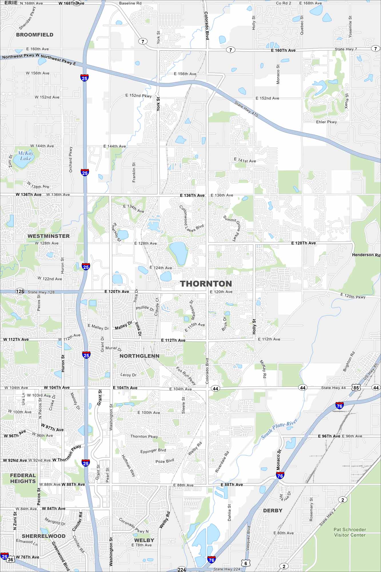
Get around Thornton with our city map. North of Denver, this fast-growing suburb features mountain views, green space, and easy connections to the metro area.
Colorado State Maps
Browse Colorado with our detailed state maps


Map Information
On the Map
Interstates/Highways: I-25, I-76, State Hwy 7, State Hwy 44, State Hwy 128, US Hwy 85 Major Roads: 120th Ave, Thornton Pkwy, 104th Ave, 88th Ave, 144th Ave, 136th Ave, Colorado Blvd, Washington St, Holly St, Quebec St, York St, Huron St, Pecos St, 160th Ave, 152nd Ave, 112th Ave, E-470, Northwest Pkwy, Riverdale Rd, Welby Rd Lakes and Reservoirs: McKay Lake, East Lake Major Rivers: South Platte River Parks and Preserves: Pat Schroeder Visitor Center Nearby Communities: Westminster, Northglenn, Federal Heights, Sherrelwood, Welby, Derby, Broomfield, ErieColorado City Maps
Here are maps of Colorado’s urban areas


