US Election 1908 Map
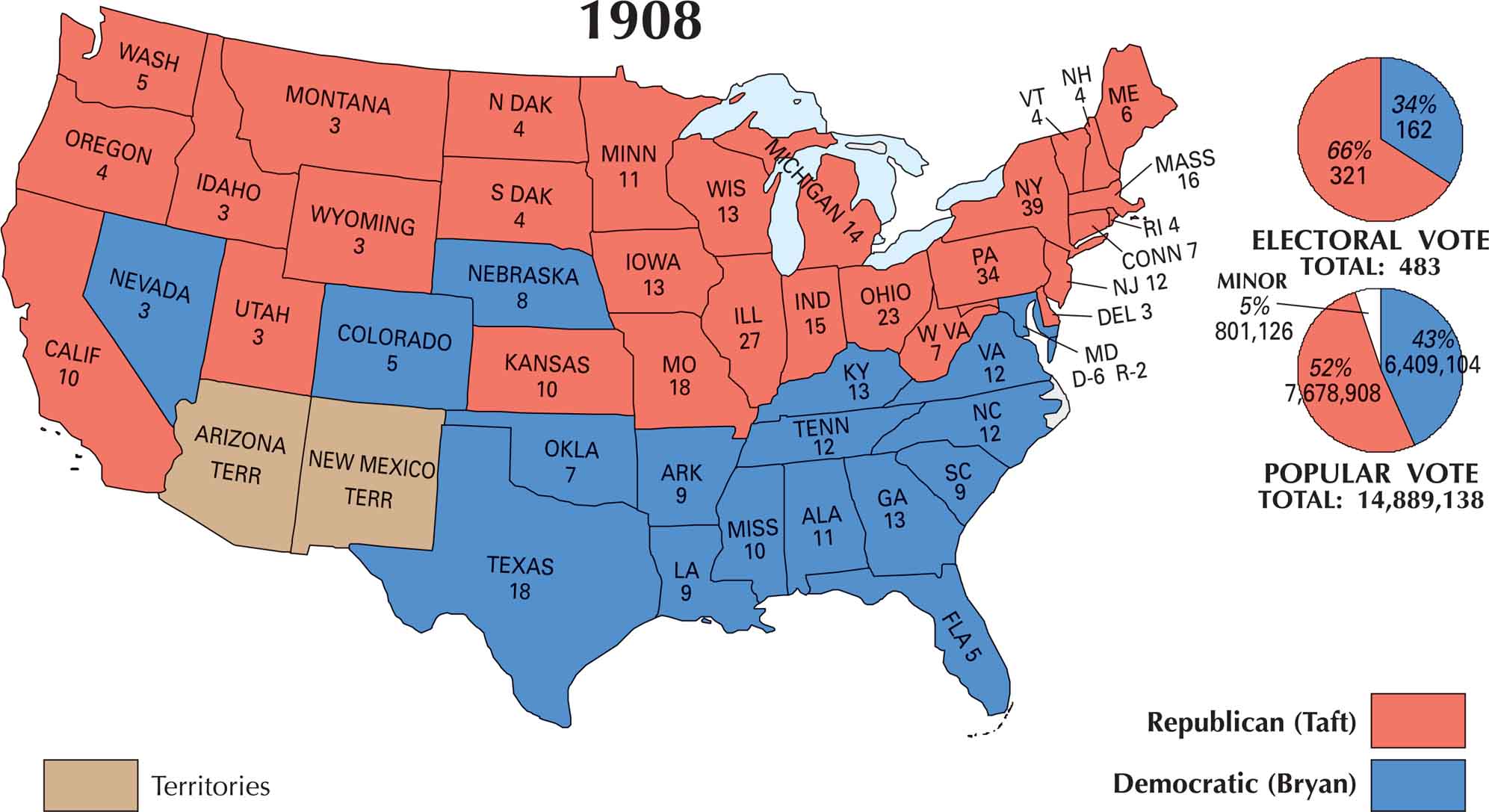
Our US election 1908 map shows the country was split clearly between North and South. William Howard Taft took the White House, dominating the industrial North and Midwest. But William Jennings Bryan kept the South in his column.
Map Information
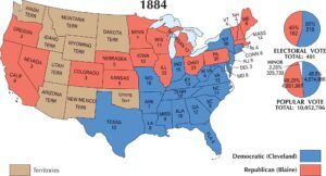
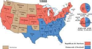
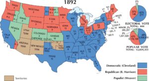
US Election Maps
Click on a map below to check out the US election map and results.


On the Map
Here is the state-by-state electoral breakdown and a summary of the 1908 Presidential Election.
States and Electoral Votes
|
State |
Total Votes |
Taft (R) |
Bryan (D) |
|---|---|---|---|
|
New York |
39 |
39 |
0 |
|
Pennsylvania |
34 |
34 |
0 |
|
Illinois |
27 |
27 |
0 |
|
Ohio |
23 |
23 |
0 |
|
Texas |
18 |
0 |
18 |
|
Missouri |
18 |
18 |
0 |
|
Massachusetts |
16 |
16 |
0 |
|
Indiana |
15 |
15 |
0 |
|
Michigan |
14 |
14 |
0 |
|
Georgia |
13 |
0 |
13 |
|
Kentucky |
13 |
0 |
13 |
|
Iowa |
13 |
13 |
0 |
|
Wisconsin |
13 |
13 |
0 |
|
Tennessee |
12 |
0 |
12 |
|
Virginia |
12 |
0 |
12 |
|
North Carolina |
12 |
0 |
12 |
|
Alabama |
11 |
0 |
11 |
|
New Jersey |
12 |
12 |
0 |
|
Kansas |
10 |
10 |
0 |
|
California |
10 |
10 |
0 |
|
Mississippi |
10 |
0 |
10 |
|
South Carolina |
9 |
0 |
9 |
|
Maryland |
8 |
2 |
6 |
|
Minnesota |
9 |
9 |
0 |
|
Louisiana |
9 |
0 |
9 |
|
Arkansas |
9 |
0 |
9 |
|
Nebraska |
8 |
0 |
8 |
|
Maine |
6 |
6 |
0 |
|
West Virginia |
7 |
7 |
0 |
|
Connecticut |
7 |
7 |
0 |
|
Oklahoma |
7 |
0 |
7 |
|
Washington |
5 |
5 |
0 |
|
Colorado |
5 |
0 |
5 |
|
Oregon |
4 |
4 |
0 |
|
South Dakota |
4 |
4 |
0 |
|
Florida |
5 |
0 |
5 |
|
New Hampshire |
4 |
4 |
0 |
|
Vermont |
4 |
4 |
0 |
|
Rhode Island |
4 |
4 |
0 |
|
North Dakota |
4 |
4 |
0 |
|
Montana |
3 |
3 |
0 |
|
Utah |
3 |
3 |
0 |
|
Wyoming |
3 |
3 |
0 |
|
Idaho |
3 |
3 |
0 |
|
Nevada |
3 |
0 |
3 |
|
Delaware |
3 |
3 |
0 |
Election Summary
- The Winner: William Howard Taft (Republican), the hand-picked successor of Theodore Roosevelt, won with 321 electoral votes.
- The Challenger: William Jennings Bryan (Democrat) suffered his third and final defeat in a presidential race, finishing with 162 electoral votes.
- Popular Vote: Taft secured 51.6% (approx. 7.67 million votes) compared to Bryan’s 43.0% (approx. 6.41 million votes).
- New State Participation: Oklahoma participated in its first-ever presidential election, casting all 7 of its electoral votes for Bryan.
- Electoral Split: Maryland provided a rare split in this era, with 6 electors going to Bryan and 2 to Taft.