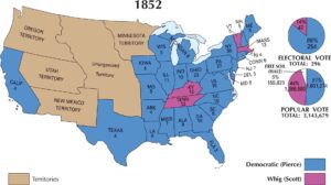
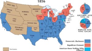
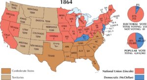
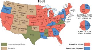
US Election 1860 Map

Our map of the 1860 election shows a division that is impossible to miss. Four major candidates split the country almost perfectly along regional lines. Abraham Lincoln’s Republican support covers nearly the entire North and the new western states. But the South was a solid block for John C. Breckinridge. The border states lean toward John Bell, and parts of the North still back Stephen Douglas. When all the dust settled, Abraham Lincoln won this election.
Map Information
US Election Maps
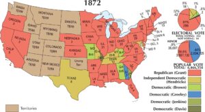
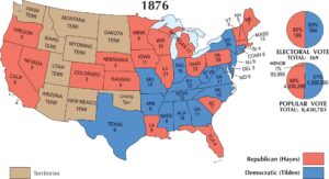
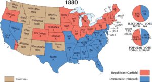
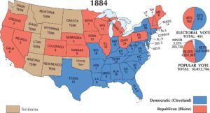
Click on a map below to check out the US election map and results.
On the Map
The 1860 Presidential Election map captures one of the most pivotal moments in American history, showing a four-way split that preceded the Civil War. This election saw the Republican Party win the presidency for the first time, while the Democratic Party fractured into Northern and Southern factions.
States and Electoral Votes
|
State |
Total Votes |
Lincoln (R) |
Breckinridge (SD) |
Bell (CU) |
Douglas (D) |
|
New York |
35 |
35 |
0 |
0 |
0 |
|
Pennsylvania |
27 |
27 |
0 |
0 |
0 |
|
Ohio |
23 |
23 |
0 |
0 |
0 |
|
Virginia |
15 |
0 |
0 |
15 |
0 |
|
Massachusetts |
13 |
13 |
0 |
0 |
0 |
|
Indiana |
13 |
13 |
0 |
0 |
0 |
|
Kentucky |
12 |
0 |
0 |
12 |
0 |
|
Tennessee |
12 |
0 |
0 |
12 |
0 |
|
Illinois |
11 |
11 |
0 |
0 |
0 |
|
North Carolina |
10 |
0 |
10 |
0 |
0 |
|
Georgia |
10 |
0 |
10 |
0 |
0 |
|
Alabama |
9 |
0 |
9 |
0 |
0 |
|
Missouri |
9 |
0 |
0 |
0 |
9 |
|
Mississippi |
7 |
0 |
7 |
0 |
0 |
|
Maine |
8 |
8 |
0 |
0 |
0 |
|
Maryland |
8 |
0 |
8 |
0 |
0 |
|
South Carolina |
8 |
0 |
8 |
0 |
0 |
|
New Jersey |
7 |
4 |
0 |
0 |
3 |
|
Michigan |
6 |
6 |
0 |
0 |
0 |
|
Louisiana |
6 |
0 |
6 |
0 |
0 |
|
New Hampshire |
5 |
5 |
0 |
0 |
0 |
|
Vermont |
5 |
5 |
0 |
0 |
0 |
|
Wisconsin |
5 |
5 |
0 |
0 |
0 |
|
Connecticut |
6 |
6 |
0 |
0 |
0 |
|
Rhode Island |
4 |
4 |
0 |
0 |
0 |
|
Arkansas |
4 |
0 |
4 |
0 |
0 |
|
Iowa |
4 |
4 |
0 |
0 |
0 |
|
Texas |
4 |
0 |
4 |
0 |
0 |
|
California |
4 |
4 |
0 |
0 |
0 |
|
Minnesota |
4 |
4 |
0 |
0 |
0 |
|
Oregon |
3 |
3 |
0 |
0 |
0 |
|
Delaware |
3 |
0 |
3 |
0 |
0 |
|
Florida |
3 |
0 |
3 |
0 |
0 |
Election Summary
- The Winner: Abraham Lincoln (Republican) won with 180 electoral votes (59%).
- Southern Democrat: John C. Breckinridge won 72 electoral votes (24%), sweeping most of the Deep South.
- Constitutional Union: John Bell won 39 electoral votes (13%), carrying the border states of Virginia, Kentucky, and Tennessee.
- Northern Democrat: Stephen A. Douglas won 12 electoral votes (4%), despite finishing second in the popular vote.
- Popular Vote: Totaled 4,682,069. Lincoln won 40% (1,866,452), Douglas 29% (1,376,957), Breckinridge 18% (847,953), and Bell 13% (588,879).
- New States: Minnesota (4) and Oregon (3) participated in their first presidential election.
- Sectionalism: Lincoln did not carry a single slave state, while his opponents split the remaining regions.