Downtown Cincinnati Map
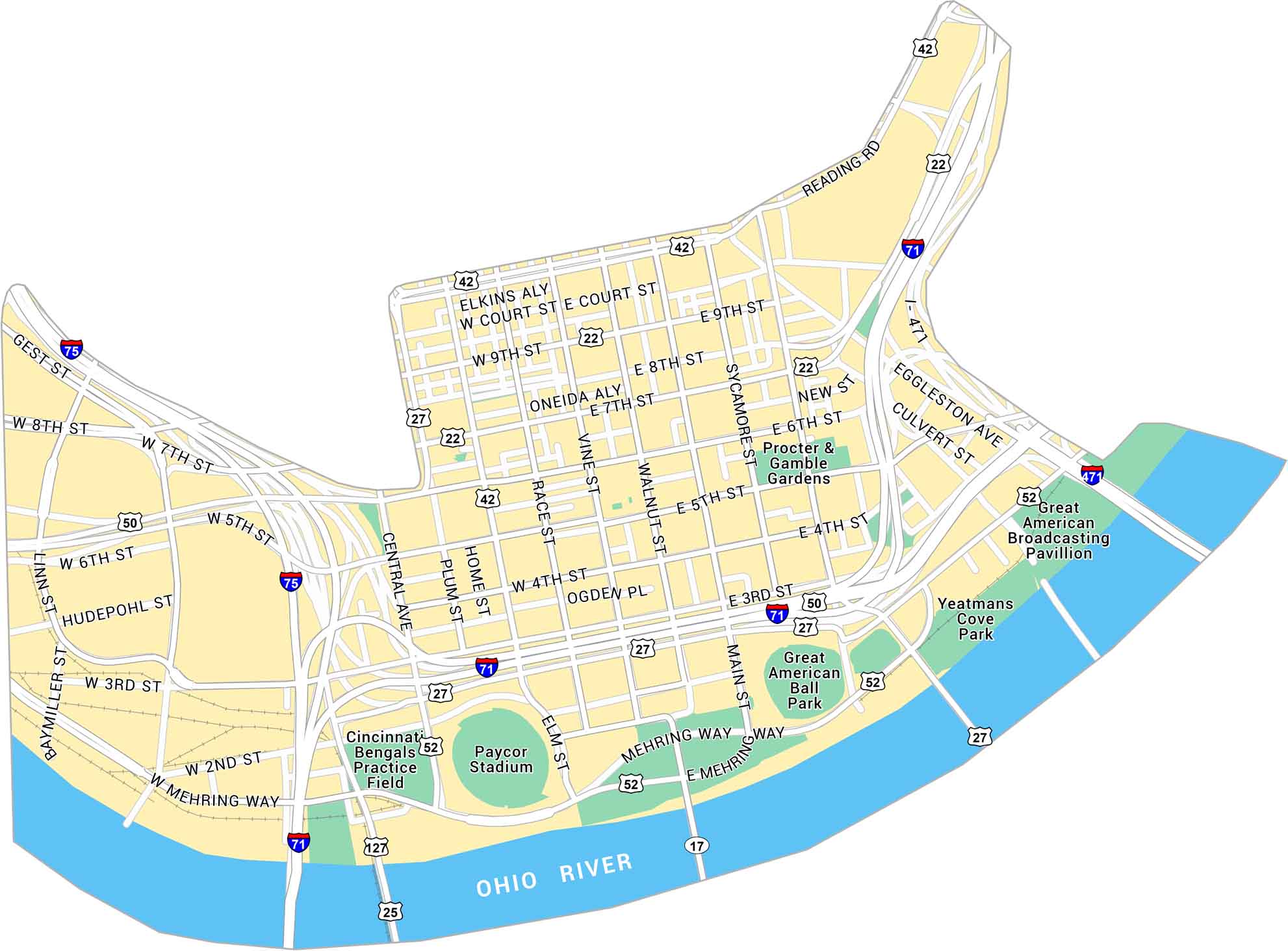
Here’s our map of Downtown Cincinnati, situated along the Ohio River. You’ll see stadiums, bridges, and streets running through the heart of the city. The map also shows local parks, major roads, and highways.
Map Information
On the Map
Interstates/Highways: I-71, I-75, I-471, US Hwy 50, US Hwy 42, US Hwy 127, US Hwy 25, US Hwy 22, US Hwy 52, US Hwy 27, State Rte 17 Major Roads: Mehring Way, Central Ave, Main St, Vine St, Walnut St, Reading Rd, Eggleston Ave, Sycamore St, Broadway St, Race St, Plum St, Gest St, 9th St, 8th St, 7th St, 6th St, 5th St, 4th St, 3rd St, 2nd St Major Rivers: Ohio River Parks: Procter & Gamble Gardens, Yeatmans Cove Park Landmarks: Paycor Stadium, Great American Ball Park, Cincinnati Bengals Practice Field, Great American Broadcasting PavillionCity Maps of Ohio
Here are maps of Columbus and Ohio’s major cities


