Downtown Cleveland Map
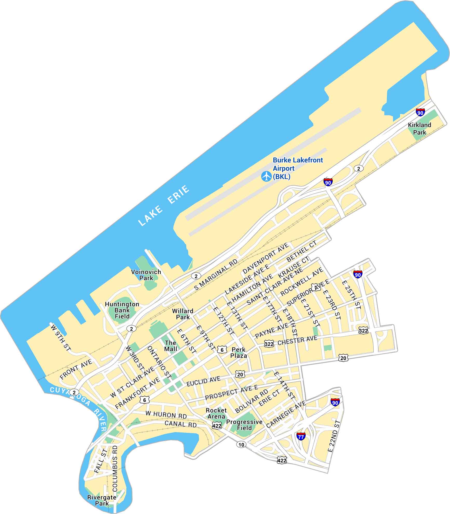
Our map of Downtown Cleveland lays out the lakefront, stadium, and busy downtown streets. It’s an easy way to get oriented in the city including highways, parks, and main connecting roads.
Map Information
On the Map
Interstates/Highways: I-90, I-77, US Hwy 20, US Hwy 322, US Hwy 422, State Rte 2, State Rte 6, State Rte 10 Major Roads: Euclid Ave, Carnegie Ave, Superior Ave, Lakeside Ave, Ontario St, Chester Ave, Payne Ave, Orange Ave, Prospect Ave, St Clair Ave, Marginal Rd, Front Ave, Canal Rd, Huron Rd, Columbus Rd, 9th St, 13th St, 18th St, 21st St, 25th St Lakes/Rivers: Lake Erie, Cuyahoga River Parks: Voinovich Park, Willard Park, Perk Plaza, Rivergate Park, Kirkland Park Landmarks: Burke Lakefront Airport (BKL), Rocket Arena, Progressive Field, Huntington Bank Field, The MallCity Maps of Ohio
Here are maps of Columbus and Ohio’s major cities


