Downtown Columbus Map
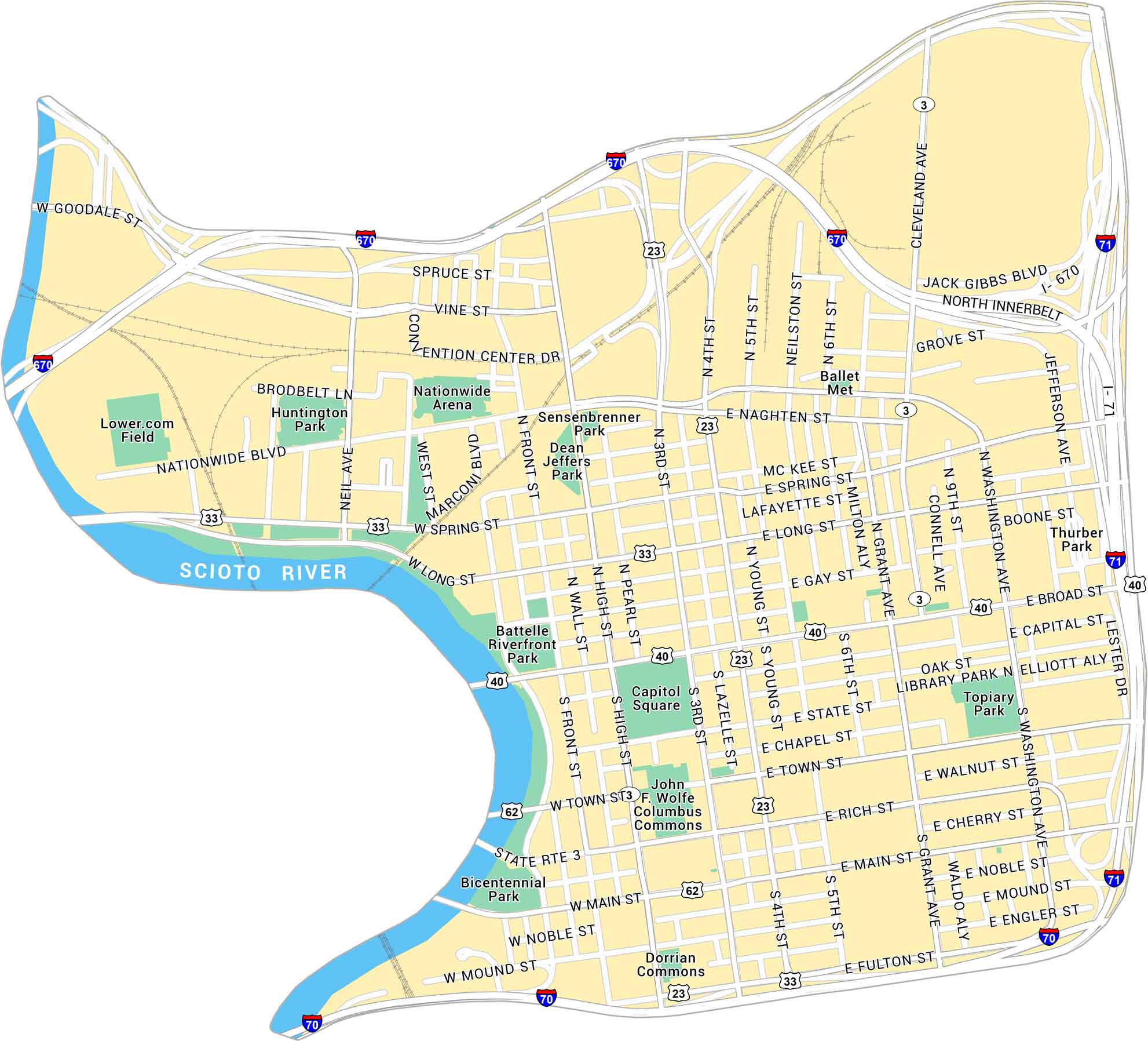
This map of Downtown Columbus shows the Scioto River and the streets around the Capitol. It gives a clear look at downtown’s layout and surrounding areas. We feature local parks, roadways, and major interstates.
Map Information
On the Map
Interstates/Highways: I-70, I-71, I-670, US Hwy 33, US Hwy 40, US Hwy 62, US Hwy 23, State Rte 3 Major Roads: High St, Broad St, Main St, Front St, 3rd St, 4th St, 5th St, 6th St, Cleveland Ave, Fourth St, Long St, Spring St, Town St, Rich St, Mound St, Fulton St, Neil Ave, Grant Ave, Washington Ave, Goodale St Major Rivers: Scioto River Parks: Bicentennial Park, Battelle Riverfront Park, Huntington Park, Sensenbrenner Park, Dean Jeffers Park, Thurber Park, Topiary Park Landmarks: Nationwide Arena, Lower.com Field, Convention Center Dr, Capitol Square, Columbus Commons, Dorrian Commons, John F. Wolfe Columbus Commons, Ballet MetCity Maps of Ohio
Here are maps of Columbus and Ohio’s major cities


