Downtown San Jose Map
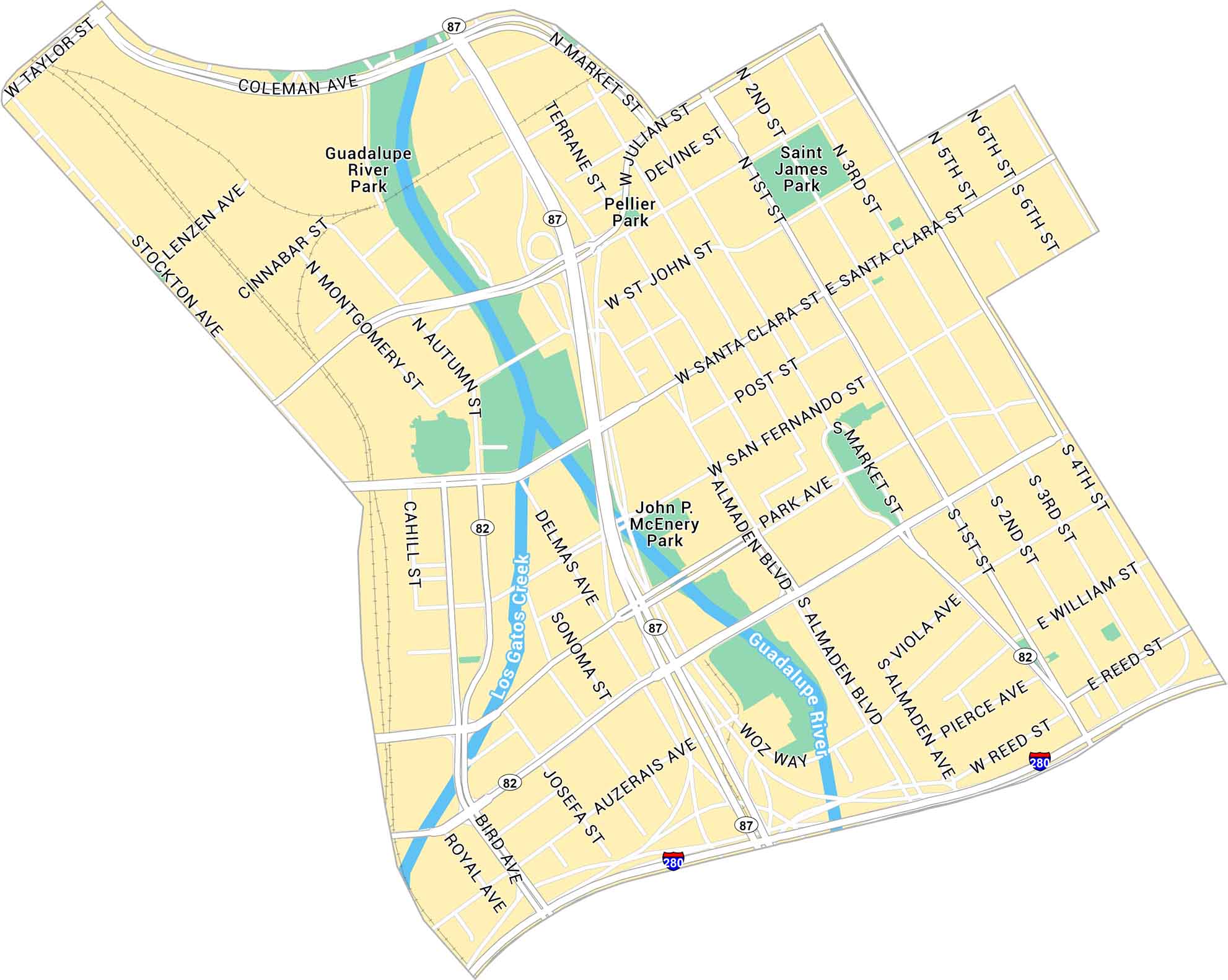
Our map of Downtown San Jose shows the city’s center with the Guadalupe River flowing through it. It lays out main roads, parks, and the light rail lines cutting through downtown. This is the heart of Silicon Valley with lots of headquarters here.
Map Information
On the Map
Interstates/Highways: I-280, State Rte 87, State Rte 82 Major Roads: Santa Clara St, Almaden Blvd, Market St, San Fernando St, Park Ave, Coleman Ave, Taylor St, Julian St, San John St, Post St, San Salvador St, William St, Reed St, Auzerais Ave, Woz Way, Bird Ave, Montgomery St, Autumn St, Stockton Ave, Lenzen Ave Major Rivers: Guadalupe River, Los Gatos Creek Parks: Guadalupe River Park, Saint James Park, John P McEnery Park, Pellier ParkCalifornia City Maps
Here are detailed maps of California


