Mission Hills Map, San Diego
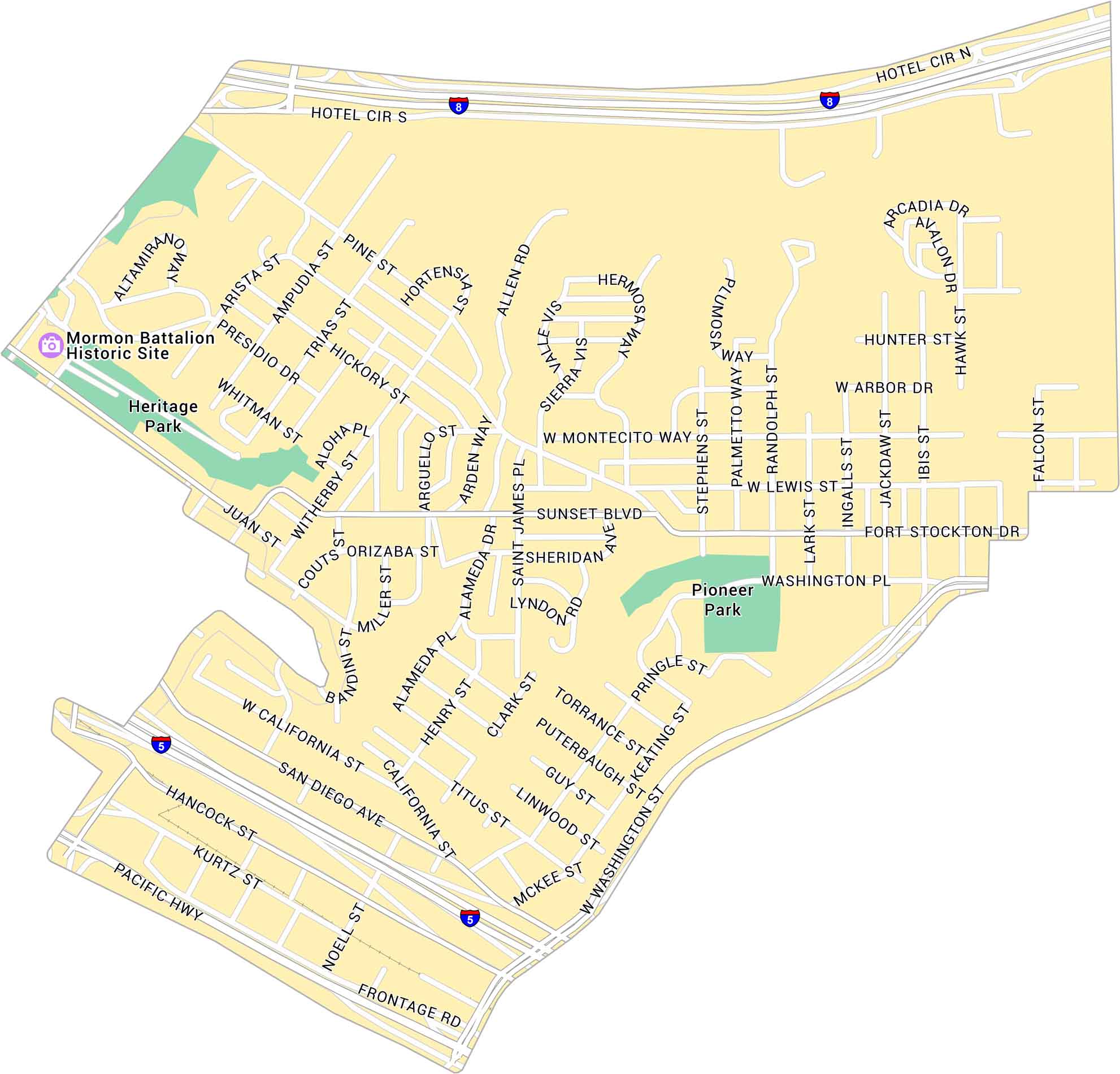
Our map of Mission Hills shows the hillside neighborhood just north of downtown San Diego. It highlights highways, main streets and parks. It’s certainly a quiet area with easy access to Balboa Park and the city center.
Map Information
On the Map
Interstates/Highways: I-8, I-5, Pacific Hwy Major Roads: Washington St, Fort Stockton Dr, Sunset Blvd, Mission Hills Blvd, W Washington Pl, San Diego Ave, California St, Hancock St, Kurtz St, Noell St, Frontage Rd, Juan St, Witherby St, Alameda Dr, Saint James Pl, Stephens St, Randolph St, Lark St, Ingalls St Parks: Pioneer Park, Heritage Park Landmarks: Mormon Battalion Historic SiteCalifornia City Maps
Here are detailed maps of California


