Oak Cliff Map, Dallas
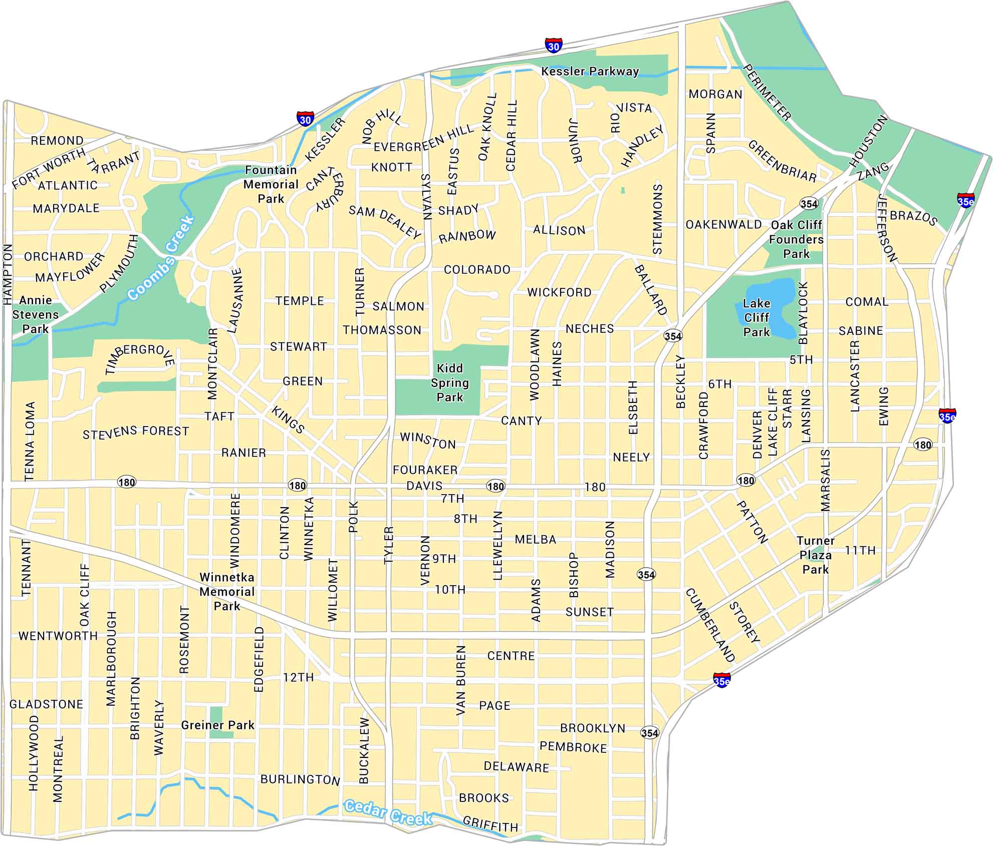
Our map of Oak Cliff shows the large, historic area just southwest of downtown Dallas. It highlights major roads, parks, and neighborhoods spread across rolling terrain.
Map Information
Dallas Neighborhood Maps
See our neighborhood maps for a closer look of the city.
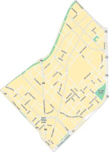
On the Map
Interstates/Highways: I-30, I-35E, US Hwy 354, State Rte 180 Major Roads: Davis St, Jefferson Blvd, Zang Blvd, Beckley Ave, Marsalis Ave, Lancaster Rd, Hampton Rd, Sylvan Ave, Colorado Blvd, Centre St, 7th St, 8th St, 10th St, 12th St, Tyler St, Polk St, Edgefield Ave, Windomere Ave, Clinton Ave, Winnetka Ave Major Rivers: Cedar Creek, Coombs Creek Parks: Lake Cliff Park, Founders Park, Kidd Springs Park, Winnetka Memorial Park, Greiner Park, Turner Plaza Park, Fountain Memorial Park, Annie Stevens ParkCity Maps of Texas
Explore our map collection of Texas cities.


