Map of Van Buren, Arkansas
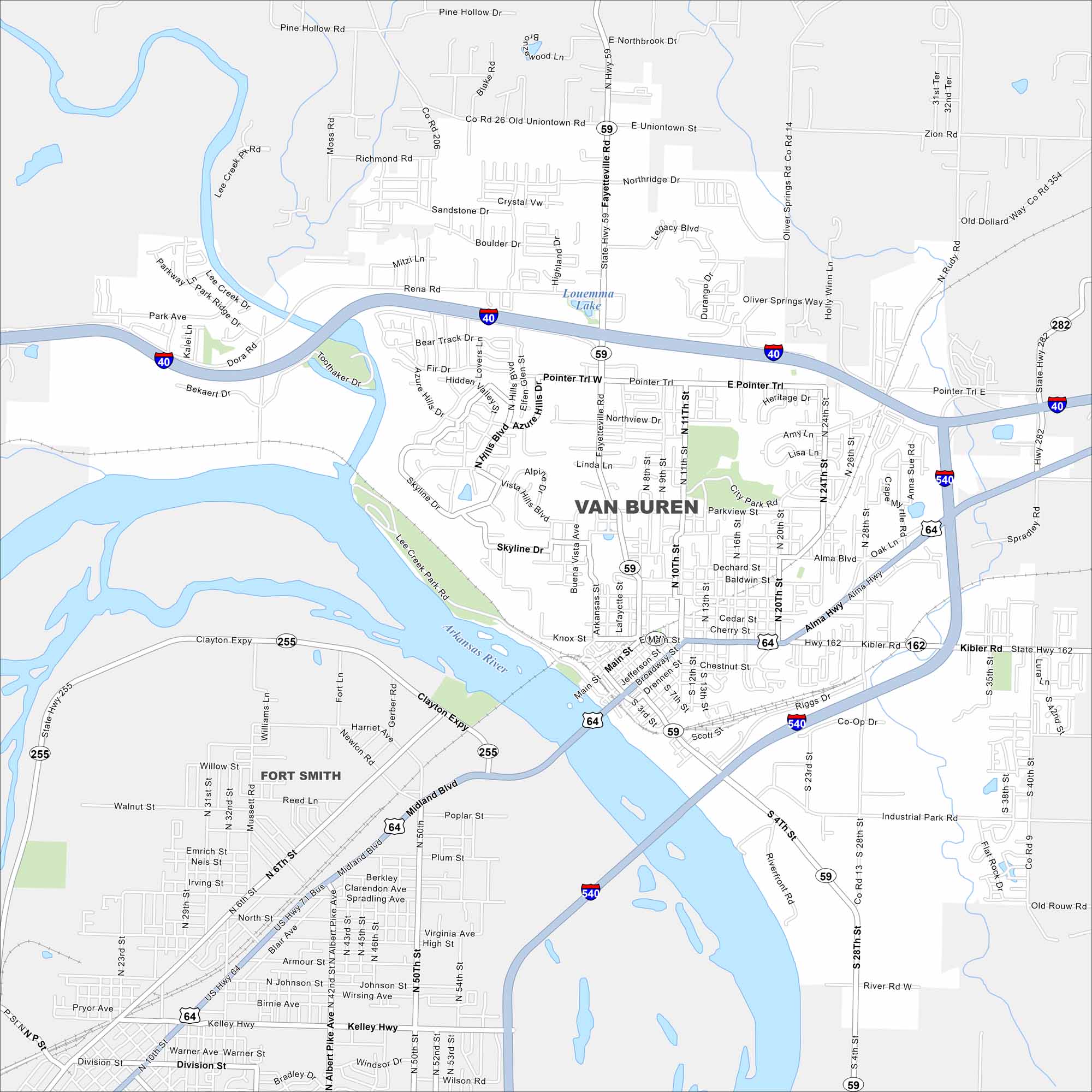
Van Buren is a historic Arkansas town on the Arkansas River. Our map helps you see its bridges, streets, and rail lines. I-40 and I-540 are the major highways that cut through here.
Arkansas State Maps
Check out our Arkansas maps here


Map Information
On the Map
Interstates/Highways: I-40, I-540, US Hwy 64, US Hwy 71 Bus, State Hwy 59, State Hwy 162, State Hwy 282, State Hwy 255 Major Roads: Main St, Fayetteville Rd, Alma Hwy, Pointer Trl, Pointer Trl E, Pointer Trl W, Broadway St, Jefferson St, Baldwin St, Parkview St, City Park Rd, Northview Dr, Linda Ln, Rena Rd, Kibler Rd, Scott St, Industrial Park Rd, Skyline Dr, Knox St, Drennen St Lakes and Reservoirs: Louemma Lake Major Rivers: Arkansas River Nearby Communities: Fort Smith, KiblerArkansas City Maps
Discover Arkansas through our city maps


