Map of Victoria, Texas
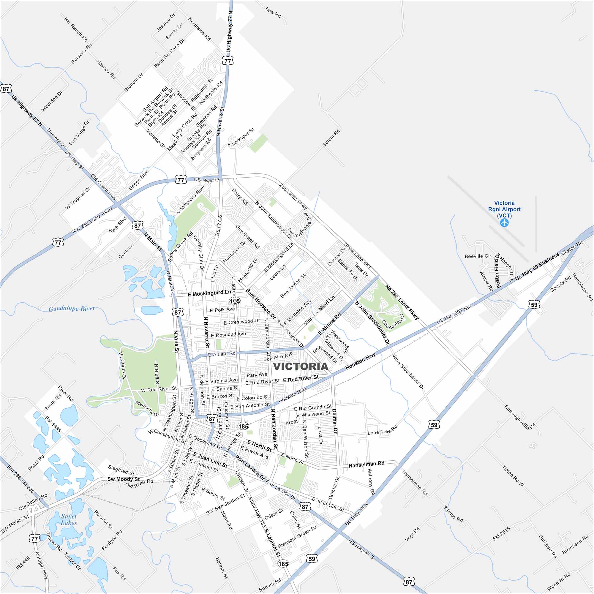
Our map of Victoria shows you around this South Texas crossroads. The city is known for its historic downtown and cultural centers.
Map Information
On the Map
Interstates/Highways: US Hwy 77, US Hwy 59, US Hwy 87, State Rte 185, State Rte 463 Major Roads: Main St, Navarro St, Laurent St, Mockingbird Ln, Airline Rd, Houston Hwy, Rio Grande St, Red River St, Northside Rd, Zac Lentz Pkwy, Constitution St, Juan Linn St, Convent St, Goodwin Ave, Ben Jordan St, Sam Houston Dr, Delmar Dr, John Stockbauer Dr, Lone Tree Rd, Hanselman Rd Airports: Victoria Rgnl Airport (VCT) Lakes and Reservoirs: Saxet Lakes Major Rivers: Guadalupe RiverTexas State Maps
Scan our maps of the massive southern state of Texas.


City Maps of Texas
Explore our map collection of Texas cities.


