Map of Woodinville, Washington
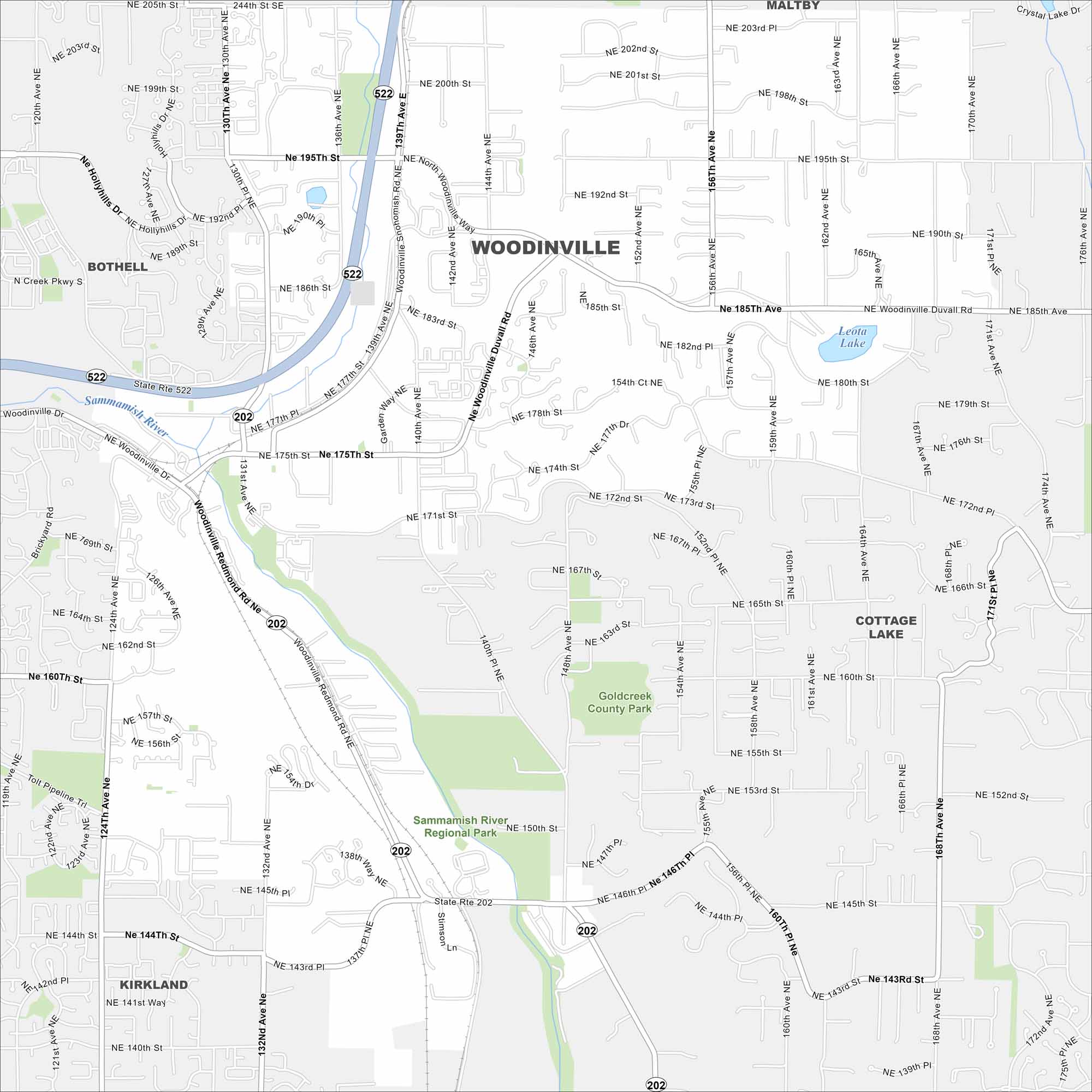
Get a snapshot of Woodinville in the Sammamish Valley. It’s known for wineries, breweries, and a scenic riverside setting.
Map Information
On the Map
Interstates/Highways: State Rte 202, State Rte 522 Major Roads: Woodinville Redmond Rd, Woodinville Snohomish Rd, Woodinville Duvall Rd, 140th Ave, 132nd Ave, 156th Ave, 131st Ave, 124th Ave, 171st St, 175th St, 190th St, 195th St, 202nd St, Garden Way, 142nd Ave, 144th Ave, 148th Ave, 152nd Ave, 160th Ave, 164th St Lakes and Reservoirs: Leota Lake Major Rivers: Sammamish River Parks and Preserves: Sammamish River Regional Park, Goldcreek County Park Nearby Communities: Bothell, Maltby, Cottage Lake, KirklandWashington State Maps
Move through the Evergreen State with our map collection.


City Maps of Washington
Check out our city maps of Washington


