Map of Vancouver, Washington
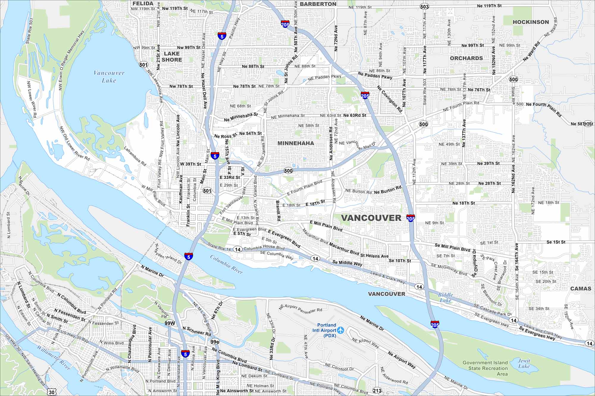
See how Vancouver is connected across the Columbia River. Our map shows its neighborhoods, waterfront, and quick routes into Portland. Don’t get this Vancouver confused to the one in British Columbia.
Map Information
On the Map
Interstates/Highways: I-5, I-205, US Hwy 30, US Hwy 99, State Rte 14, State Rte 500, State Rte 501, State Rte 503 Major Roads: Mill Plain Blvd, Fourth Plain Blvd, Evergreen Blvd, Padden Pkwy, St Johns Rd, Andresen Rd, Covington Rd, 117th Ave, 162nd Ave, 164th Ave, 78th St, 99th St, 119th St, Fruit Valley Rd, Main St, Columbia St, Columbia House Blvd, Marine Dr, McGillivray Blvd, Ellsworth Rd Airports: Portland Intl Airport (PDX) Lakes and Reservoirs: Vancouver Lake, Biddle Lake Major Rivers: Columbia River, Willamette River Parks and Preserves: Government Island State Recreation Area Nearby Communities: Felida, Lake Shore, Barberton, Hockinson, Orchards, Minnehaha, CamasWashington State Maps
Move through the Evergreen State with our map collection.


City Maps of Washington
Check out our city maps of Washington


