Map of Valparaiso, Indiana
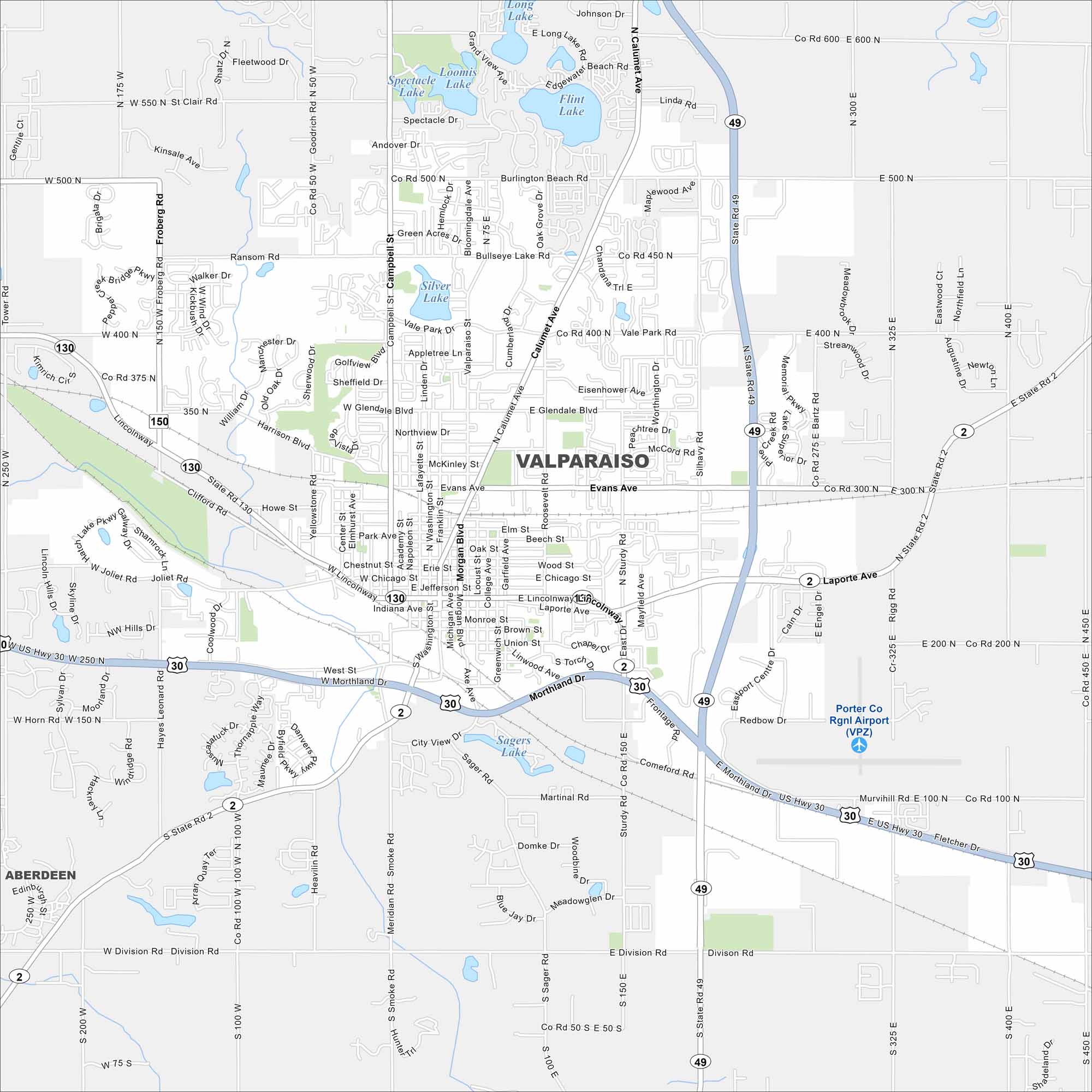
Get around Valparaiso with our detailed city map. It’s known for Valparaiso University, a lively downtown, and nearby Indiana Dunes.
Indiana State Maps
Study about Indiana with our map collection


Map Information
On the Map
Interstates/Highways: US Hwy 30, State Rte 2, State Rte 49, State Rte 130, State Rte 150 Major Roads: Lincolnway, Morthland Dr, Calumet Ave, Laporte Ave, Evans Ave, Campbell St, Valparaiso St, Silhavy Rd, Vale Park Rd, Roosevelt Rd, Morgan Blvd, Sturdy Rd, Division Rd, Smoke Rd, Joliet Rd, Burlington Beach Rd, Glendale Blvd, Heavilin Rd, Meridian Rd, Harrison Blvd Airports: Porter Co Rgnl Airport (VPZ) Lakes and Reservoirs: Flint Lake, Long Lake, Spectacle Lake, Loomis Lake, Silver Lake, Bullseye Lake, Sagers Lake Nearby Communities: AberdeenIndiana City Maps
Here are our maps of Indianapolis and Indiana cities


