Map of Tuscaloosa, Alabama
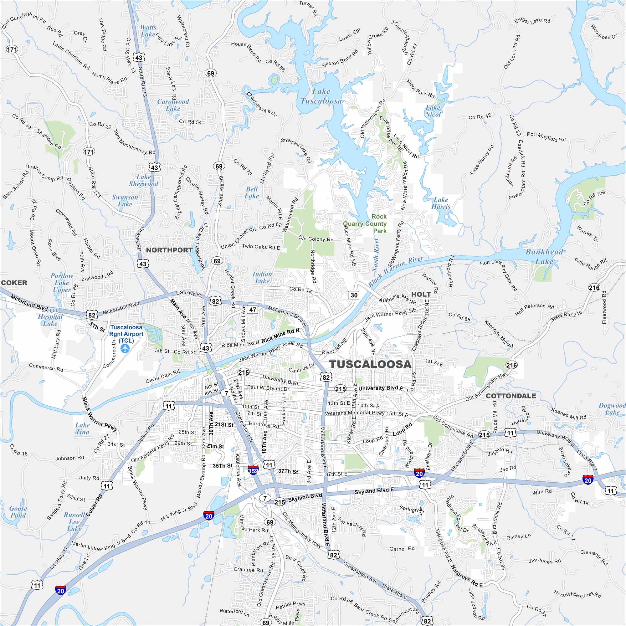
Our map of Tuscaloosa highlights this riverfront city. It’s home to the University of Alabama, Crimson Tide football, and a growing downtown. Two major water features are Lake Tuscaloosa and the Black Warrior River.


Map Information
On the Map
Interstates/Highways: I-20, I-359, US 82, US 43, US 11, AL 69, AL 215, AL 216, AL 171, AL 7, AL 30, AL 47 Major Roads: McFarland Blvd, University Blvd, Skyland Blvd, Rice Mine Rd, Jack Warner Pkwy, 15th St, 21st St, 35th St, Lurleen B Wallace Blvd, Hargrove Rd, Flatwoods Rd, Old Colony Rd, Twin Oaks Rd, Loop Rd, Crescent Ridge Rd, Veteran Memorial Pkwy, Paul W Bryant Dr, Waterford Ln Airports: Tuscaloosa Regional Airport (TCL) Lakes and Reservoirs: Lake Tuscaloosa, Lake Nicol, Lake Harris, Bankhead Lake, Watts Lake, Caralwood Lake, Lake Sherwood, Swanson Lake, Bell Lake, Indian Lake, Partlow Lake Upper, Bryce Hospital Lake, Lake Tina, Russell Creek Lake, Goose Pond, Dogwood Lake Rivers and Creeks: Black Warrior River Nearby Communities: Northport, Coker, Holt, CottondaleAlabama City Maps
Here are our city maps of Alabama


