Map of Tigard, Oregon
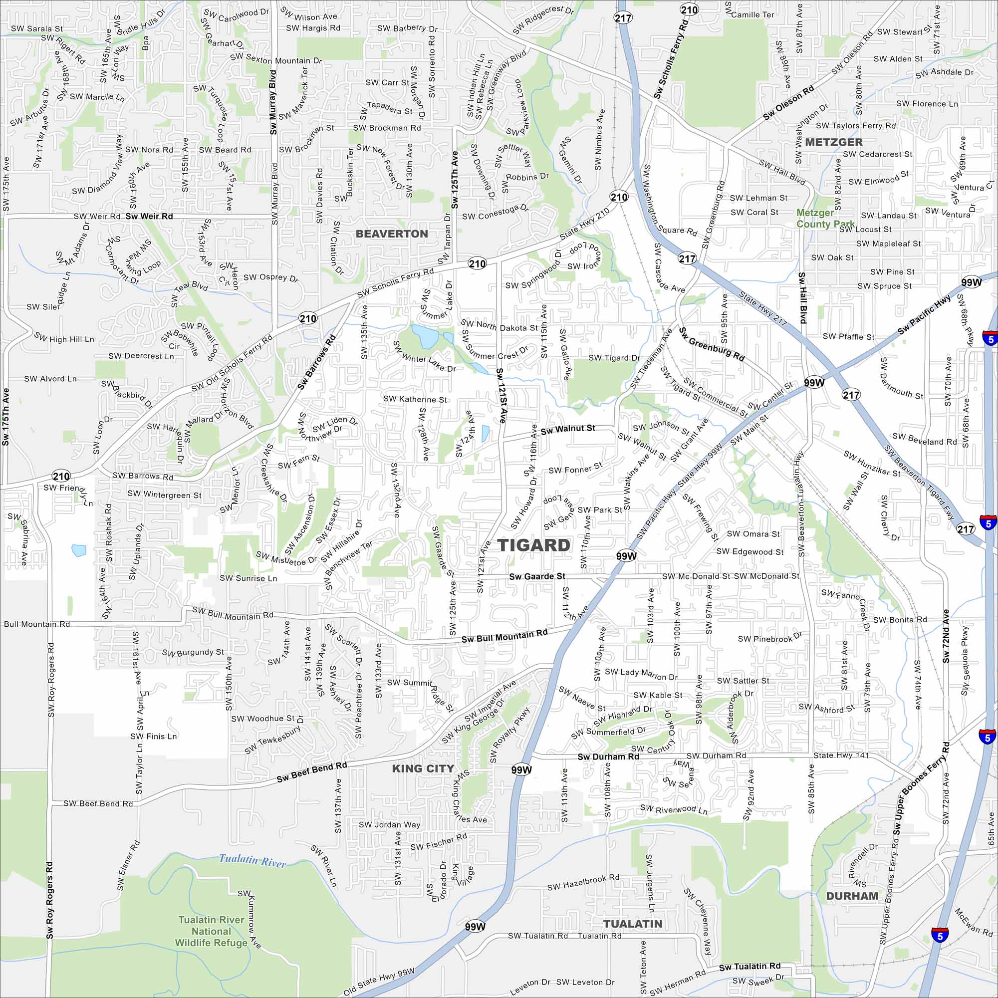
Our map of Tigard helps you explore this Portland metro suburb. It features shopping centers, Tualatin River access, and suburban neighborhoods.
Map Information
On the Map
Interstates/Highways: I-5, US Hwy 99W, State Rte 217, State Rte 210, State Rte 141 Major Roads: Pacific Hwy, Beaverton Tigard Hwy, Scholls Ferry Rd, Hall Blvd, Durham Rd, Gaarde St, Bull Mountain Rd, Beef Bend Rd, 121st Ave, Main St, Greenburg Rd, Tiedeman Rd, Walnut St, McDonald St, Barrows Rd, Weir Rd, Murray Blvd, Sexton Mountain Rd, Roy Rogers Rd Major Rivers: Tualatin River Parks and Preserves: Tualatin River National Wildlife Refuge Nearby Communities: Beaverton, Metzger, King City, Durham, TualatinOregon State Maps
Here is our state map collection of Oregon.


City Maps of Oregon
Get to know Portland and Oregon’s urban areas.


