Wyoming Outline Map
Our Wyoming outline maps displays this almost perfect rectangle. Every border is a straight line without any river or terrain borders.

Our Wyoming outline maps displays this almost perfect rectangle. Every border is a straight line without any river or terrain borders.
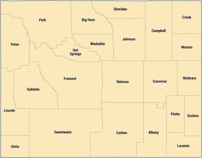
Our Wyoming county map shows its 23 counties. Laramie County down south has Cheyenne, but most counties are incredibly rural.
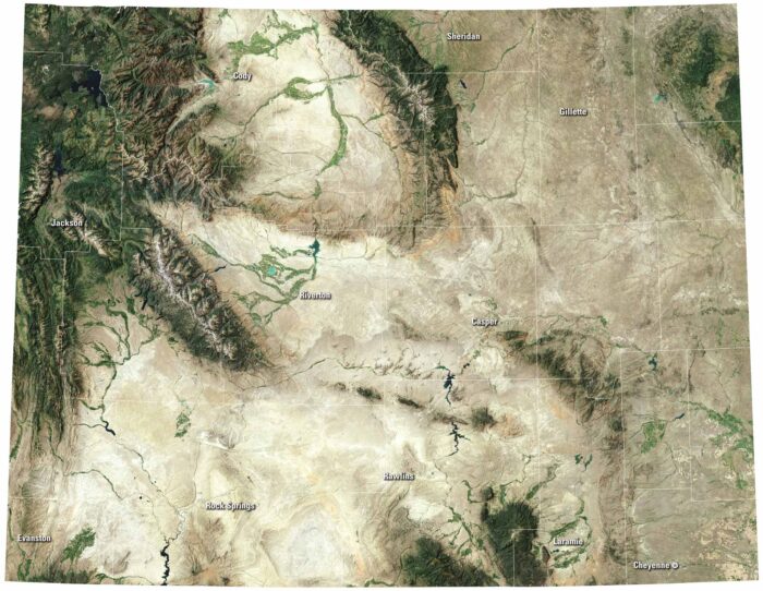
Wyoming’s satellite map is full of open land and rugged scenery. Yellowstone’s lakes stand out along with cities like Cheyenne and Casper.
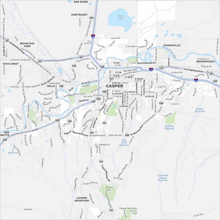
Casper is surrounded by wide plains and the North Platte River. Our map shows the city stretching at the foot of Casper Mountain.
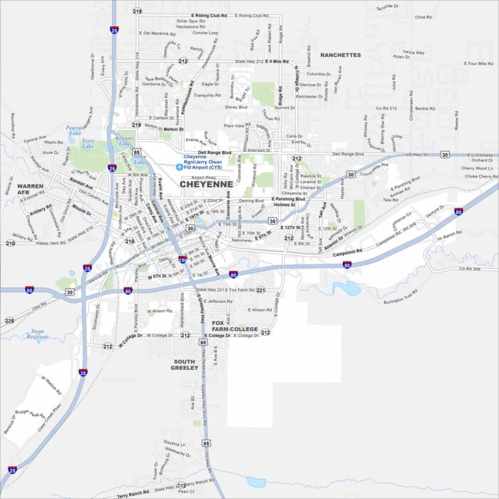
Cheyenne is mapped with its streets, highways, and rail lines. As the state capital, it lies on the high plains near the Colorado border.
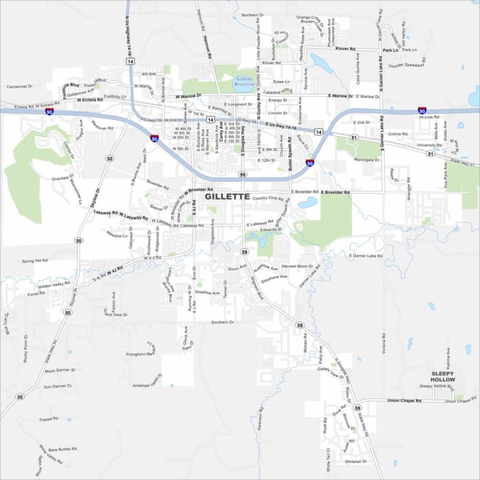
Gillette lies in northeast Wyoming surrounded by wide plains. It’s a hub for coal and energy because of nearby mining operations.
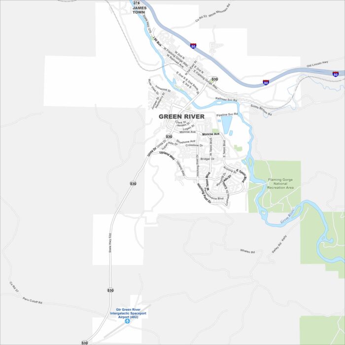
Explore our map of Green River in southwest Wyoming. The city sits along the Green River itself. Rugged canyons and mesas rise nearby.
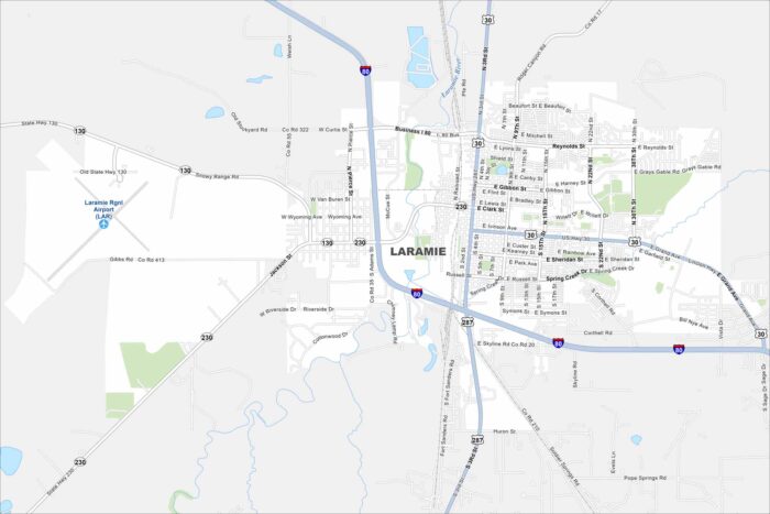
Laramie sits high in a wide mountain valley. Our map shows the railroad line running straight through town.
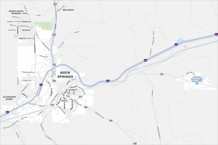
Our Rock Springs map shows the main roads and the open landscape around them. It’s a clear look at how the city spreads through wide country.
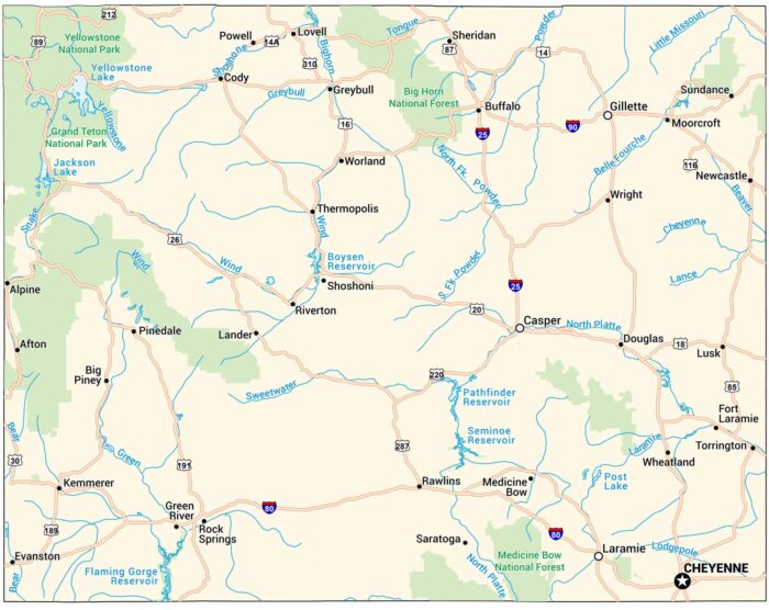
Our map of Wyoming shows highways, rivers, and lakes. Yellowstone National Park sits in the northwest surrounded by mountains and wide plains.