Map of Lacey, Washington
Explore Lacey, located south of Olympia. Lakes and parks are scattered through the city with I-5 cutting through along the north side.
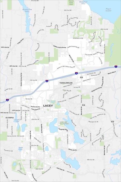
Explore Lacey, located south of Olympia. Lakes and parks are scattered through the city with I-5 cutting through along the north side.
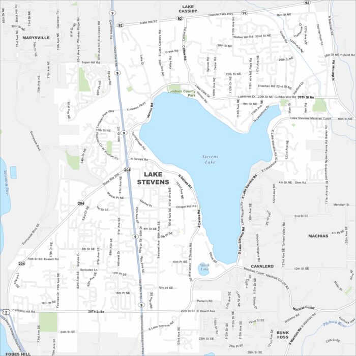
Lake Stevens dominates the center of the map. While subdivisions circle its shoreline, mountains rise in the distance to the east.
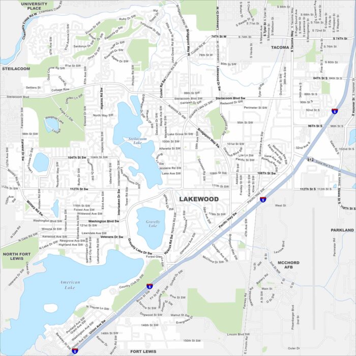
Lakes cover the map all around the city including Steilacoom, American, and Gravelly. Suburban streets travel between them.
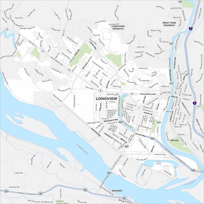
Our map of Longview follows the Columbia River on the city’s edge. Bridges link it to Oregon. Highways spread out through forested hills.
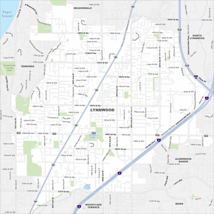
Our map of Lynnwood, Washington highlights its spot north of Seattle. Interstates and highways converge here.
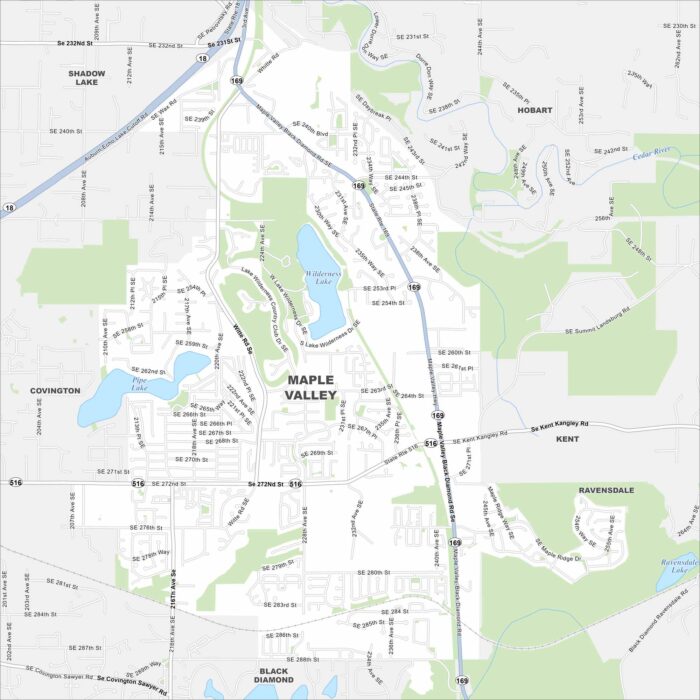
Our map of Maple Valley shows its highways winding through. The Cedar River and nearby lakes play a big role here.
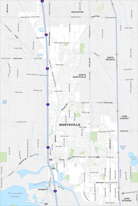
Marysville lies north of Everett along the Snohomish River. Our map highlights neighborhoods, highways, and the nearby Possession Sound.
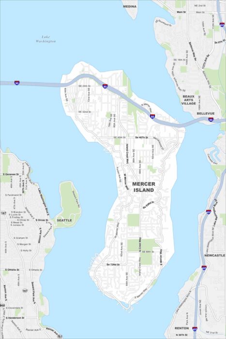
Our map of Mercer Island shows its unique placement in the middle of Lake Washington. Bridges connect it to Seattle and Bellevue. Neighborhoods and parks cover most of the island. Map Information
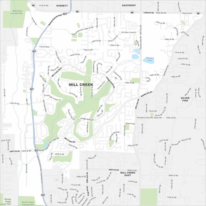
Mill Creek is north of Seattle and is in Snohomish County. Our map shows master-planned neighborhoods, parks, and major routes.
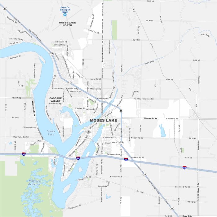
Our map of Moses Lake shows a city wrapped around its namesake lake. Highways cut across open farmland nearby.
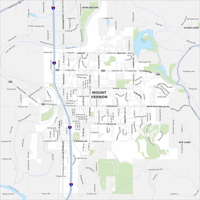
Take a look at Mount Vernon on our map. Located in Skagit County, you’ll notice the Skagit River running right through town.
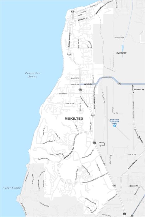
Check out Mukilteo with our map of Puget Sound. It’s not too populated here with neighborhoods stretching up into forested hills.
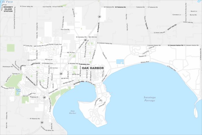
Oak Harbor is located on Whidbey Island in Puget Sound. Our map shows a compact downtown and neighborhoods by the shoreline.
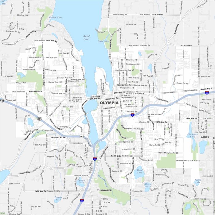
Our map of Olympia outlines Washington’s capital on the southern tip of Puget Sound. Government buildings and marinas cluster near downtown.
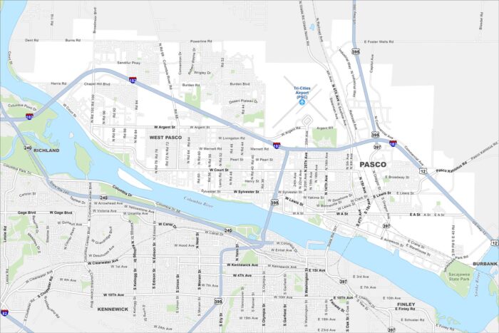
Pasco sits along the Columbia River in the Tri-Cities region. Take a look at our map to see parks, highways, and riverfront development.