Washington Outline Map
Washington’s coast is full of deep bays and island groups. Inland, the borders straighten out with more surveyed boundaries.
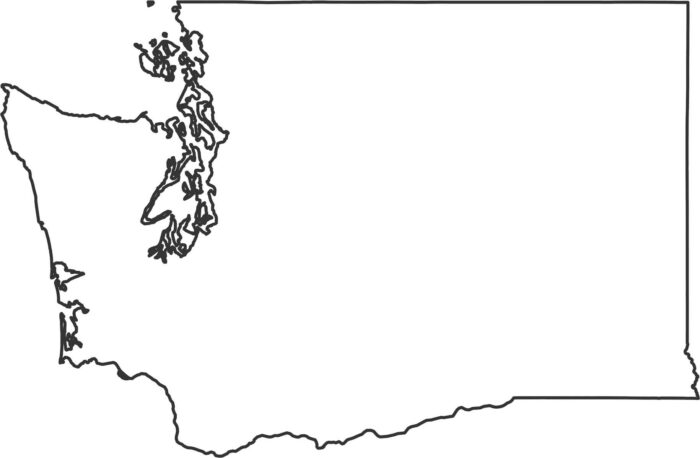
Washington’s coast is full of deep bays and island groups. Inland, the borders straighten out with more surveyed boundaries.
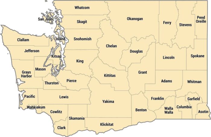
Get to know Washington’s 39 counties. Their shapes vary due to the state’s diverse geography like the Puget and Columbia River.
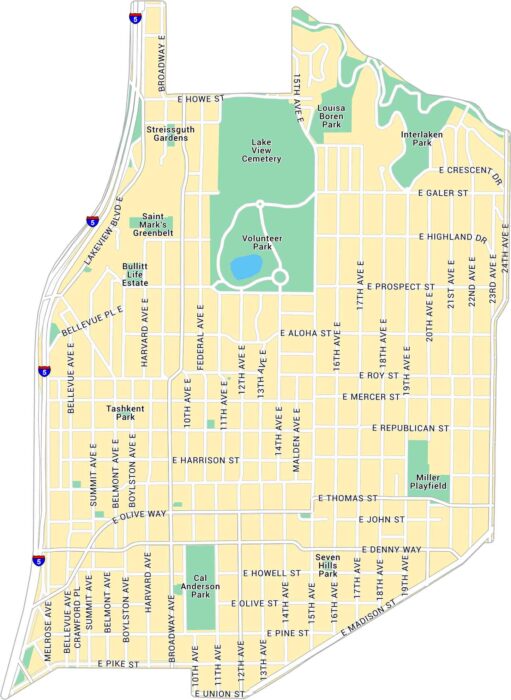
Our map of Capitol Hill highlights one of Seattle’s most exciting neighborhoods. You’ll find the main streets and local parks.
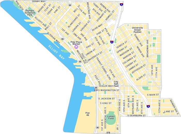
Our map of Downtown Seattle shows the stretch between Pike Place Market and Elliott Bay. It outlines the waterfront, streets and landmarks.
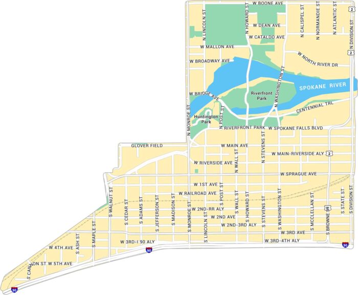
Downtown Spokane’s Riverside district sits along the Spokane River. Our map shows the river’s path, nearby streets, and its green spaces.
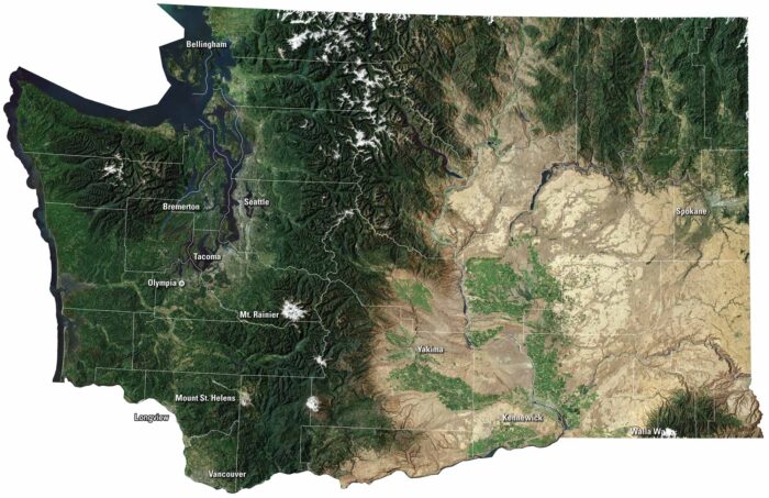
Our Washington satellite map shows it both wild and full of life. Islands and bays shape the Puget Sound, while green forests blanket the land.
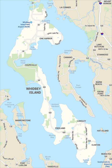
Our map of Whidbey Island shows its highways, parks and small towns. Shoreline roads run the length of the surrounding Puget Sound.
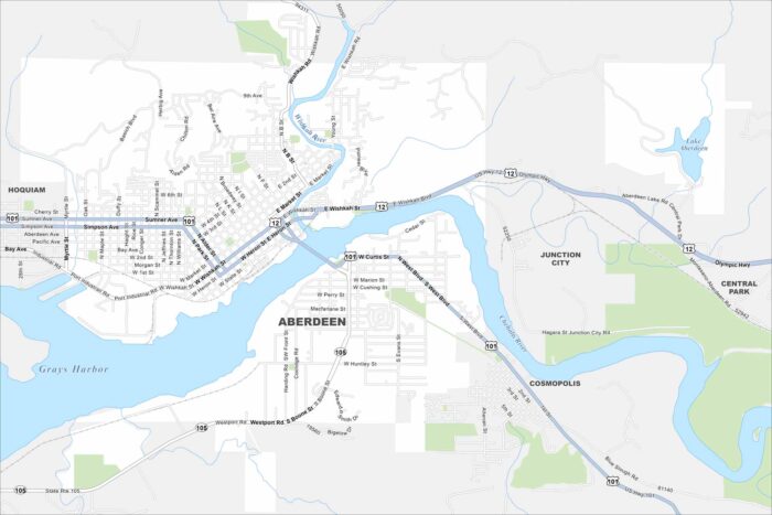
Our map of Aberdeen shows its waterfront location. It’s at the intersection of the Chehalis River and the Pacific Ocean.
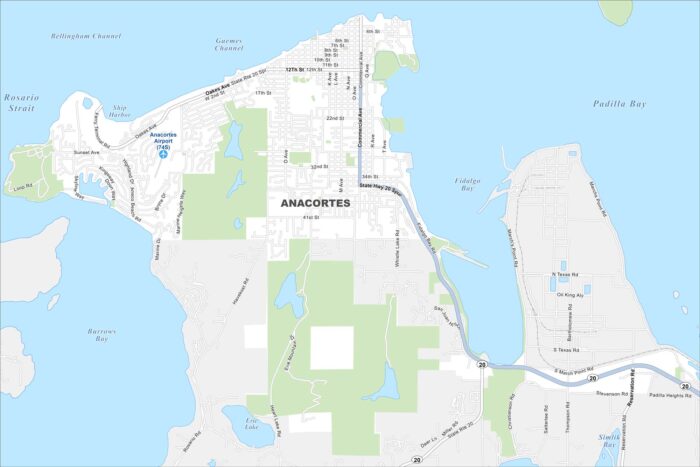
Anacortes is a coastal beauty perched on Fidalgo Island. This is where ferry routes head out to the San Juan Islands.
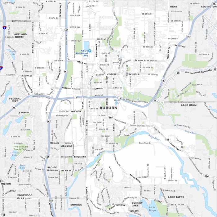
See the highways, streets, and river paths marked here. Our map of Auburn shows roads that run between Seattle and Tacoma.
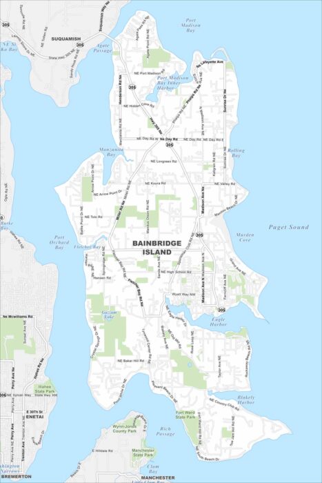
Our map of Bainbridge Island shows its roads, highways, and shoreline curves. Streets travel around bays and the Puget Sound.
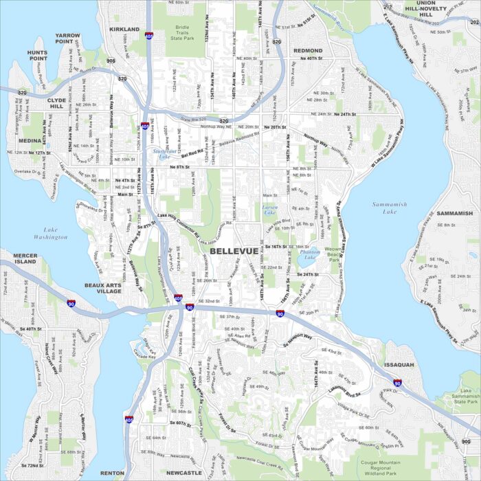
Our map of Bellevue shows highways, lakeshores, and urban streets. It sits east of Seattle, between Lake Washington and Lake Sammamish.
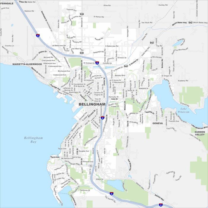
Explore Bellingham on our map at the edge of Bellingham Bay. The city spreads from the waterfront into the surrounding hills.
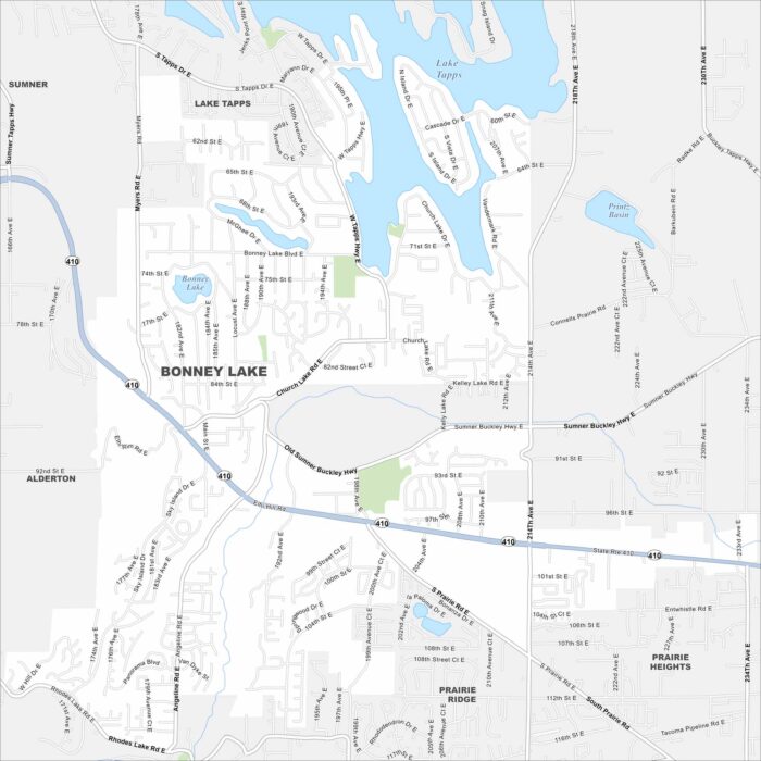
Bonney Lake is set against a backdrop of Mount Rainier. See it on our map with its roads spread among lakes and forests.
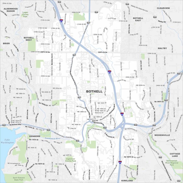
Check out Bothell, Washington on our map. This city is located north of Seattle and is shaped by the Sammamish River.