Virginia Outline Map
Our Virginia outline map shows the Chesapeake Bay and Atlantic Ocean on the eastern edge. The Potomac River creates much of the north edge.
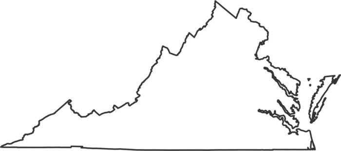
Our Virginia outline map shows the Chesapeake Bay and Atlantic Ocean on the eastern edge. The Potomac River creates much of the north edge.
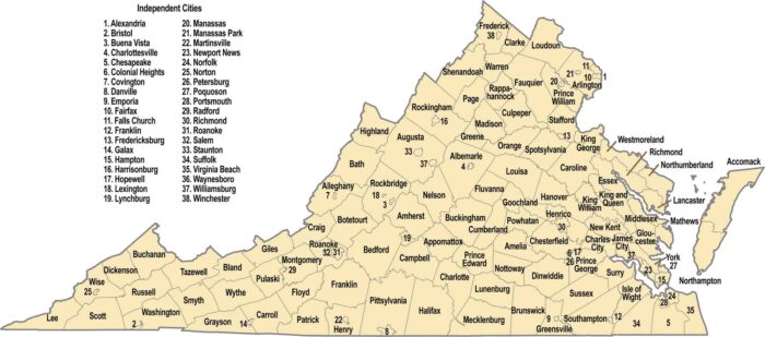
Our Virginia county map shows 95 counties plus 38 independent cities. The boundaries are influenced by the Blue Ridge Mountains in the west.
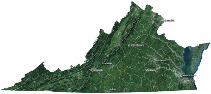
Rolling hills meet long stretches of Atlantic shoreline in Virginia. Our Virginia satellite map displays Richmond, Norfolk, and Roanoke.
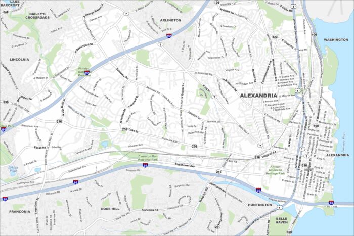
Cobblestone streets make way for a busy waterfront in Alexandria. Our map displays its neighborhoods along the Potomac.
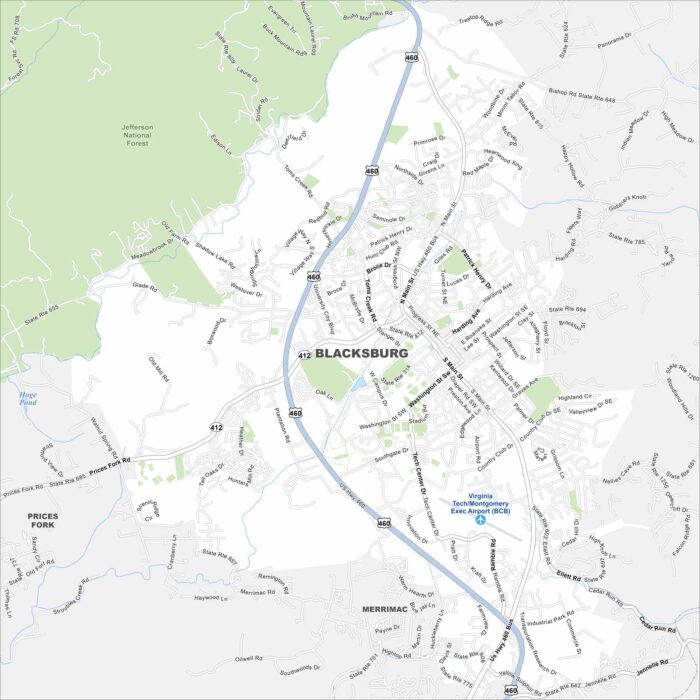
We’ve mapped Blacksburg, Virginia with its streets, highways, and parks. It’s best known as the home of Virginia Tech.
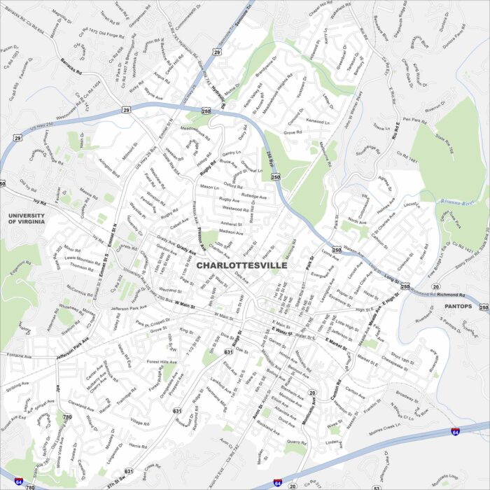
Our map of Charlottesville includes neighborhood streets, the highway network, and parkways. It’s home to the University of Virginia.
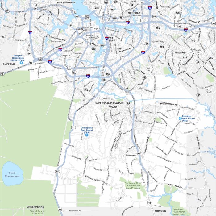
See Chesapeake with its highways, and winding waterways. Part of the Hampton Roads region, the city is known for the Great Dismal Swamp.
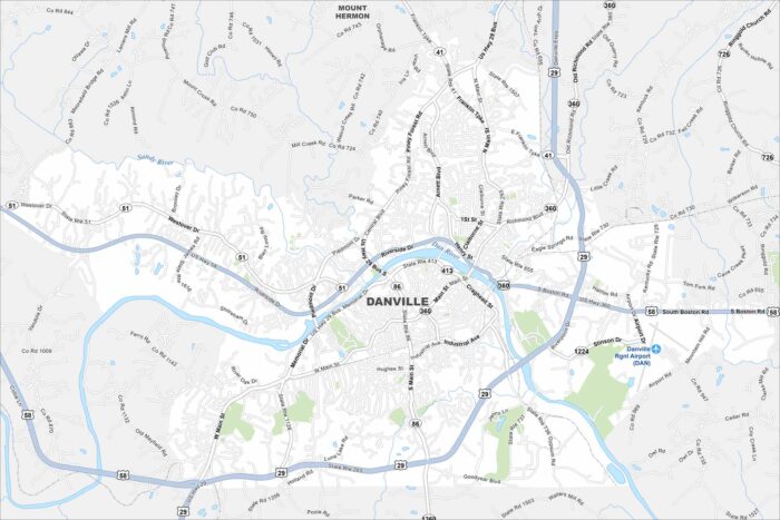
Our map of Danville shows the streets, highways, and the Dan River cutting through. The city grew as a tobacco and textile hub.
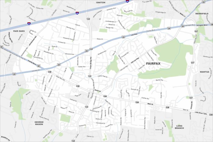
Our map of Fairfax places it west of Washington, D.C. Compact neighborhoods spread between highways like I-66 and Route 50.
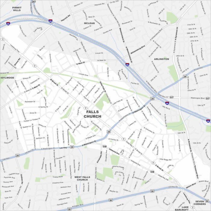
Our map of Falls Church shows it just outside Washington, D.C. Major routes like I-66 and Route 29 frame its edges.
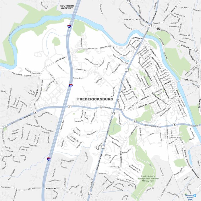
Explore our map of Fredericksburg along the Rappahannock River. The historic downtown sits near its banks.
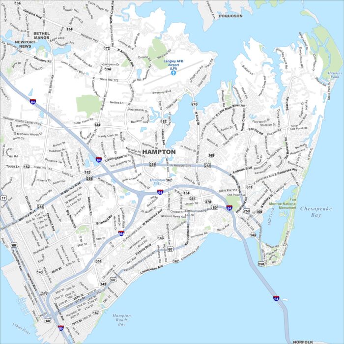
Our map shows Hampton, which is on the Virginia Peninsula. It’s surrounded by the Chesapeake Bay and Hampton Roads.
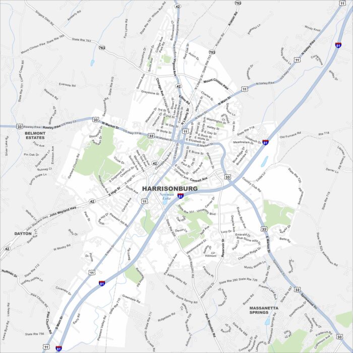
Harrisonburg rests in the Shenandoah Valley of Virginia. Mountains rise on both sides of the valley here. Interstate 81 and US-33 cross here.
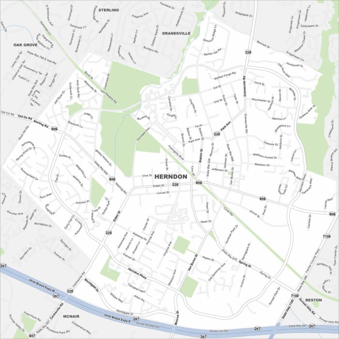
Herndon is just west of Washington, D.C., near Dulles Airport. This map shows its streets branching from the Dulles Toll Road in the south.
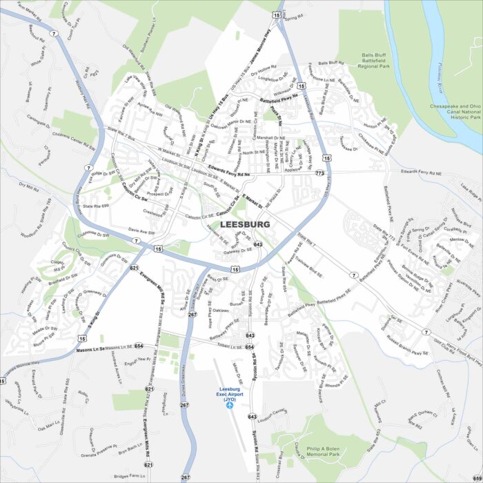
Leesburg anchors Loudoun County at the foot of the Blue Ridge. Our map shows its historic district at the core.