Map of Millcreek, Utah
Take a look at our map of Millcreek, Utah. You can find it in the Salt Lake Valley so its outdoor access is a major draw here.
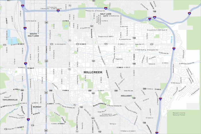
Take a look at our map of Millcreek, Utah. You can find it in the Salt Lake Valley so its outdoor access is a major draw here.
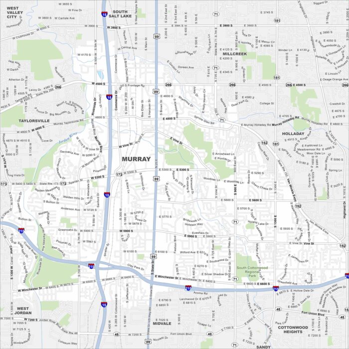
Our map of Murray shows a city in the Salt Lake Valley. Major highways cross through, with neighborhoods tucked between its roads.
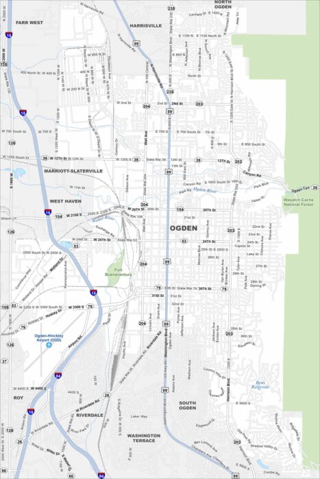
Our map of Ogden shows a city at the foot of the Wasatch Mountains. The downtown grid spreads toward the Great Salt Lake.
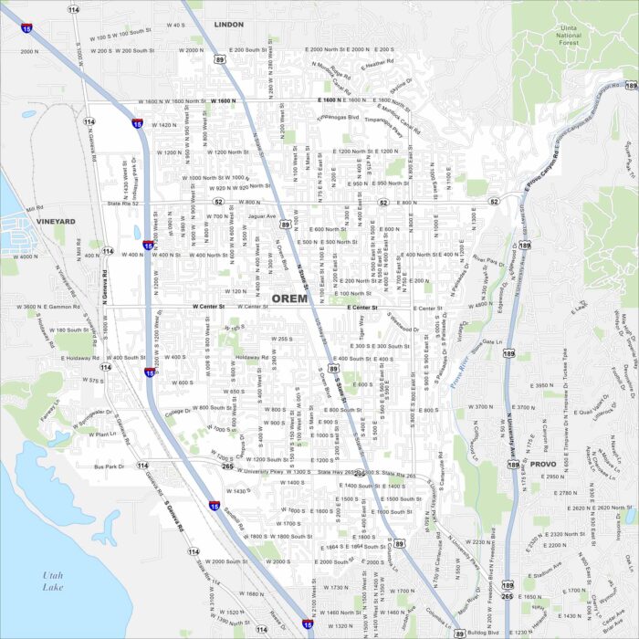
Our map of Orem highlights a city stretched along Utah Valley. Mountains rise immediately to the east, framing neighborhoods and campuses.
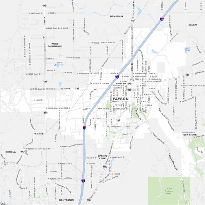
Payson rests against the foothills of the Wasatch Range. Our map points out its downtown area and nearby Nebo Loop scenic drive.
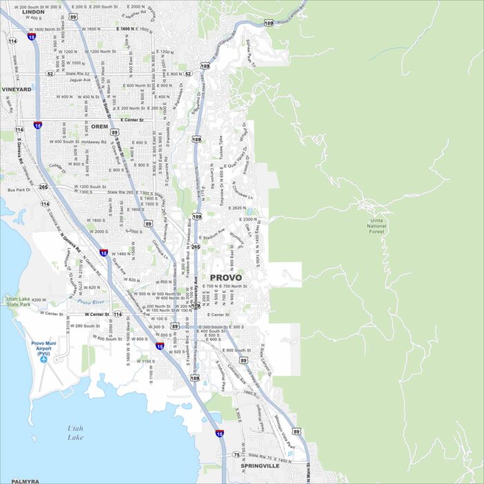
Located between Utah Lake and the Wasatch Mountains, Provo is full of scenic views. Our map highlights downtown and connecting roads.
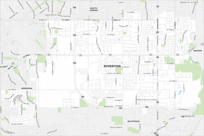
Our map of Riverton displays major parks and local roads. This city is known for its exceptional school system and recreational areas.
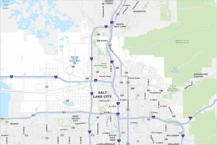
We’ve mapped out every major road in Salt Lake City. From Temple Square to the foothills, our map helps you move through the capital.
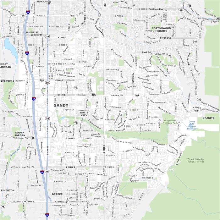
Our road map of Sandy, Utah makes it easy to reach shops, neighborhoods, and the Wasatch slopes. It’s a gateway to the mountains.
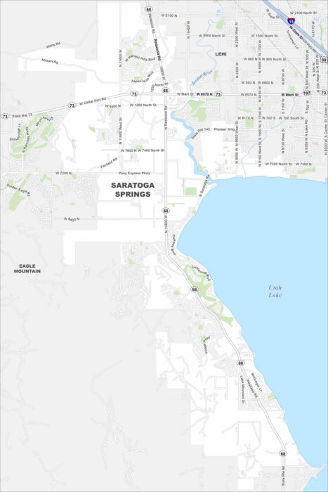
Take a look at our map of Saratoga Springs. It highlights the neighborhoods along Utah Lake and Jordan River.
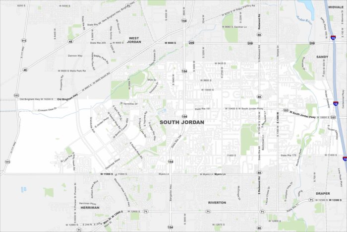
Our South Jordan map highlights a fast-growing suburb of Salt Lake City. It’s known for the Oquirrh Lake area and Jordan River.
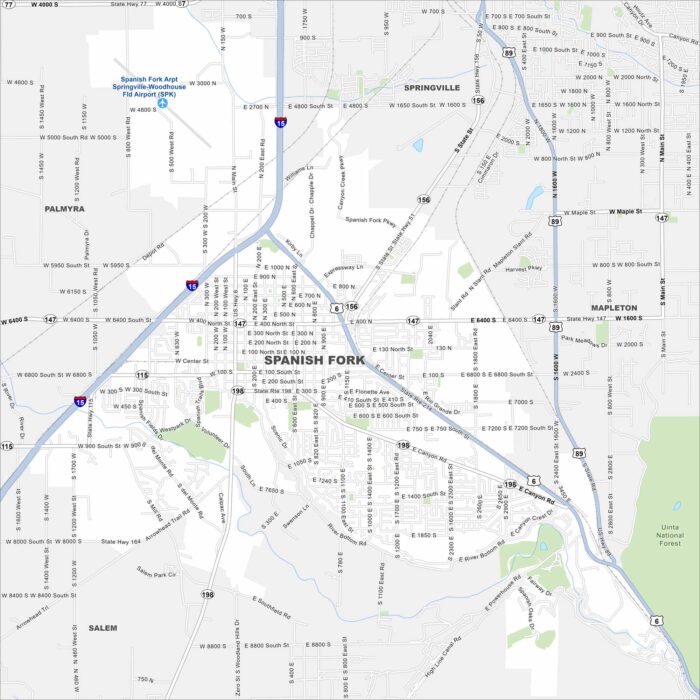
Our map of Spanish Fork helps you see the heart of Utah Valley. The city is known for its festivals, mountains, and family neighborhoods.
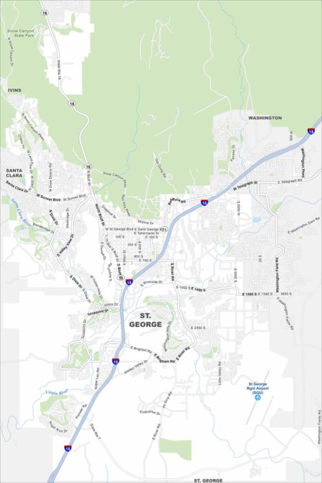
Take a look at our map of St. George, Utah. Red rock landscapes, golf courses, and warm weather make it a popular destination year-round.
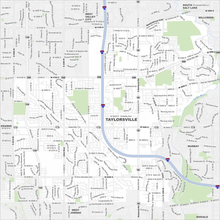
Here’s a simple map of Taylorsville in Salt Lake County. It’s a suburban city with quick mountain access and strong community roots.
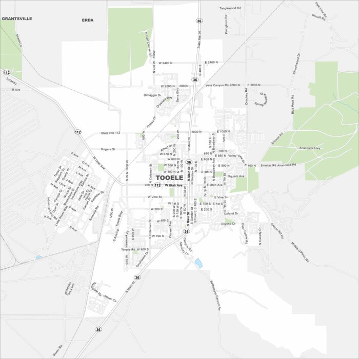
Get around Tooele with our city map. Set against the Oquirrh Mountains, it’s close to the Great Salt Lake and lots of outdoor recreation.