Utah Outline Map
Check out how every single border in Utah is a straight line. The state forms a near-perfect rectangle with corners at right angles.
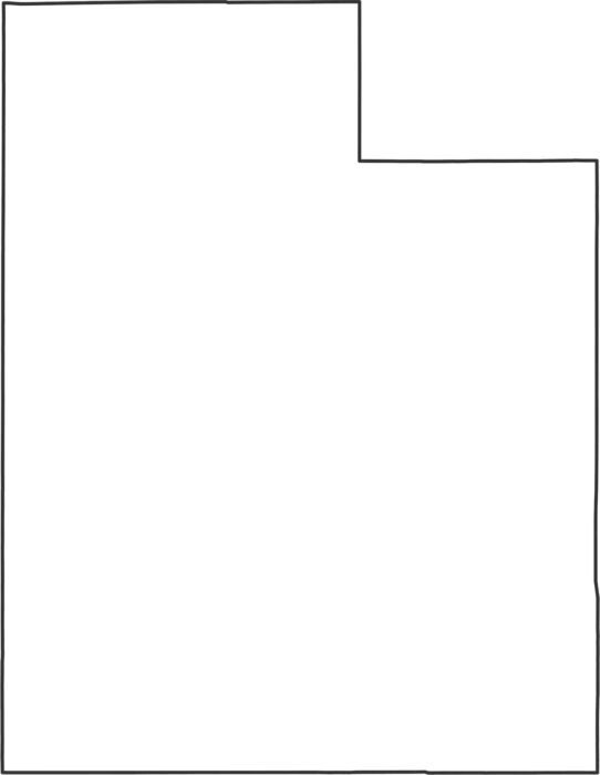
Check out how every single border in Utah is a straight line. The state forms a near-perfect rectangle with corners at right angles.

There are just 29 counties in Utah. But they cover everything from red rock desert to snowy mountains. Salt Lake County is most populous.
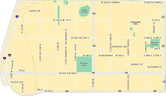
Downtown Salt Lake City is open and easy to navigate with mountains on every side. Our map lays out its highways, streets and parks.
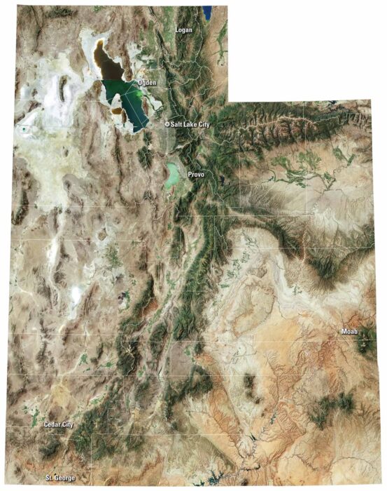
From national parks to quiet valleys, our Utah satellite map shows every corner of this state. It includes Salt Lake City and Wasatch Range.
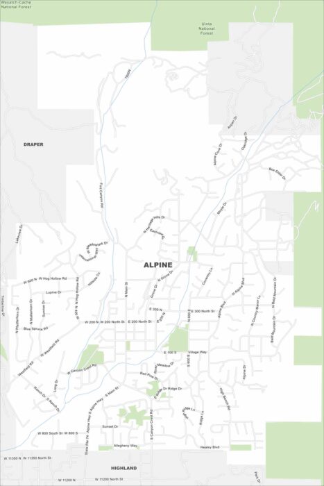
The name says it all. Alpine sits right against the Wasatch Range. This is where suburban roads meet rugged canyon trails.
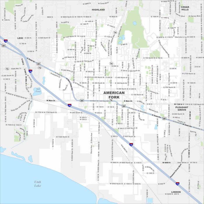
Situated near Utah Lake, American Fork sits at the mouth of a canyon that leads straight into the mountains. Our map shows its highways.
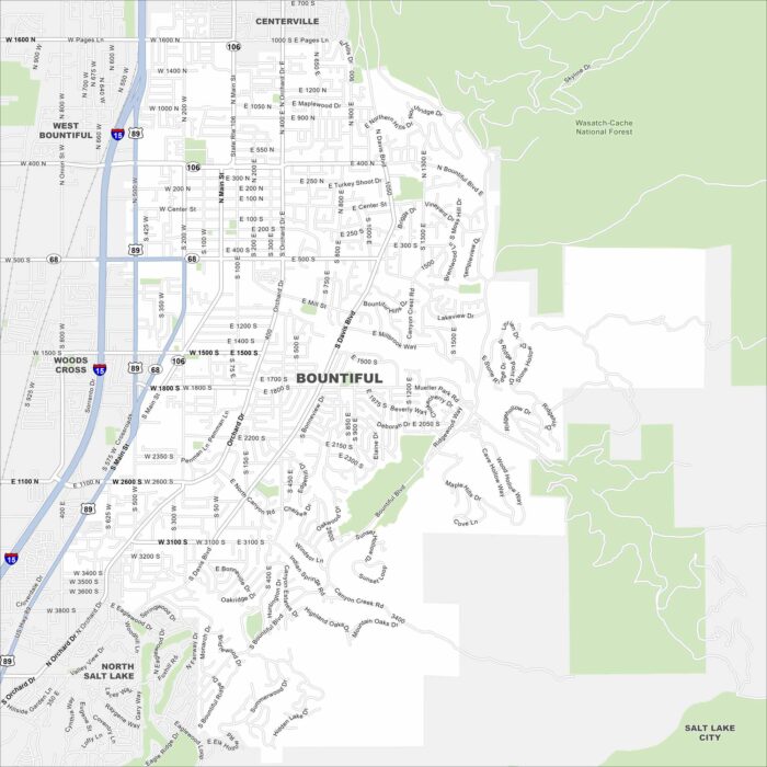
See Bountiful with our map. It’s located just north of Salt Lake City. The Wasatch Mountains rise steeply behind the city.
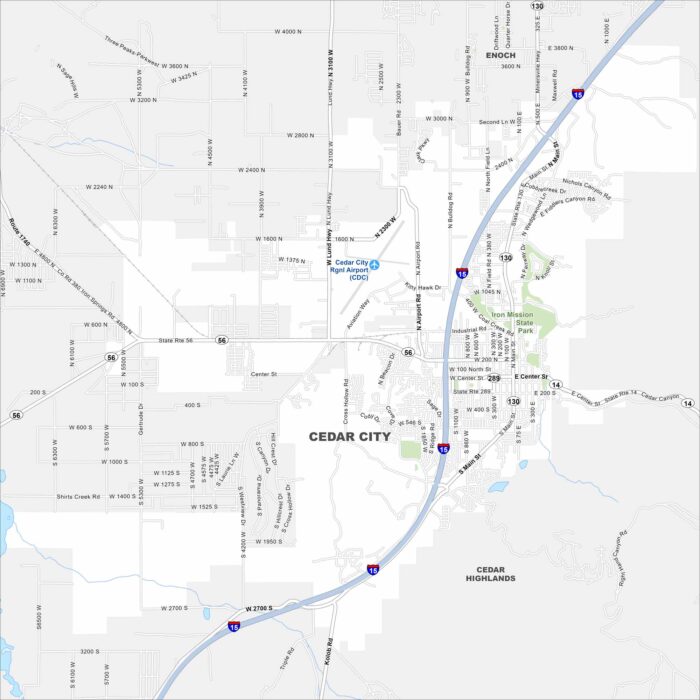
Cedar City is framed by mountains and high desert landscapes. Our map shows how it connects with nearby canyons and open land.
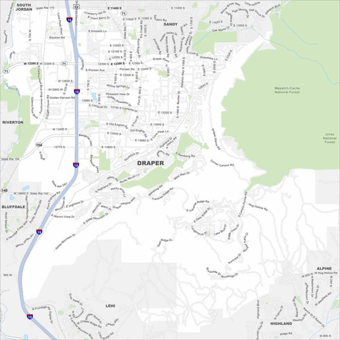
Draper lies at the south end of Salt Lake Valley. Our map shows the Wasatch Mountains rising to the east and open desert to the west.
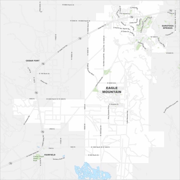
Explore Eagle Mountain on the edge of Utah County. This region has open desert, foothills, and fast-growing housing communities.
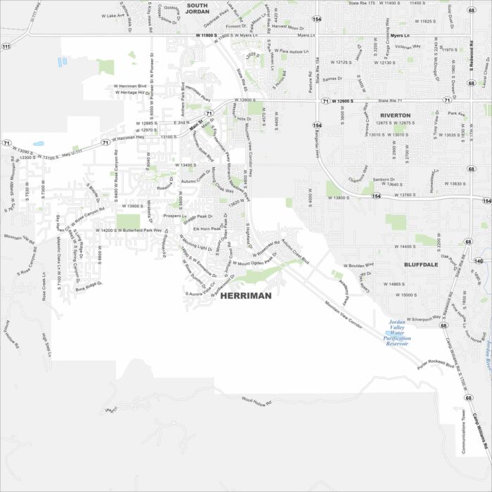
Check out our map of Herriman at the southwestern edge of the Salt Lake Valley. It backs up against the Oquirrh Mountains.
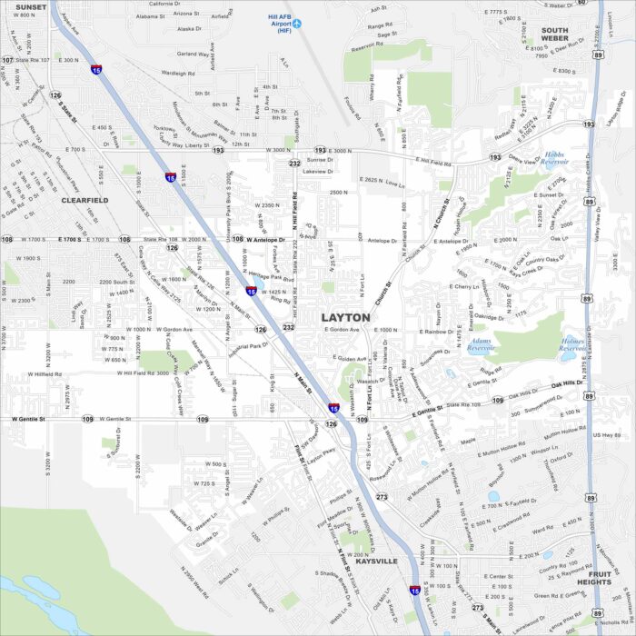
Layton stretches along the Wasatch Front. This map shows neighborhoods tucked between mountain slopes and the Great Salt Lake.
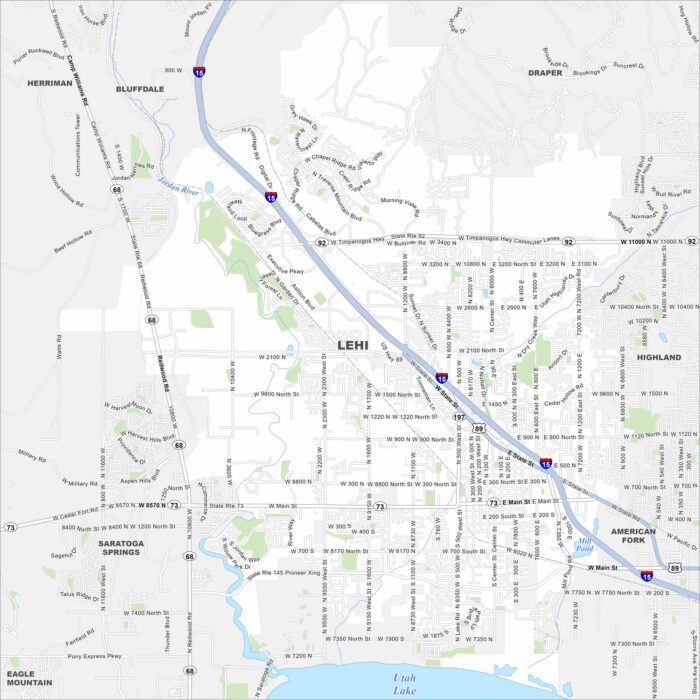
Our map of Lehi places it between Utah Lake and the Wasatch Mountains. The geography shows valley and mountain side by side.
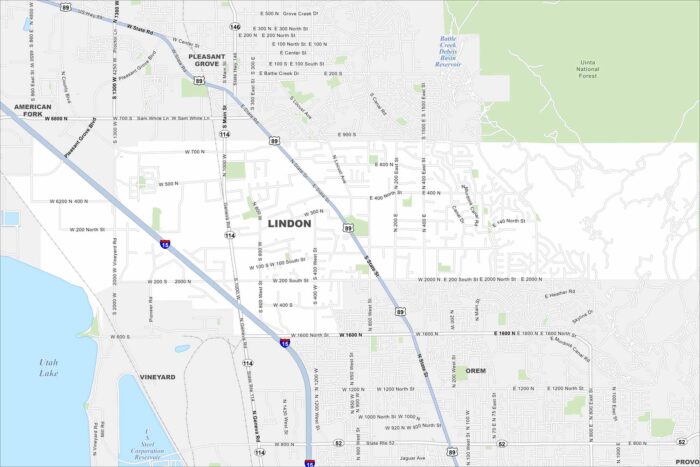
Lindon sits between Orem and Pleasant Grove in Utah Valley. Our map shows its highways and roads stretching toward Utah Lake.
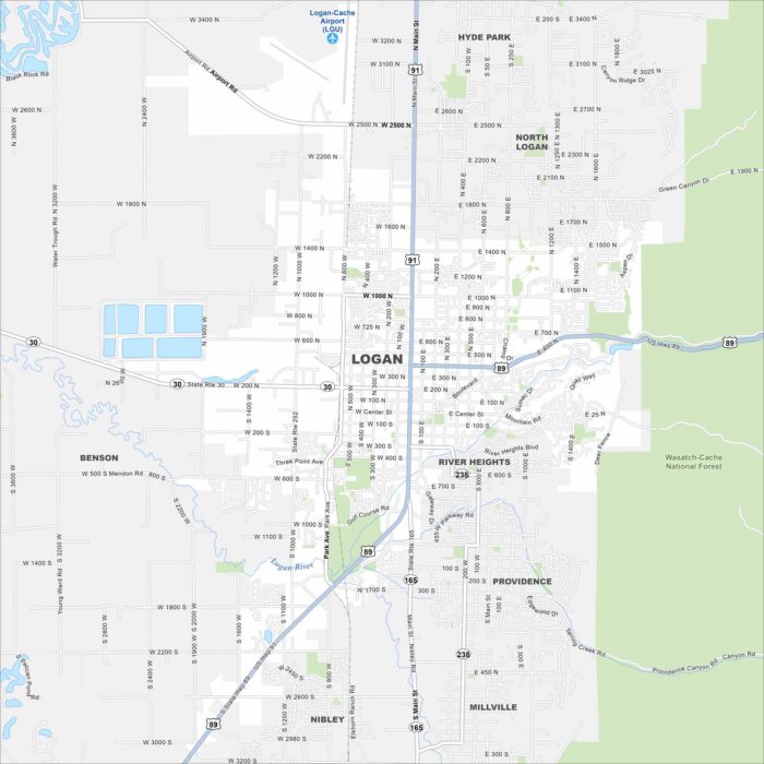
Explore Logan at the northern end of Utah’s Cache Valley. The Logan River winds through the southern section of the city.