Map of Brownsville, Texas
Brownsville sits at the southern tip of Texas, right on the Rio Grande. Our map shows the border crossing and roads leading into Mexico.
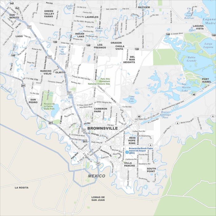
Brownsville sits at the southern tip of Texas, right on the Rio Grande. Our map shows the border crossing and roads leading into Mexico.
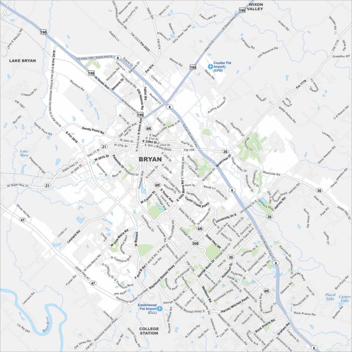
Check out Bryan on our map, paired with nearby College Station. Roads stretch across the Brazos Valley. The city is often tied to Texas A&M.
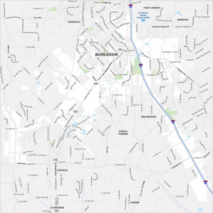
Check out our map of Burleson, just south of Fort Worth. It’s marked by suburban growth, wide streets, and open spaces.
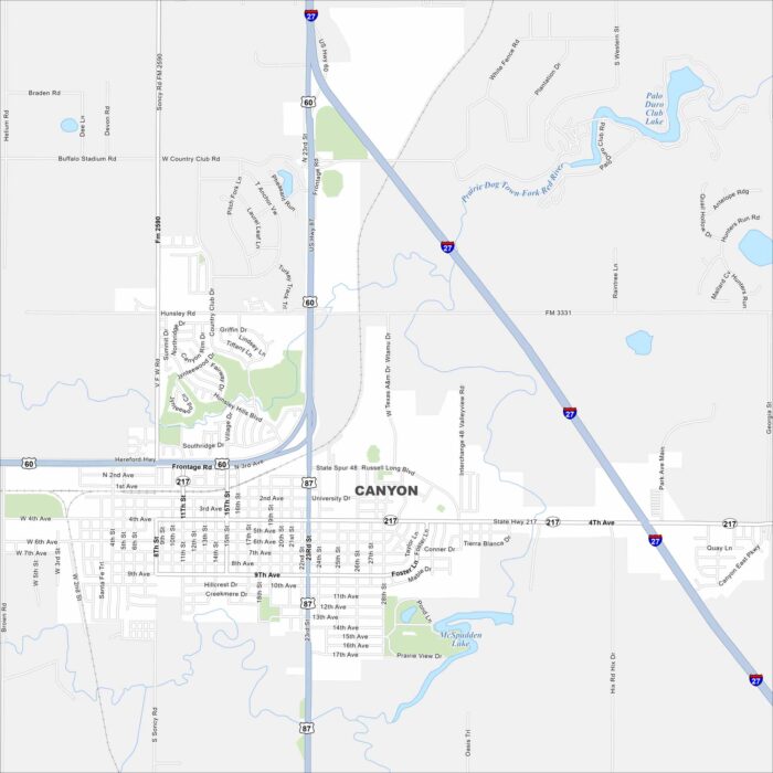
Check out Canyon, Texas on our map. It’s a Panhandle town south of Amarillo. The nearby Palo Duro Canyon is the real landmark here.
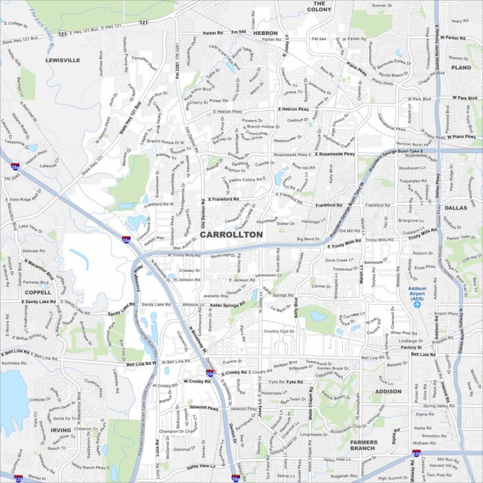
Our map of Carrollton shows this city in the Dallas-Fort Worth metro. Neighborhoods stretch across flat plains with greenbelt parks.
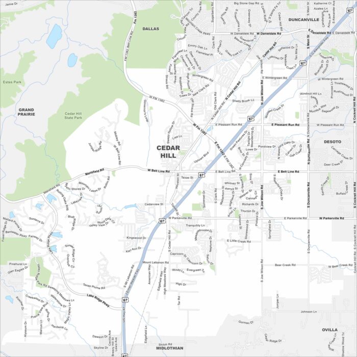
Here’s our map of Cedar Hill, Texas. The city sits in the Dallas-Fort Worth metroplex but keeps a more natural setting.
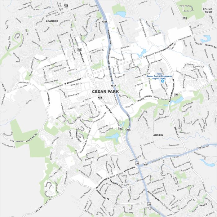
Cedar Park is a growing suburb just north of Austin. Our map highlights its neighborhoods, parks, and nearby highways.
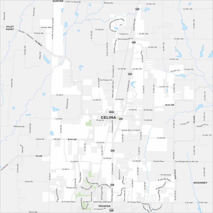
Our map of Celina shows a fast-growing city north of Dallas. Open land surrounds new neighborhoods and development.
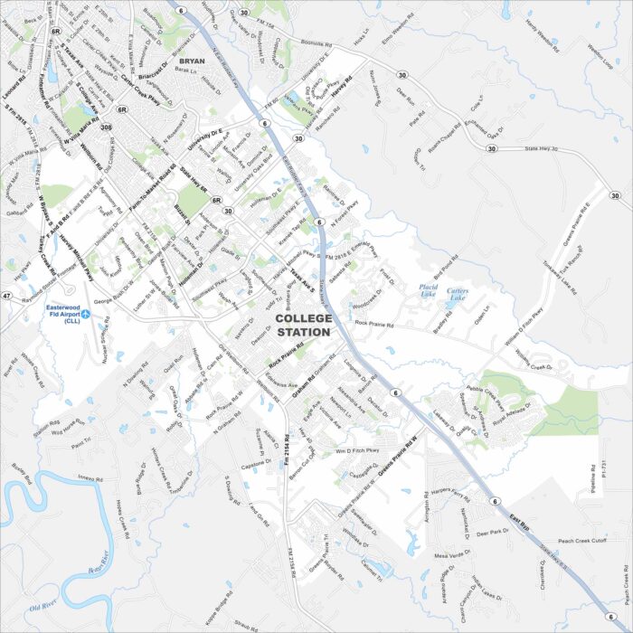
College Station centers on Texas A&M University. The city grew around the campus and spreads across the flat Brazos Valley.
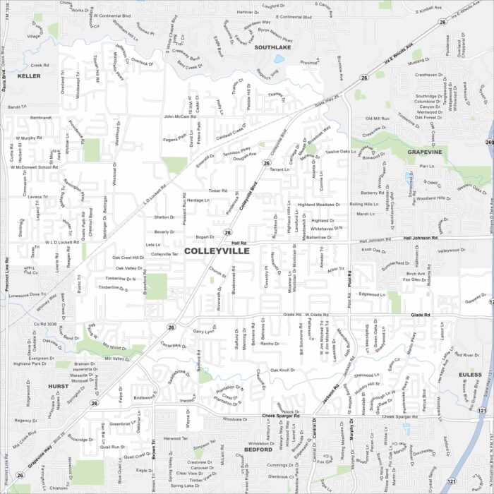
Colleyville is mapped with its streets, highways, and parks. You can find this city between Dallas and Fort Worth with lots of open space.
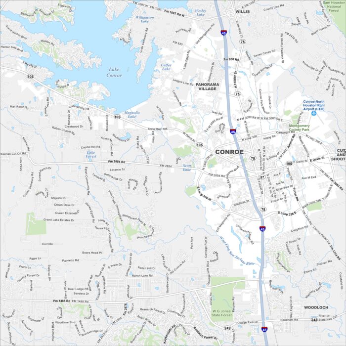
Conroe lies along Lake Conroe, north of Houston. The city grew around timber and oil. We’ve mapped it with roads, highways, and nearby lakes.
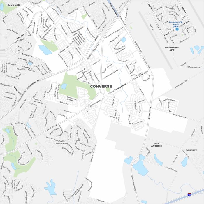
See Converse with its local highways, waterways and parks on our map. This San Antonio suburb is known for its family-friendly neighborhoods.
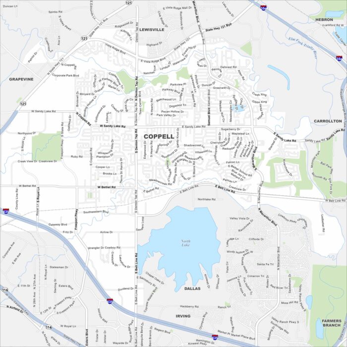
Our map of Coppell outlines local streets, highways, and green spaces. It’s part of the Dallas-Fort Worth metroplex near Grapevine Lake.
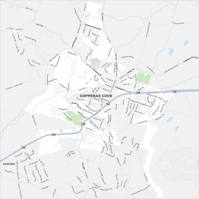
Check out our map of Copperas Cove with its streets, waterways, and open land. Known as the “City of Five Hills”, it lies near Fort Cavazos.
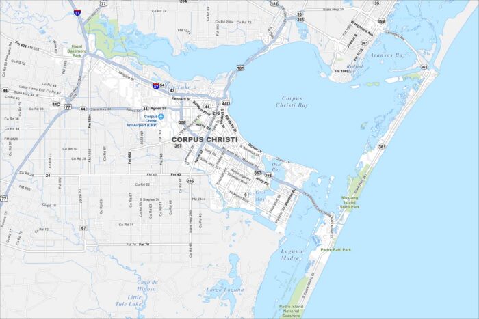
Our map of Corpus Christi highlights the city’s roads, highways, and shoreline. It’s known as the “Sparkling City by the Sea”.