Map of Columbia, Tennessee
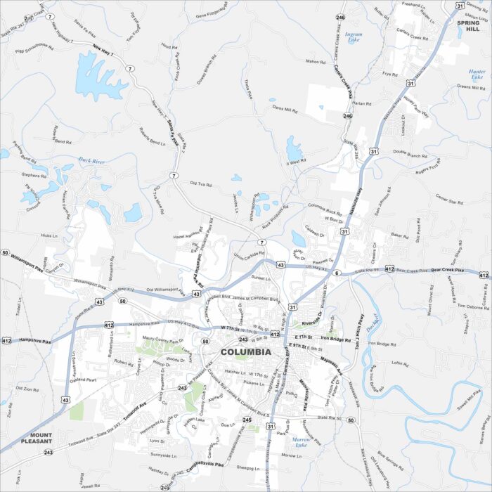
We’ve mapped Columbia with its road network and waterways. You can find it south of Nashville with the Duck River flowing through it.
We’ve mapped Columbia with its road network and waterways. You can find it south of Nashville with the Duck River flowing through it.
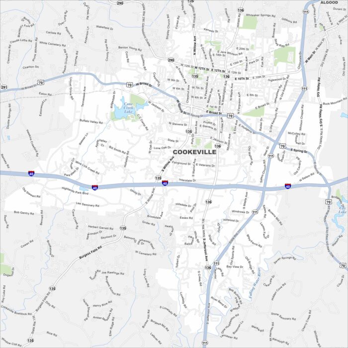
Our map of Cookeville highlights its streets, waterways, and nearby parks. It’s located in the Upper Cumberland region.
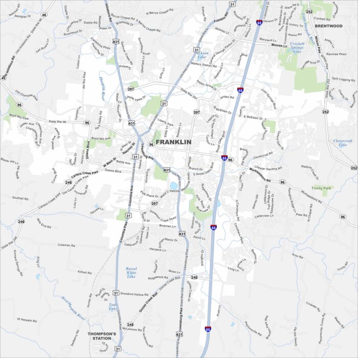
Franklin, Tennessee is south of Nashville with rolling hills and historic districts. The map shows I-65, which links it to the metro area.
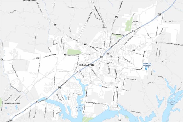
See the streets, highways, and parks laid out clearly. Our map of Gallatin highlights the roadways and waterways that run through the city.
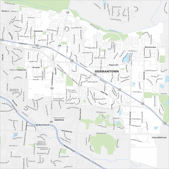
Our map of Germantown highlights the streets, parks, and highway routes. The city is part of Greater Memphis region.
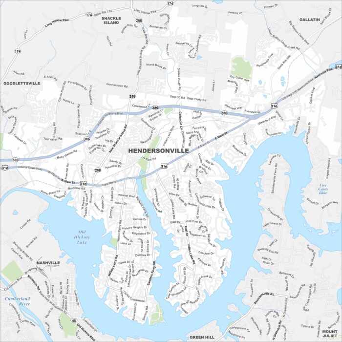
Explore our map of Hendersonville along the shores of Old Hickory Lake. Its roads spread north of Nashville, Tennessee.
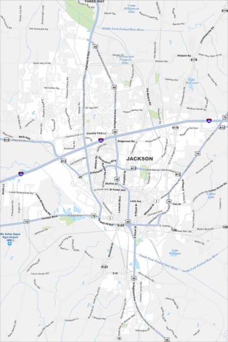
Get to know Jackson, which sits along I-40 in western Tennessee. This map shows rail lines and highways meeting in the city.
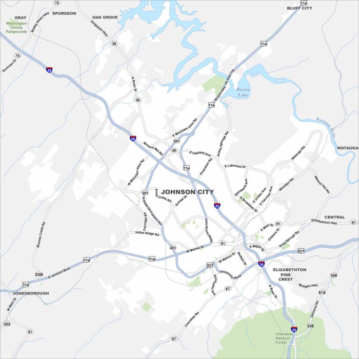
Johnson City sits in the Appalachian foothills. Our road map of Johnson City shows highways meeting near downtown.
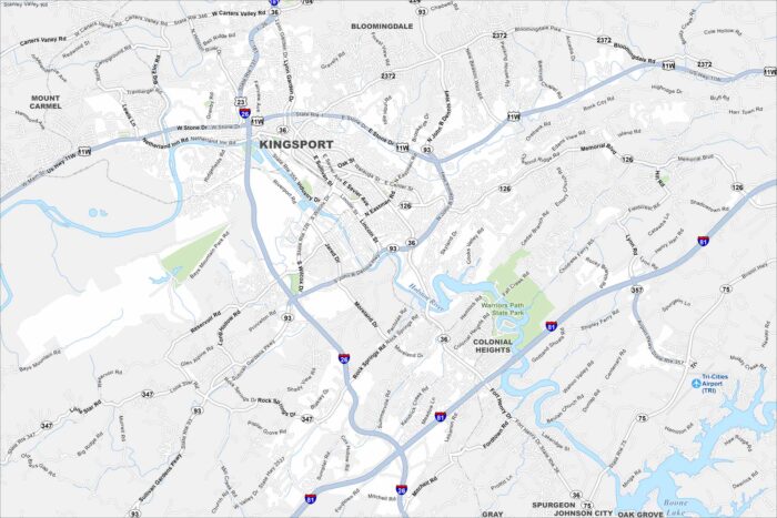
Kingsport is laid out along the Holston River. Our map shows winding roads leading into the Appalachian foothills.
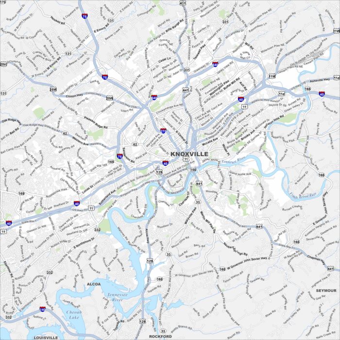
Check out our map of Knoxville. Downtown sits near the Tennessee River’s bend. The Great Smoky Mountains loom to the southeast.
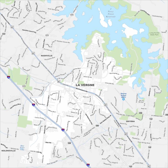
La Vergne is just southeast of Nashville. Percy Priest Lake is visible on the map, curling along the city’s northeast edge.
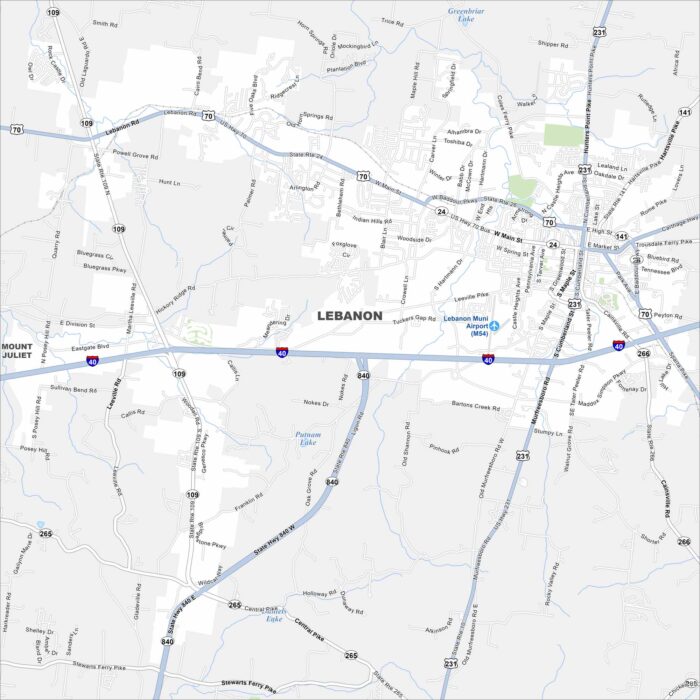
Lebanon sits east of Nashville, Tennessee. Our map displays its town square and street layout. The Cumberland River lies just beyond.
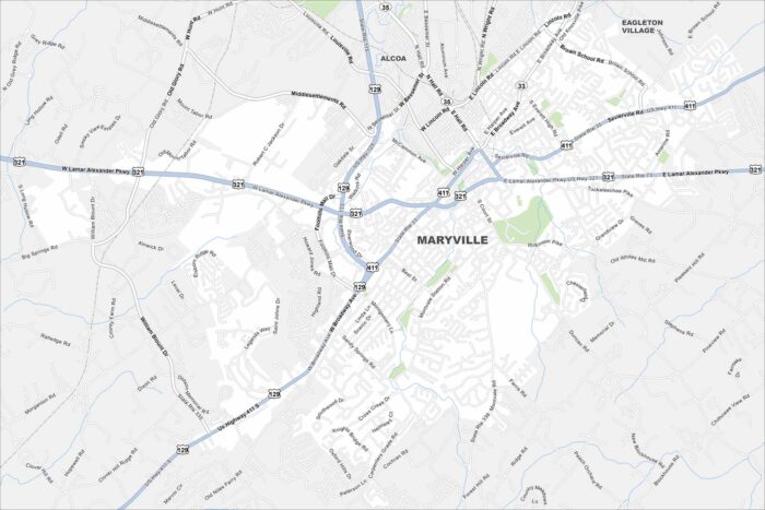
Maryville is a city in and the county seat of Blount County, Tennessee. Check out our map of Maryville, located near the Smoky Mountains.
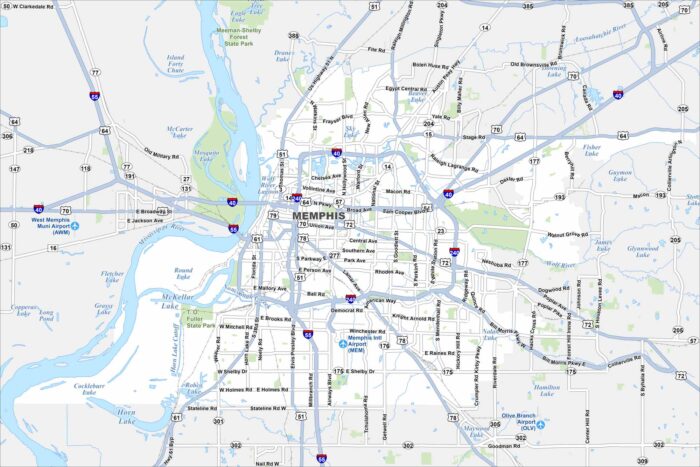
Our map of Memphis shows the Mississippi River shaping the city’s western edge. It’s a major cultural and transportation hub.
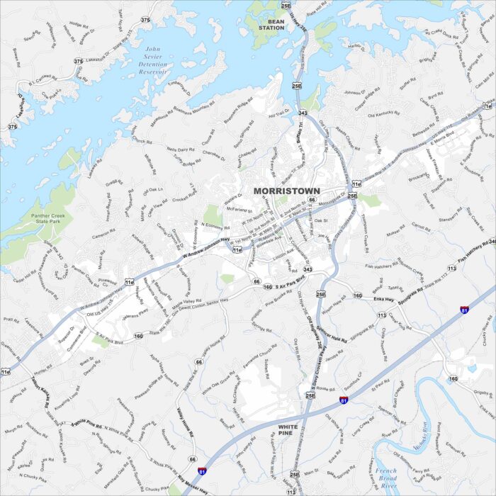
Take a look at Morristown map, located in East Tennessee. The city spreads between Cherokee Lake and the foothills of the Appalachians.