South Dakota Outline Map
South Dakota forms a blocky shape with a few river curves on the east. The rest stays straight and simple in our outline map of South Dakota.
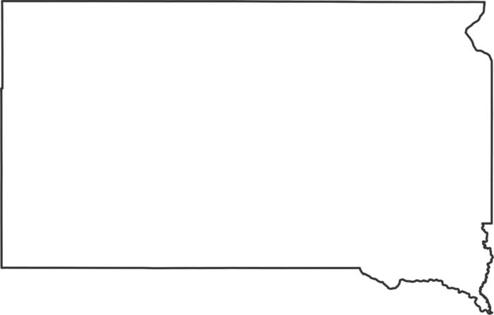
South Dakota forms a blocky shape with a few river curves on the east. The rest stays straight and simple in our outline map of South Dakota.
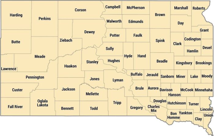
South Dakota’s counties have farmland east and ranch country out west. Minnehaha County has Sioux Falls in the southeast corner.
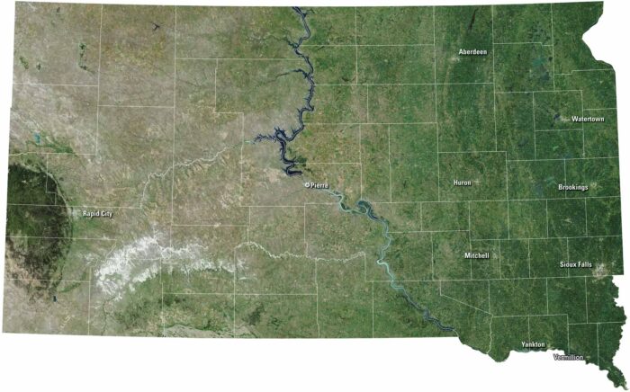
South Dakota stretches wide with rolling plains and rugged Badlands. Sioux Falls and Rapid City anchor the eastern and western sides.
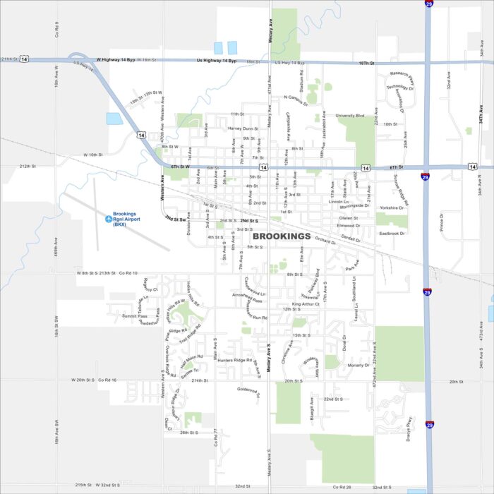
Brookings is in eastern South Dakota, surrounded by farmland. Our map highlights its grid of streets and open fields.
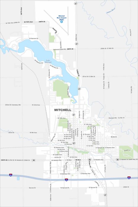
Our map of Mitchell highlights a compact city along Interstate 90. Residential streets spread outward from downtown.
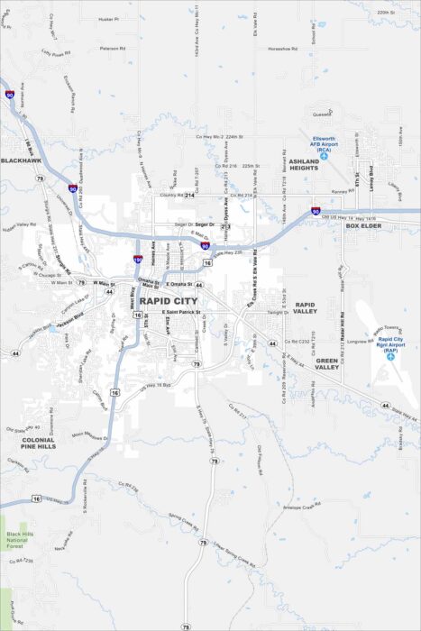
Rapid City is the gateway to Mount Rushmore and the Black Hills. Our map shows how the city spreads out from its compact downtown.
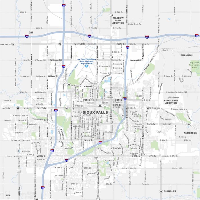
Find your bearings in Sioux Falls, South Dakota with our road map. The Big Sioux River and Falls Park are at the heart of the city.
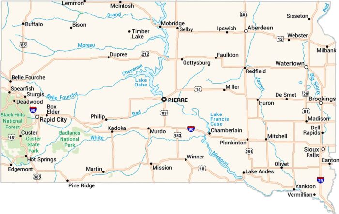
Our road map displays highways through open plains, past rivers, and into the Black Hills. You’ll see the Missouri cutting across the state.